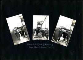
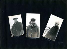
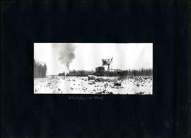
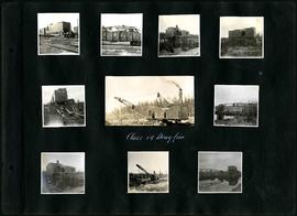
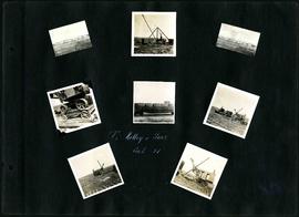
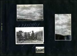
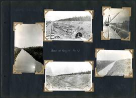
Camp 9, mixer site opposite siding 8
- i01219
- Item
- 1917
Contract 33 - Mile 82 - Camp 9 - Mixer site opposite Siding 8, Glenn.
Greater Winnipeg Water District
85 results directly related Exclude narrower terms
Camp 9, mixer site opposite siding 8
Contract 33 - Mile 82 - Camp 9 - Mixer site opposite Siding 8, Glenn.
Greater Winnipeg Water District
Chief Engineer W.G. Chase in arch
Contract 31 - Mile 43 - Chief Engineer W.G. Chace at completed arch.
Greater Winnipeg Water District
Contractor's Device for Moving Outside Forms
Contract 32 - Mile 57 - Contractor's device for moving outside arch forms.
Greater Winnipeg Water District
Contract 15 - Falcon River Diversion Dyke - Method of placing material from cars into dump by use of scow. Photo by W.G. Chace.
Greater Winnipeg Water District
Part of City of Winnipeg (1874-1971)
A photograph of a brick building on Robert Street (Galt Avenue) during the 1950 flood. The building is surrounded by a sandbag dike and water.
Harold K. White Studio
For Your Guidance While in Winnipeg promotional map
Part of Morris Block collection
A promotional map created by the Publicity Bureau of Winnipeg and Manitoba titled "For Your Guidance While in Winnipeg". Map was originally folded as a pamphlet, the front page of which features a graphic of two people driving down Highway 14 (now Highway 75) to Winnipeg. The map is not scale and features cartoon depictions of tourist destinations and landmarks around Winnipeg and St. Boniface. The maps shows major streets, railroads, and street railway lines. The map side was originally framed and cut to fit. At a result a small part of the front page is cut off, including a stamp reading "St. Raphael's Ukrainian Immigrants' Welfare Association of Can[ada]".
Forms for arch of sections 3 and 5
Contract 32 - Mile 57 - Forms for arch sections 3 and 5. Photo by W.G. Chace.
Greater Winnipeg Water District
Handmucking between the pole piling
Contract 34 - Mile 92.5 - Camp 7 - Slide at Sta. 4886. Hand mucking between the pole piling. (see image 900)
Greater Winnipeg Water District
Intake - filling last gap in cofferdam between the dykes
Contract 35 - Mile 97.5 - Intake - Filling last gap in cofferdam between the dykes. Viewed from west dyke.
Greater Winnipeg Water District
L.B. Foote photos of GWWD Railway at St. Boniface
Glass lantern slides taken by L.B. [Lewis Benjamin] Foote of the Greater Winnipeg Water District railway and passengers in St. Boniface. The Greater Winnipeg Water District hired Foote to take these photos.
Greater Winnipeg Water District
L.B. Foote photos of tourists at Shoal Lake
Glass lantern slides taken by L.B. [Lewis Benjamin] Foote of the tourists taking the Greater Winnipeg Water District Railway to and enjoying leisure time at Shoal Lake. The Greater Winnipeg Water District hired Foote to take these photos.
Greater Winnipeg Water District
Nairn Overpass approaching completion
Photograph of the Nairn Overpass as it nears completion, looking west, as a train passes underneath.
Metropolitan Corporation of Greater Winnipeg (Man.). Information Officer
Photographs of overpasses and areas of the Greater Winnipeg Area for which overpasses were proposed.
Metropolitan Corporation of Greater Winnipeg (Man.). Information Officer
Passengers aboard GWWD Railway Service car at St. Boniface Station
Passengers aboard GWWD Railway Service car at St. Boniface Station. Image derived from glass lantern slide.
Greater Winnipeg Water District
People walking across overpass
Photograph of people walking across the Nairn Overpass with snow on the ground below. The overpass is lined with flags. Photographed by Gunter A. Schoch, Landscape Architect for the Metro Parks and Protection Division.
Metropolitan Corporation of Greater Winnipeg (Man.). Information Officer
Forms part of Fonds 15. Series consists of photographs taken by GWWD employees during the building of the Greater Winnipeg Aqueduct that brings water from Shoal Lake to Winnipeg. Photos are made up of nitrate negatives and lantern slides.
Greater Winnipeg Water District
Pumping water from trench, looking southeast
Contract 32 - Mile 58 - Pumping water from trench, looking southeast.
Greater Winnipeg Water District
Pumping water on Robert Street
Part of City of Winnipeg (1874-1971)
A photograph of a pipe pouring water onto tracks on Robert Street (Galt Avenue) during the 1950 flood. A pile of wood is along one side of the street. The Ogilvie Flour Mill can be seen in the background.
Harold K. White Studio
Part of City of Winnipeg (1874-1971)
Consists of correspondence, invitations, and souvenir programmes related to the 1926 meeting of the Brotherhood of Locomotive Engineers.
Winnipeg (Man.). Committee on Legislation and Reception
Scrapbook of Corporal Wallace – page 2
Page 2 of a photograph scrapbook made by Corporal John Wallace in April 1940. Photos consist of Portage Avenue looking west from around Vaughn Street, a rail line at Portage Avenue and St. James Street, troops in formation, and Mrs. and Shirley Gardiner. See general notes section for more details.
Wallace, John