- All
- Winnipeg (Man.). Downtown, 32 results
- Portage Avenue (Winnipeg, Man.), 30 results
- Main Street (Winnipeg, Man.), 27 results
- Winnipeg (Man.). North End, 6 results
- Winnipeg (Man.). West End, 4 results
- Winnipeg (Man.). East Kildonan, 3 results
- Winnipeg (Man.). Assiniboia, 2 results
- Broadway (Winnipeg, Man.), 2 results
- Winnipeg (Man.). Transcona, 1 results
- Winnipeg (Man.). St. Boniface, 1 results
Commercial buildings
Taxonomy
Code
Scope note(s)
Source note(s)
Display note(s)
Hierarchical terms
Commercial buildings
Equivalent terms
Commercial buildings
- UF store
- UF stores
- UF shop
- UF shops
Associated terms
Commercial buildings
- RT Markets
124 archival descriptions results for Commercial buildings
124 results directly related Exclude narrower terms
Arctic Ice Company's Bell Avenue yards fire, September 5, 1948
- i02336
- Item
- 1948
Stamp (on verso): Anderson-Brunnen Photographers, 410 Boyd Bldg. - Phone 93 900.
Arthur and Fred Landen photograph album
- i04018
- Item
- 1887-1906
Photograph album created by brothers Arthur and Fred Landen of Hull, England. Consists of circa 150 photographs of Arthur Landen’s time as Honourable Lieutenant and Quartermaster in the 1st Battalion of the Northumberland Fusiliers while stationed in Spain, Gibraltar, Egypt, and elsewhere in Africa between 1887 and 1907, as well as circa 40 photographs of Fred Landen’s stay in Winnipeg between 1903 and 1906 and his home in Hull, England. Winnipeg photographs feature homes, commercial buildings, and modes of transporation. The pages are loose and many of the photographs are faded.
Landen, Frederick Cluett
Arthur and Fred Landen photograph album – page 26
- p00312
- Part
- [between 1903 and 1906]
Page 26 of a photograph album created by brothers Arthur and Fred Landen of Hull, England. Page consists of 6 photographs taken by Fred Landen depicting, clockwise from top-left: Winnipeg’s second City Hall and the Volunteer Monument (which is captioned “Scott’s Monument, Fish Creek”); the Osborne Bridge over the Assiniboine River; a horse drawn sleigh carrying cords of wood in front of City Hall; a large house on Broadway, a dog sleigh in front of H. Laffrezen's Central Bakery at 333 1/2 William Avenue; and floating ice on the Assiniboine River.
Landen, Frederick Cluett
Arthur and Fred Landen photograph album – page 28
- p00314
- Part
- [between 1903 and 1906]
Page 28 of a photograph album created by brothers Arthur and Fred Landen of Hull, England. Page consists of 6 photographs taken by Fred Landen depicting, clockwise from top-left: bricklayers in front of houses; women on a horse-drawn sleigh (captioned “Cutter”); police in raccoon-skin uniforms; a streetcar crossing the Osborne Bridge; a Ox-drawn sleigh in front of the Royal Oak Hotel in Market Square (Market Avenue and King Street); and a woman pushing a baby in a sleigh in at the northwest corner of Broadway and Kennedy Street.
Landen, Frederick Cluett
Arthur and Fred Landen photograph album – page 29
- p00315
- Part
- [between 1903 and 1906]
Page 29 of a photograph album created by brothers Arthur and Fred Landen of Hull, England. Page consists of 6 photographs taken by Fred Landen depicting, clockwise from top-left: Main Street facing north from McDermot Avenue; a horse-drawn sleigh carrying a large block of ice in front of the Transit Hotel on Notre Dame Avenue East (now Pioneer Avenue); break-water on the Assiniboine River with houses in the distance; women in sleigh buggy in front of storefronts on Main Street, between Portage and Graham Avenues; the old Manitoba Parliament Building; and a horse-drawn sleigh bus advertising the Vendome Hotel in front of the Commonwealth Block on Main Street and Market Avenue.
Landen, Frederick Cluett
Bank of Montreal, corner of Portage Avenue and Main Street
- i01671
- Item
- 1912
Date of postcard is approximate, ca. 1912.
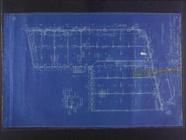
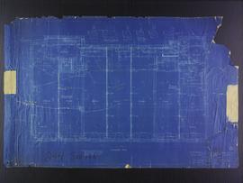
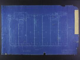
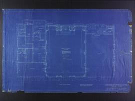
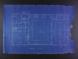
Basement plans for 383-389 Portage Avenue and 290 Edmonton Street (The Edmonton Block)
- p00256
- Part
- Apr. 1909
Part of City of Winnipeg (1874-1971)
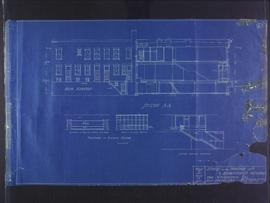
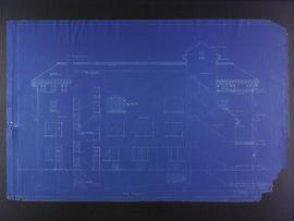
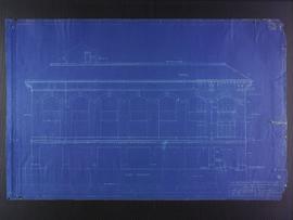
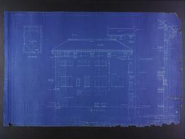
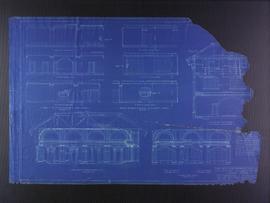
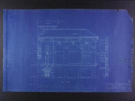
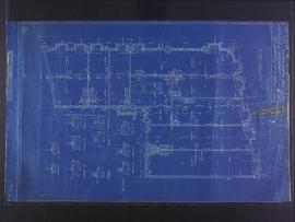
Blueprint plans of first floor of 383-389 Portage Avenue and 290 Edmonton Street (the Edmonton Block), designed by John. D. Atchison for W.H. Gardner. Drawing 2 of 5.
Atchison, John D.
Basement plans for Medical Arts Building at the corner of Graham Avenue and Kennedy Street
- p00273
- Part
- Aug. 1922
Part of City of Winnipeg (1874-1971)
Blueprint plans of basement of the Medical Arts Building at the corner of Graham Avenue and Kennedy Street. Designed by John D. Atchison. Drawing 1 of 6.
Atchison, John D.
Basement plans the Club Building for the Columbus Hall Association
- p00262
- Part
- 4 Apr. 1913
Part of City of Winnipeg (1874-1971)
Blueprint plans of basement of the Club Building for the Columbus Hall Association Ltd. on the southwest corner of Graham Avenue and Smith Street. Designed by John D. Atchison. Drawing 1 of 11.
Atchison, John D.
Butcher stall at public market
- i01762
- Item
- 1884
Item is a photographic reproduction, date unknown (original created 1884).
City Hall and Union Bank, Winnipeg
- i01712
- Item
- 1907
Postcard shows Winnipeg's second city hall (1886-1962) and Union Bank building.
City Hall and courtyard, facing Market Avenue
- i03474
- Item
- 1961
Photograph of the front side of Winnipeg's second City Hall, facing towards Market Avenue. Also featured in the photograph is the green space in front of City Hall, the Jubilee Fountain, the Volunteer Monument, businesses and store fronts on Market Avenue, and the McLaren and Cornwall Hotels in the distance. Photographed by Henry Kalen.
Metropolitan Corporation of Greater Winnipeg (Man.). Information Officer
Clark’s Department Store at Highway 59 panorama
- i04006
- Item
- 1967
View of Clarks at Highway 59, southwest corner of Panet Road and Nairn Avenue, 8.5 acres. From left to right: B/A gas bar, Loblaws, Clarks Discount Store and Auto Centre, B/A gas bar, Kavanaugh's Hamburgers. Consists of 3 separate photographs pasted together on cardboard to create a panorama. The cardboard is a scrap made from an old sign of the Metropolitan Corporation of Greater Winnipeg (visible on the reverse). The cardboard is numbered “4”, presumably as part of a compilation with other shopping centre panoramas.
Metropolitan Corporation of Greater Winnipeg (Man.). Planning Division
Corner Portage Avenue and Main Street, Winnipeg, Manitoba
- i02164
- Item
- [193-]
Print is a photographic image of the intersection of Portage Avenue and Main Street. Date of print is uncertain, [193-].
Crane and David, Bakers and Confectioners
- i01411
- Item
- [after 1910]
Staff standing in front of Crane and David Bakers and Confectioners at 765 Dufferin Avenue and a horse-drawn delivery cart.
Crestview Shopping Centre panorama
- i04011
- Item
- 1967
View of Crestview Shopping Centre, 3395 Portage Avenue, 8.3 acres. From left to right: Kmart Department Store, Dominion Store, Various Shops. Consists of 3 separate photographs pasted together on cardboard to create a panorama. The cardboard is a scrap made from an old sign of the Metropolitan Corporation of Greater Winnipeg (visible on the reverse). The cardboard is numbered “9”, presumably as part of a compilation with other shopping centre panoramas.
Metropolitan Corporation of Greater Winnipeg (Man.). Planning Division
Crossroads Shopping Centre panorama
- i04005
- Item
- 1967
View of Crossroads Shopping Centre, 1580 Regent Avenue W., 18 acres. From left to right: Woolco Department Store, Various shops, Safeway, Pacific 66 Gas Bar. Consists of 3 separate photographs pasted together on cardboard to create a panorama. The cardboard is a scrap made from an old sign of the Metropolitan Corporation of Greater Winnipeg (visible on the reverse). The cardboard is numbered “3”, presumably as part of a compilation with other shopping centre panoramas.
Metropolitan Corporation of Greater Winnipeg (Man.). Planning Division
Dakota Village Shopping Centre panorama
- i04008
- Item
- 1967
View of Dakota Village Shopping Centre, 1077-1095 St. Mary's Road, 3.5 acres. From left to right: unknown stores, Ladies and Children's Wear, Lance Pharmacy, [Dakota?] Bowling, Shoe Fair, Bank of Nova Scotia, Safeway, apartment block, Bank of Montreal. Consists of 3 separate photographs pasted together on cardboard to create a panorama. The cardboard is a scrap made from an old sign of the Metropolitan Corporation of Greater Winnipeg (visible on the reverse). The cardboard is numbered “6”, presumably as part of a compilation with other shopping centre panoramas.
Metropolitan Corporation of Greater Winnipeg (Man.). Planning Division