Print preview Close

Showing 143 results

archival descriptions
Commercial buildings Image With digital objects
Print preview Hierarchy View:

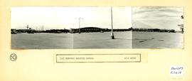
Westwood Shopping Centre panorama

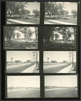
View of Westwood Shopping Centre, 3276-3332 Portage Avenue, 10.2 acres. From left to right: various shops, motel, various shops and Assiniboia Public Library, Safeway Store, Marshall Wells, Perths, Westwood Pharmacy, various Shops, Zeller's County Fair, Auto Centre. Consists of 3 separate photographs pasted together on cardboard to create a panorama. The cardboard is a scrap made from an old sign of the Metropolitan Corporation of Greater Winnipeg (visible on the reverse). The cardboard is numbered “10”, presumably as part of a compilation with other shopping centre panoramas.

Metropolitan Corporation of Greater Winnipeg (Man.). Planning Division

Arthur and Fred Landen photograph album – page 26

Page 26 of a photograph album created by brothers Arthur and Fred Landen of Hull, England. Page consists of 6 photographs taken by Fred Landen depicting, clockwise from top-left: Winnipeg’s second City Hall and the Volunteer Monument (which is captioned “Scott’s Monument, Fish Creek”); the Osborne Bridge over the Assiniboine River; a horse drawn sleigh carrying cords of wood in front of City Hall; a large house on Broadway, a dog sleigh in front of H. Laffrezen's Central Bakery at 333 1/2 William Avenue; and floating ice on the Assiniboine River.

Landen, Frederick Cluett

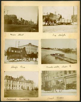
Arthur and Fred Landen photograph album – page 29

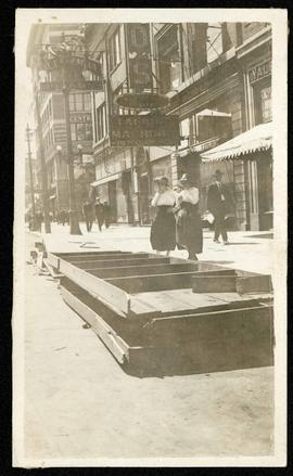
Page 29 of a photograph album created by brothers Arthur and Fred Landen of Hull, England. Page consists of 6 photographs taken by Fred Landen depicting, clockwise from top-left: Main Street facing north from McDermot Avenue; a horse-drawn sleigh carrying a large block of ice in front of the Transit Hotel on Notre Dame Avenue East (now Pioneer Avenue); break-water on the Assiniboine River with houses in the distance; women in sleigh buggy in front of storefronts on Main Street, between Portage and Graham Avenues; the old Manitoba Parliament Building; and a horse-drawn sleigh bus advertising the Vendome Hotel in front of the Commonwealth Block on Main Street and Market Avenue.

Landen, Frederick Cluett

North End Farmers' Market

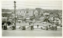
Photograph shows the North End Farmer's Market (west side Main Street, north of Stella Avenue, looking west to King Street). Included in photograph: front entrance to market, automobiles parked on street, and North End Horse Exchange (523 King Street). Photograph likely taken from 919-921 Main Street by city employee.

North End Farmers' Market

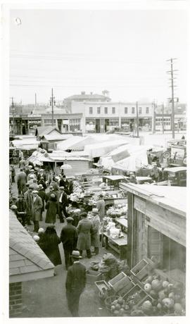
Photograph shows the North End Farmer's Market, looking east across Main Street (northwest Main Street and Stella Avenue). Included in photograph: stalls filled with vegetables and people walking through the market, Aime Bicycle Shop, 909 Main Street, two-storey brick building (899-905 Main Street), and Norquay School.

Winnipeg Renovating Co

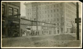
Photograph of the Winnipeg Renovating Co. and the Grain Exchange on Lombard Avenue. Item is part of small album containing photographs of maps tracking the outbreak of typhoid from 1905 to 1908 and other scenes. Item is loose and at back of album. Date of item is approximate, [circa 1909].

Winnipeg Renovating Co

Photograph of the Winnipeg Renovating Co. on Lombard Avenue. Item is part of small album containing photographs of maps tracking the outbreak of typhoid from 1905 to 1908 and other scenes. Item is loose and at back of album. Date of item is approximate, [circa 1909].

Results 101 to 120 of 143