Aerial photograph of the Red River during the 1974 Flood. The photograph faces northwest from around Helmsdale Avenue and Kildonan Drive in East Kildonan towards Scotia Street in the Seven Oaks area of West Kildonan across the river. The photographs were taken by the Department of Environmental Planning.
Winnipeg (Man.). Department of Environmental Planning
Aerial photograph of the Red River during the 1974 Flood. The photograph faces west from North Kildonan, where the Chief Peguis Trail now stands, across the river towards Kildonan Park and West Kildonan on the left, the North End Water Treatment Plant in the middle, and Old Kildonan on the right. The photographs were taken by the Department of Environmental Planning.
Winnipeg (Man.). Department of Environmental Planning
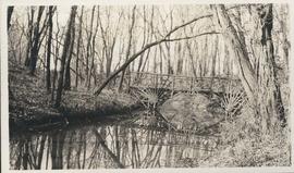
Photograph shows footbridge in wooded area, taken during the fall season. One of three photos mounted on page with caption "Scenes - Kildonan Park." Date of photograph is probable, [1923?].
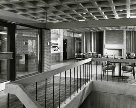
Photograph of the interior of the Peguis Pavilion in Kildonan Park. Featured is a small sitting area with tables and a small canteen window. Photograph by Henry Kalen.
Metropolitan Corporation of Greater Winnipeg (Man.). Information Officer
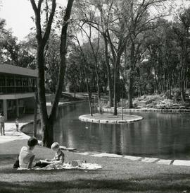
A photograph of people enjoying the pond outside of the new Peguis Pavilion in Kildonan Park. The pavilion was built in 1964. The photographer is unknown.
Metropolitan Corporation of Greater Winnipeg (Man.). Information Officer
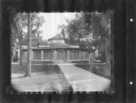
Photograph shows a view of the back entrance to the former pavilion at Kildonan Park. Photograph was likely taken by Cyril Jessop. Date of photograph is approximate, [ca. 1930].
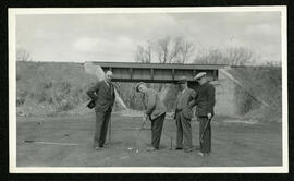
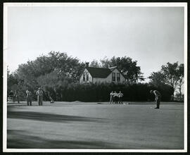
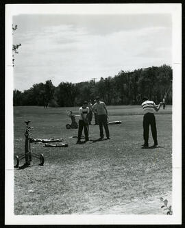
Photographs of Kildonan Park and the Kildonan Golf Course in use. Photos include aerials of the golf course, summer and winter activities in the park, and interiors of the the Peguis Pavilion.
Metropolitan Corporation of Greater Winnipeg (Man.). Information Officer
Record shows architect's rendering of the Kildonan Park Pavilion. Caption above the sketch reads 'Architect's sketch shows modern year-round pavilion, under construction at Kildonan Park.'
Metropolitan Corporation of Greater Winnipeg (Man.)


![Kildonan Park [Aerial view]](/uploads/r/city-of-winnipeg-archives-amp-records-control-branch/f/1/2/f128f88f8d2c2c0c11c754244bf269182c057eec594b0ca1962384f7a8471152/C0013_0000_0000_P0018_0036_001_142.jpg)
![Kildonan Park [Aerial view]](/uploads/r/city-of-winnipeg-archives-amp-records-control-branch/f/5/8/f589f26a584950aadbe5b101158e69cde3cad16f0f0cf05dcbb2a97e34661f16/C0013_0000_0000_P0018_0037_001_142.jpg)
