
- i00127
- Pièce
- May 15, 1950
Fait partie de City of Winnipeg (1874-1971)
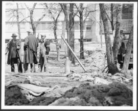
A photograph of three men building a dike during the 1950 flood.
Sans titre
2569 résultats avec objets numériques Afficher les résultats avec des objets numériques
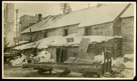
Fait partie de City of Winnipeg (1874-1971)
A photograph of three men building a dike during the 1950 flood.
Sans titre
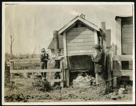
Fait partie de City of Winnipeg (1874-1971)
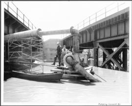
A photograph of two men working with pumps to remove water from the Norwood Bridge during the 1950 flood in Winnipeg.
Sans titre
Fait partie de City of Winnipeg (1874-1971)
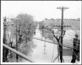
A photograph of hydro wires along flooded Bell Avenue during the 1950 flood in Winnipeg.
Sans titre

Fait partie de City of Winnipeg (1874-1971)
A photograph, taken from the north, of a flooded underpass on Anabella Street during the 1950 flood in Winnipeg. Some people in a boat are travelling down the street.
Sans titre
Fait partie de City of Winnipeg (1874-1971)
A photograph of a group of people sitting on a sandbag dike in Point Douglas during the 1950 flood in Winnipeg.
Sans titre
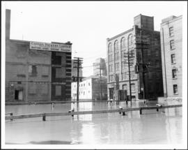
Fait partie de City of Winnipeg (1874-1971)
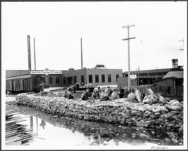
A photograph of floodwater surrounding the Canada Packers plant during the 1950 flood in Winnipeg.
Sans titre
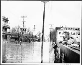
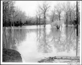
Fait partie de City of Winnipeg (1874-1971)
A photograph of flooded Notre Dame Avenue East during the 1950 flood in Winnipeg.
Sans titre
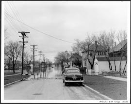
Fait partie de City of Winnipeg (1874-1971)
A photograph, looking north, of flooding at the intersection of Atlantic Avenue and St. Cross Street during the flood of 1950 in Winnipeg.
Sans titre
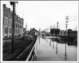
Fait partie de City of Winnipeg (1874-1971)
A photograph of an underpass on Osborne Street during the 1950 flood in Winnipeg.
Sans titre
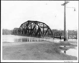
Fait partie de City of Winnipeg (1874-1971)
A photograph of the Elm Park Bridge during the 1950 flood in Winnipeg.
Sans titre
Fait partie de City of Winnipeg (1874-1971)
A photograph of a flooded underpass on Pembina Highway during the 1950 flood in Winnipeg.
Sans titre
Fait partie de City of Winnipeg (1874-1971)
A photograph of flooding at the corner of Wellington Crescent and Niagara Street during the 1950 flood in Winnipeg.
Sans titre

Fait partie de City of Winnipeg (1874-1971)
A photograph of flooding at the corner of Wellington Crescent and Ash Street during the 1950 flood in Winnipeg.
Sans titre
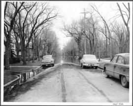
Fait partie de City of Winnipeg (1874-1971)
A photograph of flooding on West Gate during the 1950 flood in Winnipeg.
Sans titre
Telfer Block, 156 Lombard Avenue
Fait partie de City of Winnipeg (1874-1971)
Item is part of small album containing photographs of maps tracking the outbreak of typhoid from 1905 to 1908. Item is loose and at back of album. Date of item is approximate, [circa 1905].

North side of Lombard, Rorie to Main Street
Fait partie de City of Winnipeg (1874-1971)
A photograph of storefronts and advertisements on the north side of Lombard Avenue, between Rorie Street and Main Street. The photograph is part of small album containing photographs of maps tracking the outbreak of typhoid from 1905 to 1909 and other scenes. Item is loose and at back of album.
Fait partie de City of Winnipeg (1874-1971)
Item is part of small album containing photographs of maps tracking the outbreak of typhoid from 1905 to 1908 and other scenes. Item is loose and at back of album. Date of item is approximate, [circa 1909].
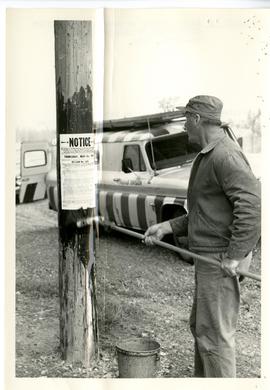
Exhibit E in the matter of posting Metropolitan Corporation of Greater Winnipeg By-law 1505
Fait partie de Metropolitan Corporation of Greater Winnipeg
Photograph shows a man posting a notice for Metropolitan Corporation of Greater Winnipeg By-law 1505 at location 5.
Sans titre

Fait partie de Metropolitan Corporation of Greater Winnipeg
Record shows architect's rendering of the Kildonan Park Pavilion. Caption above the sketch reads 'Architect's sketch shows modern year-round pavilion, under construction at Kildonan Park.'
Sans titre
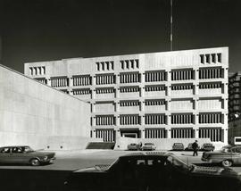
Fait partie de Metropolitan Corporation of Greater Winnipeg
A photograph of the Public Safety Building, 1951 Princess Street, taken from the parking lot by Henry Kalen.
Sans titre