- i00042
- Item
- 1871
Part of City of Winnipeg (1874-1971)
Ox drawn cart shown in photograph.
282 results with digital objects Show results with digital objects
Part of City of Winnipeg (1874-1971)
Ox drawn cart shown in photograph.
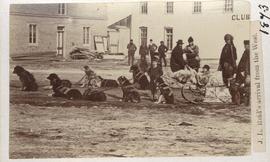
J. L. Reid's arrival from the west
Part of City of Winnipeg (1874-1971)
Dog sled shown in photograph.

Winnipeg, Main Street looking south, Spring of 1874
Part of City of Winnipeg (1874-1971)
Photograph taken from top of Courthouse.

Pontoon Bridge, Fort Garry and Warehouse from south side Assiniboine River
Part of City of Winnipeg (1874-1971)

Main Street looking north from Portage Avenue
Part of City of Winnipeg (1874-1971)
Bentley Building, Courthouse and Artesian well shown in photograph.

Part of East Ward, St. Boniface in the distance
Part of City of Winnipeg (1874-1971)
Photograph taken from top of Courthouse.

Winnipeg, Main Street looking south, Summer 1875
Part of City of Winnipeg (1874-1971)
Photograph taken from top of Courthouse.

Waghorn's Guide map and street index
Part of City Clerk's Library collection
Waghorn's Guide - a small promotional pamphlet published by J.R. Waghorn in 1895. The pamphlet contains a street map of Winnipeg, a street index, and advertisements for various Winnipeg businesses including the Clarendon Hotel, the Redwood Brewery, and the Massey-Harris Company. The map shows the old City of Winnipeg from the Red River on the east to Waverly, Aubrey, and McPhillips Streets on the west, and from Athole Avenue (now Luxton Avenue) in the north to Parker Avenue in the south. Southern Elmwood, Old St. Boniface, and Norwood are also shown on the east side of the river. Railway lines are in black and electric street railway lines are in red.

Visit of Duke and Duchess of Cornwall & York (George V and Queen Mary)
Photograph showing an arch built near the C.P.R. Station in honour of a visit by the Duke and Duchess of Cornwall & York, George V and Queen Mary.
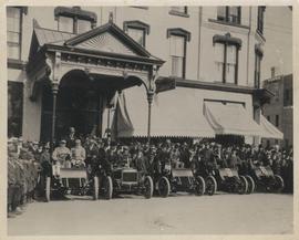
Cars and drivers, Clarendon Hotel
Photograph shows cars and drivers at Clarendon Hotel, northwest corner of Donald Street and Portage Avenue. - Inscription (on verso): 1st car, R. M. McLeod and R. Newman 2nd car, W. C. Power at wheel. 3rd car, Kelly Bros. 4th car, Douglas M. McLaughlin and Bert Wells (standing between cars is Ace Emmett). 5th car, Jack McCullock and Jimmy Boswell. - Date of photograph is approximate, ca. 1904.
Arthur and Fred Landen photograph album
Photograph album created by brothers Arthur and Fred Landen of Hull, England. Consists of circa 150 photographs of Arthur Landen’s time as Honourable Lieutenant and Quartermaster in the 1st Battalion of the Northumberland Fusiliers while stationed in Spain, Gibraltar, Egypt, and elsewhere in Africa between 1887 and 1907, as well as circa 40 photographs of Fred Landen’s stay in Winnipeg between 1903 and 1906 and his home in Hull, England. Winnipeg photographs feature homes, commercial buildings, and modes of transporation. The pages are loose and many of the photographs are faded.
Landen, Frederick Cluett

Winnipeg Street Railway on Portage Avenue in front of Merchants Hotel
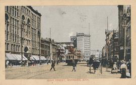
Postcard shows streetcar, horse buggies and Union Bank building.

Banfiend’s Furniture carts in front of Empire Hotel
Part of Morris Block collection
Photograph mounted on cardboard of a cavalcade of horse-drawn wagons in front of the Empire Hotel on Main Street and York Avenue, advertising deals on 3-room furniture suites at Banfield’s Furniture, 492 Main Street.
Block, Morris


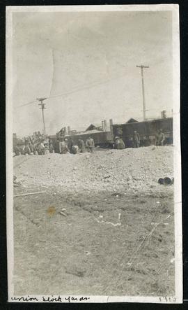
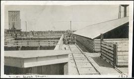
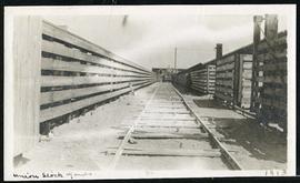
Cars hauling gravel material at Union Stock Yards
Part of Morris Block collection
Block, Morris