Winnipeg (Man.). North End

Référentiel

Code

Note(s) sur la portée et contenu

  • Encompasses the area of Winnipeg north of the Canadian Pacific Railway tracks and to the south and east of the former City of West Kildonan and Rural Municipality of Old Kildonan, as well as South Point Douglas.

Note(s) d'affichage

Termes hiérarchiques

Winnipeg (Man.). North End

Termes équivalents

Winnipeg (Man.). North End

  • Employé pour Manitoba--Winnipeg--North End
  • Employé pour North End

Termes associés

Winnipeg (Man.). North End

5 description archivistique résultats pour Winnipeg (Man.). North End

5 résultats directement liés Exclure les termes spécifiques

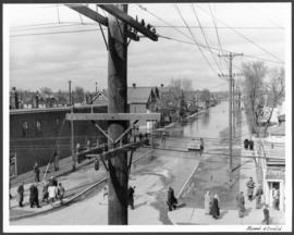
Euclid and Barber

A photograph of flooding in a residential area of Winnipeg during the 1950 flood. The photograph was taken at the intersection of Disraeli and Euclid.

Sans titre

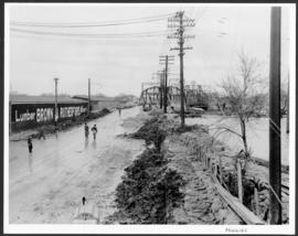
Higgins Avenue

A photograph of Higgins Avenue during the 1950 flood. A bridge over the swollen Red River can also be seen.

Sans titre

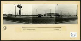
Northgate Shopping Centre panorama

View of Northgate Plaza Shopping Centre, 1375-1425 McPhillips Street, 15 acres. From left to right: Clarks Discount Store, Various Shops, Northgate Bowling Lanes, Loblaw's. Consists of 3 separate photographs pasted together on cardboard to create a panorama. The cardboard is a scrap made from an old sign of the Metropolitan Corporation of Greater Winnipeg (visible on the reverse). The cardboard is numbered “14”, presumably as part of a compilation with other shopping centre panoramas.

Sans titre