

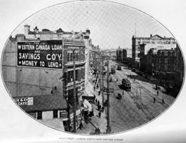
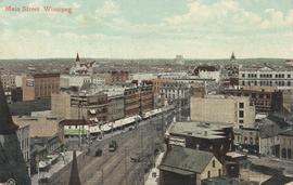
Main Street looking north from Portage Avenue
- i00038
- Item
- 1874
Part of City of Winnipeg (1874-1971)
Bentley Building, Courthouse and Artesian well shown in photograph.
68 results directly related Exclude narrower terms
Main Street looking north from Portage Avenue
Part of City of Winnipeg (1874-1971)
Bentley Building, Courthouse and Artesian well shown in photograph.

Main Street looking northeast to Grace Methodist Church
Photograph of a muddy Main Street in 1871, facing northeast from around St. Mary Avenue. Featured on the photograph's right-hand side is Grace Methodist Church, located at Main Street and Water Avenue (now William Stephenson Way), which was opened on September 17 of that year.

Main Street North from Merchants' Bank Building, Winnipeg

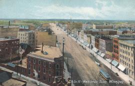
Main Street north of Portage Avenue
Photograph of a muddy Main Street in 1872, facing north from Portage Avenue and lined with shops on both sides, including a provisions store on the very right.
Date of postcard is unknown.

Main Street North, Winnipeg, Manitoba, Canada
Print is a photographic image of Main Street North. The McLaren Hotel, Hotel Cornwall and C.P.R. Station can be seen in photograph

Main Street Winnipeg looking south from City Hall
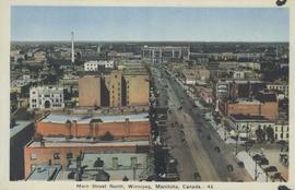
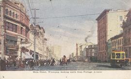
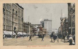
Main Street, looking north from Portage Avenue
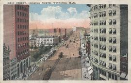
Main Street, looking north, Winnipeg, Man.
Postcard showing Main Street looking north from Bannatyne Avenue. Date of postcard is unknown.
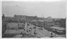
Photograph taken from McLaren Hotel at Rupert and Main Street, looking northeast, probably during World War 1. Date of photograph is uncertain, [between 1912 and 1925].
Postcard shows a view of Main Street from Portage Avenue looking north. Published by Valentine & Sons' Publishing Co., Ltd. Montreal and Toronto. Printed in Great Britain. Date of postcard is uncertain.
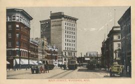
Main Street, Winnipeg, looking north from Portage Avenue
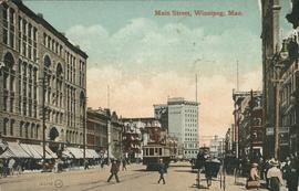
Postcard shows Main Street looking north from Portage Avenue to Union Bank Building. Published by Valentine & Sons' Publishing Co., Ltd. Montreal and Toronto. Printed in Great Britain. Date of postcard is uncertain.
Postcard shows streetcar, horse buggies and Union Bank building.
Postcard shows Main Street looking north from McDermot Avenue to Union Bank Building. Date of postcard is uncertain, [before 1949].

North side of Lombard, Rorie to Main Street
Part of City of Winnipeg (1874-1971)
A photograph of storefronts and advertisements on the north side of Lombard Avenue, between Rorie Street and Main Street. The photograph is part of small album containing photographs of maps tracking the outbreak of typhoid from 1905 to 1909 and other scenes. Item is loose and at back of album.

Portage and Main, looking west down Portage Avenue
Photograph of Portage Avenue looking west from the intersection at Main Street. Various shops and business are featured in buildings at Portage and Main that no longer exist, including the towering McArthur/Child's Building on the right. Photograph by Henry Kalen.
Metropolitan Corporation of Greater Winnipeg (Man.). Information Officer
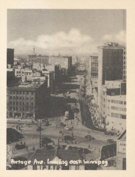
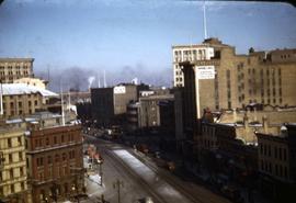
Portage Ave. looking east, Winnipeg
Photograph show Portage Avenue looking east from Main Street. Date of photograph is approximate, ca. 1940.