
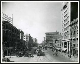
Portage Avenue looking west from Main Street
- i01440
- Item
- 1927
Date of photograph is approximate, ca. 1927.
140 results with digital objects Show results with digital objects
Portage Avenue looking west from Main Street
Date of photograph is approximate, ca. 1927.

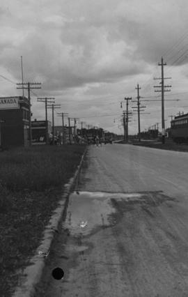
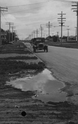
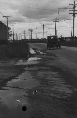
Main Street, south of Seven Oaks, 48 hours after rain
Date of photograph is July 8, 1932.
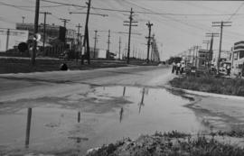
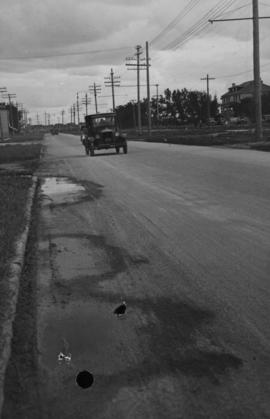
Main Street - Kilbridge to Burrin, Rainfall, June 29, 1932
Date of photograph is July 1, 1932.
Winnipeg Street Railway on Portage Avenue in front of Merchants Hotel

Winnipeg Street Railway on Portage Avenue in front of Merchants Hotel
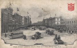
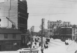
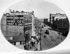
Main Street - Looking South from City Hall - Winnipeg, Man.
Postcard shows black and white drawing of Main Street with bustling activity.
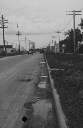
Main Street - Hartford to Belmont, 48 hours after rain
Date of photograph is July 1, 1932.
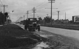
Main Street - Perth to Hartford, Rainfall, June 29, 1932
Photograph is dated July 1, 1932.
Main Street, corner Seven Oaks, Rainfall, June 29, 1932
Photograph is dated July 1, 1932.
Main Street - Perth to Hartford, Rainfall, June 29, 1932
Photograph is dated July 1, 1932.

Page shows five street views of Winnipeg, ca. 1903: 1) Main Street from Commercial Club, 2) Elgin Avenue, 3) Geo. Velie, Wholesale Wines and Liquors, 4) William Avenue, looking west, and 5) Main Street, looking north from Portage Avenue.
Main Street, looking north from Portage Avenue
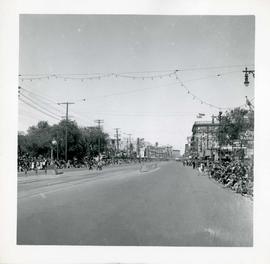
Winnipeg's 75th Anniversary parade - view of parade route

Portage Avenue looking west from Colony Street
A view of Portage Avenue looking west from Colony Street. The Hudson's Bay Company Building is featured prominantly and the Power Building is visible farther west. Playing "Young Mr. Lincoln", the Gaiety Theatre can be seen across the street with two poli

Portage Avenue looking west from Colony Street
A view of Portage Avenue looking west from Colony Street. The Hudson's Bay Company Building is featured prominantly and the Power Building and the Boyd Building are visible farther west.

Waghorn's Guide map and street index
Part of City Clerk's Library collection
Waghorn's Guide - a small promotional pamphlet published by J.R. Waghorn in 1895. The pamphlet contains a street map of Winnipeg, a street index, and advertisements for various Winnipeg businesses including the Clarendon Hotel, the Redwood Brewery, and the Massey-Harris Company. The map shows the old City of Winnipeg from the Red River on the east to Waverly, Aubrey, and McPhillips Streets on the west, and from Athole Avenue (now Luxton Avenue) in the north to Parker Avenue in the south. Southern Elmwood, Old St. Boniface, and Norwood are also shown on the east side of the river. Railway lines are in black and electric street railway lines are in red.

Notre Dame Avenue facing west from Arlington Street
View of the boulevard on Notre Dame Avenue facing west, between Arlington and McPhillips Streets. Free Press Depot Number 2 can be seen on the right.
Photographs of beautification efforts on Provencher Boulevard.