
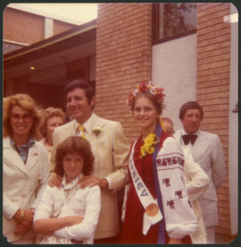
Monty Hall at the Folklorama Kiev Pavilion
- i04671
- Item
- 1974
Monty Hall posing for a photograph at the Folklorama’s Kiev / Ukrainian Pavilion.
957 results with digital objects Show results with digital objects
Monty Hall at the Folklorama Kiev Pavilion
Monty Hall posing for a photograph at the Folklorama’s Kiev / Ukrainian Pavilion.

Aerial of 1974 Flood – Red River between North and West Kildonan
Aerial photograph of the Red River during the 1974 Flood. The photograph faces west from North Kildonan, where the Chief Peguis Trail now stands, across the river towards Kildonan Park and West Kildonan on the left, the North End Water Treatment Plant in the middle, and Old Kildonan on the right. The photographs were taken by the Department of Environmental Planning.
Winnipeg (Man.). Department of Environmental Planning
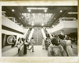
Winnipeg Convention Centre grand opening
Guests gather in front of the grand staircase for the grand opening of the Winnipeg Convention Centre on January 14, 1975.
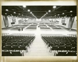
Winnipeg Convention Centre grand opening
Seating for around 5,000 guests attending the Winnipeg Convention Centre’s grand opening on January 14, 1975.
Elmwood homes, downtown businesses, and rural Winnipeg
Photographs of various homes in Elmwood, possibly used for assessment purposes, as well as photographs of Winnipeg businesses and other buildings in the core area and unknown rural locations.
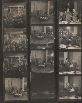
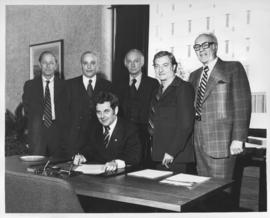
Inaugural Meeting of City Council, November 1, 1977
Item consists of a contact sheet with twelve different images showing the Inaugural Meeting of City Council and Declaration of Office, November 1, 1977. Mayor Robert Steen and City Clerk Herb E. Sanger in view. Photographer's stamp on verso.
Allan, Hugh

Council Meeting, November 2, 1977
Photograph shows first session of Council after it was reduced from 50 Councillors to 29 Councillors, taken from seating gallery looking down into Council Chamber. - Stamp (on verso): Photograph by Hugh Allan, 116 Hazeldell Ave, Winnipeg, Man., R2F 0P5.
Allan, Hugh
A photograph of Mayor Robert Steen. Inscriptions and photographer's stamp on verso. Inscriptions: "Debenture Issue" and "Financial People." Date of photograph is February 2, 1978.
Allan, Hugh

Festoon Lighting Ceremony, Courtyard, City Hall, November 17, 1978, Mayor Steen
Allan, Hugh
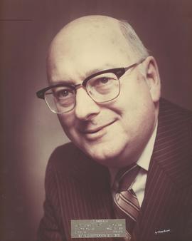
H. E. (Herb) Sanger, City Clerk
Caption: H. E. Sanger. Entered Service of the City July 1st, 1938. Deputy City Clerk March 13th, 1966. City Clerk, 1976-1979. Retired September 19th, 1979.
Allan, Hugh
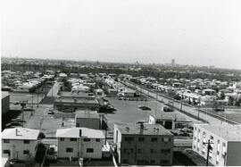
Aerial view of strip mall at Rothesay and Kingsford
Aerial view of Springfield Heights strip mall at Rothesay Street and Kingsford Avenue, facing south. Businesses include Easton’s and a Husky Service Centre.
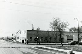
Businesses at the corner of Rothesay and Edison
Hagemier Corporation and 7-Eleven at the corner of Rothesay Street and Edison Avenue.
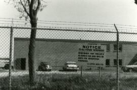
Sign about industrial zoning at business near Rothesay Street
Sign put up by J.I. Dyck Mfg. Ltd. Informing other that the property (near Rothesay Street) is zoned for industrial purposes.
Slides of the interior and exterior of the Pan Am Pool.
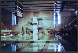
Colour slide showing the Pan Am Pool, facing the high-dive.
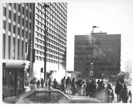
Caption (on file): "Shivering on the corner of Portage and Main on a cold, windy day waiting for traffic lights to change will now be just a memory with the opening of a climate controlled underground pedestrian concourse linking the four corners of Winnipeg's famous intersection."
Allan, Hugh
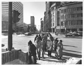

Aerial view of intersection at Portage Avenue and Main Street
Photograph shows aerial view of intersection at Portage Avenue and Main Street (after barriers closing intersection to pedestrian concourse). Also shows Bank of Nova Scotia (Trizec Building) under construction. Photograph likely taken from the top of the Richardson Building.
Allan, Hugh