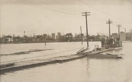
Group of people on barge with flood waters all around, 1916 Flood, Norwood
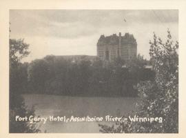
Fort Garry Hotel, Assiniboine River - Winnipeg
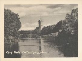
City Park - Winnipeg, Man.
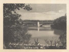
Bridge of the Forts, Assiniboine River, Winnipeg, Man.
![Assiniboine skating rink, ft. [?] of Kennedy Street - 1918](/uploads/r/city-of-winnipeg-archives-amp-records-control-branch/5/c/4/5c459682c313c672f73aaa83adbcc27373ee5977fea1a1ef42f5e5d1f62c9fc3/C0013_0000_0000_P0022_0095_068_142.jpg)
Assiniboine skating rink, ft. [?] of Kennedy Street - 1918
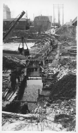
Assiniboine River crossing at Main Street, laying pipe

Assiniboine Bridge
Arthur and Fred Landen photograph album – page 32

Arthur and Fred Landen photograph album – page 31
Arthur and Fred Landen photograph album – page 29

Arthur and Fred Landen photograph album – page 28

Arthur and Fred Landen photograph album – page 26

Aerial photograph south side of Assiniboine River, west from Assiniboine Park, 1943

Aerial photograph south of Winnipeg, east of Red River, 1943

Aerial photograph Red River north from southern boundaries of North Kildonan and West St. Paul, north of Winnipeg, 1943

Aerial photograph area west of Red River, south of Winnipeg City Limits, 1943

Aerial of 1974 Flood – Red River between North and West Kildonan

Aerial of 1974 Flood – Red River between East and West Kildonan

Aerial of 1974 Flood – Pritchard Avenue Boat Dock and Redwood Bridge

Aerial of 1974 Flood – Fraser’s Grove Park
