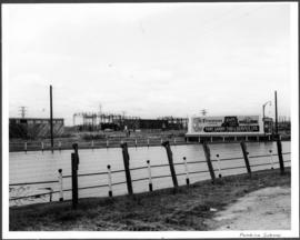
Beginning of Causeway Sutherland at Disraeli
Add to clipboard
A photograph of equipment and vehicles at the beginning of a rock causeway at the intersection of Sutherland Avenue and Disraeli Street during the 1950 flood.
Harold K. White Studio
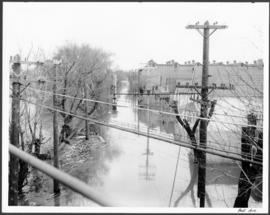
Gladstone Street from Sutherland Avenue
Add to clipboard
A photograph of flooding on Gladstone Street during the 1950 flood in Winnipeg. The photograph was taken from Sutherland Avenue.
Harold K. White Studio
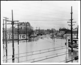
Pembina Subway
Add to clipboard
A photograph of a flooded underpass on Pembina Highway during the 1950 flood in Winnipeg.
Harold K. White Studio
Osborne and Broadway
Add to clipboard
A photograph of the intersection of Broadway and Osborne Street during the 1950 flood in Winnipeg. The photo is taken from Osborne Street, looking north; the stone cross of All Saints' Church can be seen near the left side of the image.
Harold K. White Studio
Main Street
Add to clipboard
A photograph of floodwater and sandbag dikes outside 368 and 372 Main Street during the 1950 flood in Winnipeg.
Harold K. White Studio
Portage Avenue Subway
Add to clipboard
A photograph of a flooded underpass on Portage Avenue during the 1950 flood in Winnipeg.
Harold K. White Studio
Bell Avenue
Add to clipboard
A photograph of hydro wires along flooded Bell Avenue during the 1950 flood in Winnipeg.
Harold K. White Studio
Wellington Crescent & Niagara
Add to clipboard
A photograph of flooding at the corner of Wellington Crescent and Niagara Street during the 1950 flood in Winnipeg.
Harold K. White Studio
Wellington Crescent at Ash
Add to clipboard
A photograph of flooding at the corner of Wellington Crescent and Ash Street during the 1950 flood in Winnipeg.
Harold K. White Studio
West Gate
Add to clipboard
A photograph of flooding on West Gate during the 1950 flood in Winnipeg.
Harold K. White Studio
Maryland Bridge
Add to clipboard
A photograph of floodwater around the Maryland Bridge during the 1950 flood in Winnipeg.
Harold K. White Studio
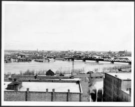
North from Arnold and Hay
Add to clipboard
A photograph of floodwater during the 1950 flood in Winnipeg. This photograph was taken looking north from the corner of Arnold Avenue and Hay Street; the Manitoba Legislature can be seen in the distance.
Harold K. White Studio
Assiniboine Avenue
Add to clipboard
A photograph of flooded Assiniboine Avenue during the 1950 flood in Winnipeg.
Harold K. White Studio
Oakwood Riverview
Add to clipboard
A photograph of people boating down Oakwood Avenue in the Riverview neighbourhood during the 1950 flood in Winnipeg.
Harold K. White Studio
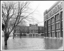
Municipal Hospitals
Add to clipboard
A photograph of the Municipal Hospitals on Morley Street, surrounded by floodwater, during the 1950 flood in Winnipeg.
Harold K. White Studio
Diking and flood waters
Add to clipboard
A photograph of floodwater being held back by a sandbag dike during the 1950 flood in Winnipeg.
Harold K. White Studio
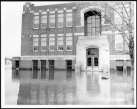
Riverview School
Add to clipboard
A photograph of Riverview School, surrounded by floodwater, during the 1950 flood in Winnipeg.
Harold K. White Studio