Main Street North, Winnipeg, Manitoba, Canada
- i02165
- Item
- [194-?]
Print is a photographic image of Main Street North. The McLaren Hotel, Hotel Cornwall and C.P.R. Station can be seen in photograph
140 results with digital objects Show results with digital objects
Main Street North, Winnipeg, Manitoba, Canada
Print is a photographic image of Main Street North. The McLaren Hotel, Hotel Cornwall and C.P.R. Station can be seen in photograph
Postcard shows Main Street looking north from McDermot Avenue to Union Bank Building. Date of postcard is uncertain, [before 1949].
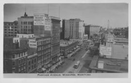
Portage Avenue, Winnipeg, Manitoba
Photograph shows view of Paris and Avenue buildings and Bank of Nova Scotia building. Date of photograph is approximate, ca. 1940.
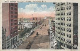
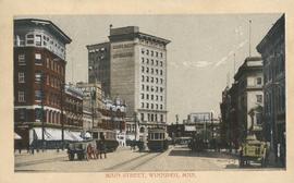
Main Street, looking north, Winnipeg, Man.
Postcard showing Main Street looking north from Bannatyne Avenue. Date of postcard is unknown.

Thoroughfares: Academy Road at Wellington Crescent
View of cars and cyclists heading down Academy Road towards Wellington Crescent and the Maryland Bridge. A small portion of Misericordia Hospital can be seen across the bridge.

Portage Avenue looking west from Colony Street
A view of Portage Avenue looking west from Colony Street. The Hudson's Bay Company Building is featured prominantly and the Power Building and the Boyd Building are visible farther west.

Portage Avenue looking west from Colony Street
A view of Portage Avenue looking west from Colony Street. The Hudson's Bay Company Building is featured prominantly and the Power Building is visible farther west. Playing "Young Mr. Lincoln", the Gaiety Theatre can be seen across the street with two poli
View of Notre Dame Avenue looking east from Kate Street
Photograph shows Notre Dame Avenue looking east from Kate Street toward Lindsay Building at 228 Notre Dame Avenue. Businesses appearing in photograph include Green Orchard Lunch, 551 Notre Dame Avenue, and B - A Service Station. Date of photograph is approximate, ca. 1939.
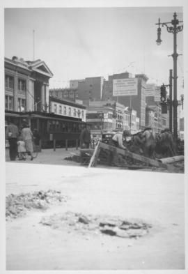
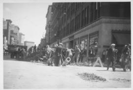
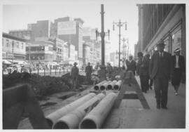
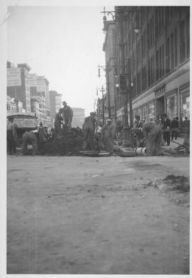
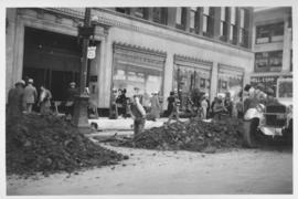
Item consists of a photograph documenting City work on Portage Avenue - pedestrians and buildings in view. Stamp (on verso): Eastman Photographic Materials Ltd., Winnipeg [...].
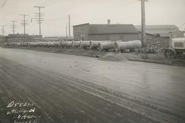
McPhillips Street, June 29, 1938

For Your Guidance While in Winnipeg promotional map
Part of Morris Block collection
A promotional map created by the Publicity Bureau of Winnipeg and Manitoba titled "For Your Guidance While in Winnipeg". Map was originally folded as a pamphlet, the front page of which features a graphic of two people driving down Highway 14 (now Highway 75) to Winnipeg. The map is not scale and features cartoon depictions of tourist destinations and landmarks around Winnipeg and St. Boniface. The maps shows major streets, railroads, and street railway lines. The map side was originally framed and cut to fit. At a result a small part of the front page is cut off, including a stamp reading "St. Raphael's Ukrainian Immigrants' Welfare Association of Can[ada]".
Block, Morris
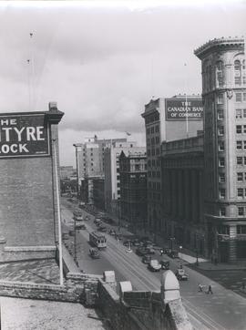
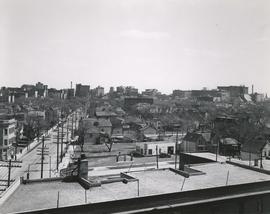
View of Main Street looking north from the Western Canada Loan Building
Photograph shows view of Main Street looking north from the roof of the Western Canada Loan Building, 392 Main Street at Portage Avenue. Date of photograph is approximate, ca. 1935.

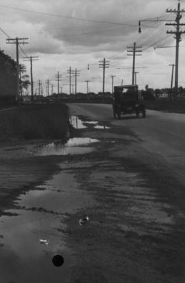
Photograph shows old St. James Bridge approach, looking north up Madison Street (now Century Street/Route 90). Present Viscount Gort site in center. Date of photograph is uncertain, [after 1932].
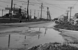
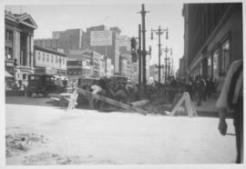
Main Street, corner Seven Oaks, Rainfall, June 29, 1932
Photograph is dated July 1, 1932.