
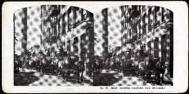
Eaton's promotional stereogram no. 27 - mail orders leaving the building
- i04497
- Item
- [ca. 1920]
Part of Morris Block collection
Block, Morris
Eaton's promotional stereogram no. 27 - mail orders leaving the building
Part of Morris Block collection
Block, Morris

Eaton's promotional stereogram no. 32 - city delivery
Part of Morris Block collection
Block, Morris
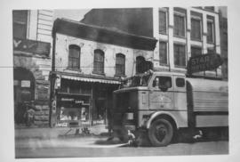
Sicard Flusher, Market Street - May 1948
Star Hotel, Market Café, Dirkfield's Novelty Mfg. shown in background of photograph.
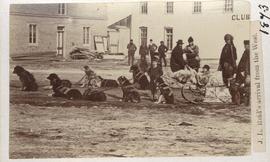
J. L. Reid's arrival from the west
Part of City of Winnipeg (1874-1971)
Dog sled shown in photograph.
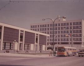
A photograph of the Civic Centre Complex, Winnipeg's third city hall (1964-present). Council Building, Administration Building, and public transit bus in view. Taken from William Avenue and Main Street, looking northwest. Date of photograph is uncertain, [197-?]. The photographer is likely Henry Kalen.
Kalen, Henry

Visit of Duke and Duchess of Cornwall & York (George V and Queen Mary)
Photograph showing an arch built near the C.P.R. Station in honour of a visit by the Duke and Duchess of Cornwall & York, George V and Queen Mary.

The Cove Restaurant, corner of Portage and Carlton
Photograph of "The Cove" Restaurant at 355 Portage Avenue, at Carlton Street. The photograph was taken from a building on Carlton Street looking southeast towards the Eaton's Building, Mitchell-Copp, Zeller's, and the Carlton Building.

Arthur and Fred Landen photograph album – page 28
Page 28 of a photograph album created by brothers Arthur and Fred Landen of Hull, England. Page consists of 6 photographs taken by Fred Landen depicting, clockwise from top-left: bricklayers in front of houses; women on a horse-drawn sleigh (captioned “Cutter”); police in raccoon-skin uniforms; a streetcar crossing the Osborne Bridge; a Ox-drawn sleigh in front of the Royal Oak Hotel in Market Square (Market Avenue and King Street); and a woman pushing a baby in a sleigh in at the northwest corner of Broadway and Kennedy Street.
Landen, Frederick Cluett
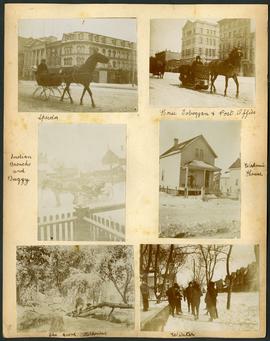
Arthur and Fred Landen photograph album – page 30
Page 30 of a photograph album created by brothers Arthur and Fred Landen of Hull, England. Page consists of 6 photographs taken by Fred Landen depicting, clockwise from top-left: A horse-drawn “speeder” sleigh in front of the Nares Building on Main Street and Lombard Avenue; a horse-drawn toboggan in front of the old post office on Main Street and McDermot Avenue; a workman’s house; children standing in winter clothes in a residential neighbourhood; Fred Landen sitting in wooded area, “The Grove” in “Kildonia” [Kildonan] - likely Fraser's Grove in East Kildonan; and a horse and buggy in a residential neighbourhood.
Landen, Frederick Cluett
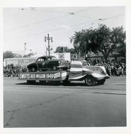
Winnipeg's 75th Anniversary parade - Swift's Red Wagon 1949 float
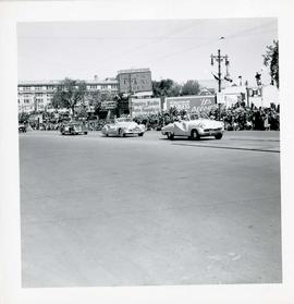
Winnipeg's 75th Anniversary parade - line of cars
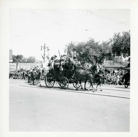
Winnipeg's 75th Anniversary parade – Cowboys on stagecoach
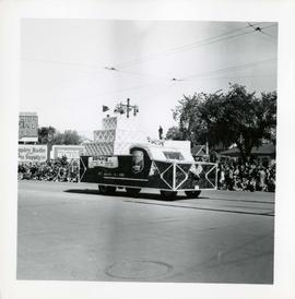
Winnipeg's 75th Anniversary parade - Ogilvie float


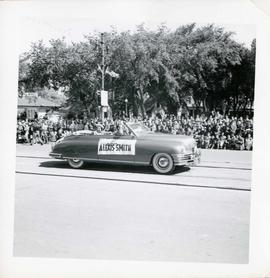
Winnipeg's 75th Anniversary parade - Hollywood star Alexis Smith
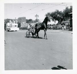
Winnipeg's 75th Anniversary parade - "Princess Patch" cart

Waghorn's Guide map and street index
Part of City Clerk's Library collection
Waghorn's Guide - a small promotional pamphlet published by J.R. Waghorn in 1895. The pamphlet contains a street map of Winnipeg, a street index, and advertisements for various Winnipeg businesses including the Clarendon Hotel, the Redwood Brewery, and the Massey-Harris Company. The map shows the old City of Winnipeg from the Red River on the east to Waverly, Aubrey, and McPhillips Streets on the west, and from Athole Avenue (now Luxton Avenue) in the north to Parker Avenue in the south. Southern Elmwood, Old St. Boniface, and Norwood are also shown on the east side of the river. Railway lines are in black and electric street railway lines are in red.

Canadian National Railways and Icelandic pioneers floats
Part of City of Winnipeg (1874-1971)
Winnipeg (Man.). Special Jubilee Committee