
- i00157
- Item
- 1950
Part of City of Winnipeg (1874-1971)
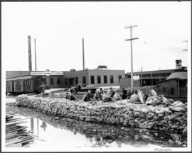
A photograph of a group of people sitting on a sandbag dike in Point Douglas during the 1950 flood in Winnipeg.
Harold K. White Studio
Part of City of Winnipeg (1874-1971)
A photograph of a group of people sitting on a sandbag dike in Point Douglas during the 1950 flood in Winnipeg.
Harold K. White Studio
Part of City of Winnipeg (1874-1971)
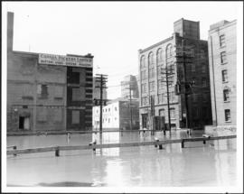
A photograph of floodwater surrounding the Canada Packers plant during the 1950 flood in Winnipeg.
Harold K. White Studio
Part of City of Winnipeg (1874-1971)
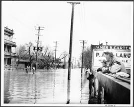
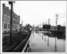
A photograph of flooded Notre Dame Avenue East during the 1950 flood in Winnipeg.
Harold K. White Studio
Part of City of Winnipeg (1874-1971)
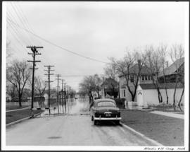
A photograph, looking north, of flooding at the intersection of Atlantic Avenue and St. Cross Street during the flood of 1950 in Winnipeg.
Harold K. White Studio
Part of City of Winnipeg (1874-1971)
A photograph of an underpass on Osborne Street during the 1950 flood in Winnipeg.
Harold K. White Studio
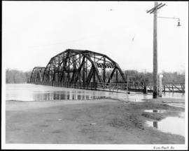
Part of City of Winnipeg (1874-1971)
A photograph of the Elm Park Bridge during the 1950 flood in Winnipeg.
Harold K. White Studio
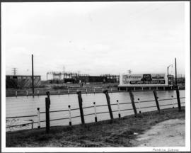
Part of City of Winnipeg (1874-1971)
A photograph of a flooded underpass on Pembina Highway during the 1950 flood in Winnipeg.
Harold K. White Studio
Part of City of Winnipeg (1874-1971)
A photograph of flooding at the corner of Wellington Crescent and Niagara Street during the 1950 flood in Winnipeg.
Harold K. White Studio

Part of City of Winnipeg (1874-1971)
A photograph of flooding at the corner of Wellington Crescent and Ash Street during the 1950 flood in Winnipeg.
Harold K. White Studio
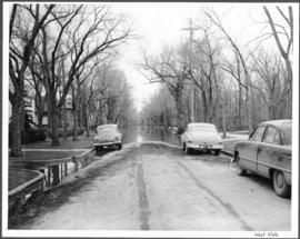
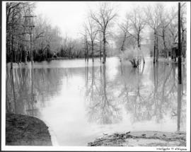
Part of City of Winnipeg (1874-1971)
A photograph of flooding on West Gate during the 1950 flood in Winnipeg.
Harold K. White Studio
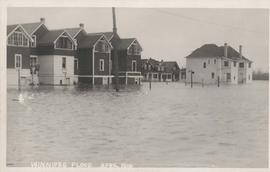
Postcard is a photographic print showing buildings surrounded by water. Unknown photographer, Noko mark appears in stamp box.
Winnipeg under water - April 1916
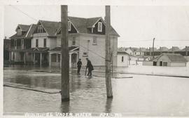
Postcard is a photographic print showing water flooding homes likely in St. Boniface. Unknown photographer, Noko mark appears in stamp box.

No. 8 A portion of the Lyndale dike in Norwood with the Norwood Bridge in the background
Photograph shows scene from 1950 flood. Description (on verso): Note the roof of the Greater Winnipeg Sanitary District Marion Street pumping station on the right. Stamp (on verso): City of Winnipeg - Engineering Dept., Water Works Division, Ross and Tecumseh.
Dyking built up around Shaarey Zedek Synagogue, 1950 Flood
Photograph taken at Shaarey Zedek Synagogue, 561 Wellington Crescent off Academy Road, on the western bank of the Assiniboine River. - Stamp (on verso): by Harold K. White Studio, 274 Fort St. Winnipeg, Phone 924 289.
Harold K. White Studio
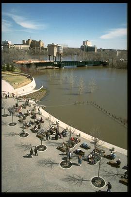
1997 flood - The Forks - view of the confluence
Part of Winnipeg Flood Record and Archives Committee collection
A photograph of the confluence of the flooded Red and Assiniboine Rivers during the 1997 flood.
Winnipeg (Man.). Community Services Department

1997 flood - City Hall - 6th floor call centre
Part of Winnipeg Flood Record and Archives Committee collection
A photograph of city employees at a call centre in City Hall during the 1997 flood.
Winnipeg (Man.). Community Services Department
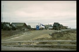
1997 flood - Mouth of the floodway (south end) - military personnel
Part of Winnipeg Flood Record and Archives Committee collection
A photograph of military vehicles and personnel near the mouth of the south end of the floodway during the 1997 flood.
Winnipeg (Man.). Community Services Department
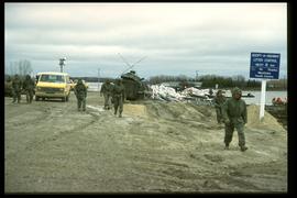
1997 flood - Mouth of the floodway (south end) - military personnel
Part of Winnipeg Flood Record and Archives Committee collection
A photograph of military vehicles and personnel near the mouth of the south end of the floodway during the 1997 flood.
Winnipeg (Man.). Community Services Department
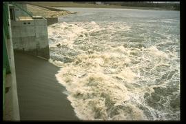
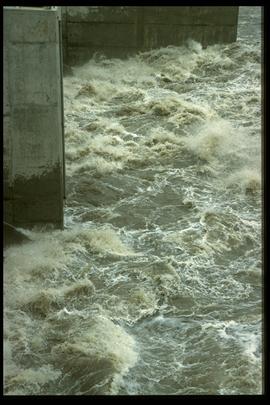
1997 flood - Courchaine Road - floodway gates
Part of Winnipeg Flood Record and Archives Committee collection
A photograph of water rushing through the floodway gates near Courchaine Road during the 1997 flood.
Winnipeg (Man.). Community Services Department
1997 flood - Courchaine Road - floodway gates
Part of Winnipeg Flood Record and Archives Committee collection
A photograph of water rushing through the floodway gates near Courchaine Road during the 1997 flood.
Winnipeg (Man.). Community Services Department