Affichage de 68 résultats

description archivistique
Winnipeg (Man.). Downtown Streets
Aperçu avant impression Hierarchy Affichage :

68 résultats avec objets numériques Afficher les résultats avec des objets numériques

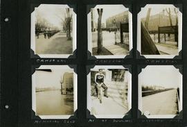
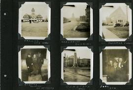
Scrapbook of Corporal Wallace – page 9

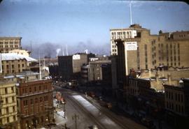
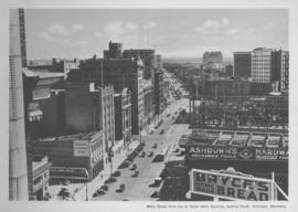
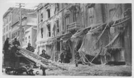
Page 9 of a photograph scrapbook made by Corporal John Wallace in April 1940. Photographs depict a street in Gladstone Manitoba, a trolley bus in Winnipeg on Kennedy Street (between Ellice and Qu'Appelle), and the Butler family, acquaintances of Wallace. See page three of this scrapbook for more details on the Butler family.

Sans titre

Scrapbook of Corporal Wallace – page 8

Page 8 of a photograph scrapbook made by Corporal John Wallace in April 1940. Photographs depict the Queen’s Own Cameron Highlanders of Canada near the Raleigh Apartments at Vaughan Street and Ellice Avenue, Memorial Boulevard (likely at Broadway, facing west with the Mall Hotel in the distance), a road outside Fort Osborne Barracks, and Corporal Wallace at the home of “The Dowlings” (likely on Beaverbrook Street).

Sans titre

Scrapbook of Corporal Wallace – page 6

Page 6 of a photograph scrapbook made by Corporal John Wallace in April 1940. Photographs depict the Pavilion in City Park (Assiniboine Park), the Legislature Building off in the distance down Memorial Boulevard, St. Ignatius Church at Corydon Avenue and Stafford Street, the Winnipeg Cenotaph, and acquaintenances of Wallace, Mr. and Mrs. McCarthy and “Sister Sue”, and two people identified only as “Joan” and “Den”. See general notes section for more details.

Sans titre

Scrapbook of Corporal Wallace – page 2

Page 2 of a photograph scrapbook made by Corporal John Wallace in April 1940. Photos consist of Portage Avenue looking west from around Vaughn Street, a rail line at Portage Avenue and St. James Street, troops in formation, and Mrs. and Shirley Gardiner. See general notes section for more details.

Sans titre

Waghorn's Guide map and street index

Waghorn's Guide - a small promotional pamphlet published by J.R. Waghorn in 1895. The pamphlet contains a street map of Winnipeg, a street index, and advertisements for various Winnipeg businesses including the Clarendon Hotel, the Redwood Brewery, and the Massey-Harris Company. The map shows the old City of Winnipeg from the Red River on the east to Waverly, Aubrey, and McPhillips Streets on the west, and from Athole Avenue (now Luxton Avenue) in the north to Parker Avenue in the south. Southern Elmwood, Old St. Boniface, and Norwood are also shown on the east side of the river. Railway lines are in black and electric street railway lines are in red.

Winnipeg Renovating Co

Photograph of the Winnipeg Renovating Co. on Lombard Avenue. Item is part of small album containing photographs of maps tracking the outbreak of typhoid from 1905 to 1908 and other scenes. Item is loose and at back of album. Date of item is approximate, [circa 1909].

Résultats 1 à 20 sur 68