
![C.P.R. Yards looking West [Aerial view]](/uploads/r/city-of-winnipeg-archives-amp-records-control-branch/1/d/2/1d24b0471a50903dd76276838a7e169e4890a17020a9cfe6a0d34e153ebb9ec9/C0013_0000_0000_P0018_0027_001_142.jpg)
C.P.R. Yards looking West [Aerial view]
- i01911
- Item
- 1942
Inscription (on recto): WG A114 30-2-42 CPR [Canadian Pacific Railway] RR [Railroad] Yards looking West.
C.P.R. Yards looking West [Aerial view]
Inscription (on recto): WG A114 30-2-42 CPR [Canadian Pacific Railway] RR [Railroad] Yards looking West.

Polo Park Shopping Centre panorama
View of Polo Park Shopping Centre, 1485 Portage Avenue, 41 acres. South side of shopping centre. Left to right: Winnipeg Motor Products, Motor Club, Simpson Sears Service Station, Simpson Sears Department Store. Consists of 3 separate photographs pasted together on cardboard to create a panorama. The cardboard is a scrap made from an old sign of the Metropolitan Corporation of Greater Winnipeg (visible on the reverse). The cardboard is numbered “13”, presumably as part of a compilation with other shopping centre panoramas.
Metropolitan Corporation of Greater Winnipeg (Man.). Planning Division

Thoroughfares: Academy Road at Wellington Crescent
View of cars and cyclists heading down Academy Road towards Wellington Crescent and the Maryland Bridge. A small portion of Misericordia Hospital can be seen across the bridge.
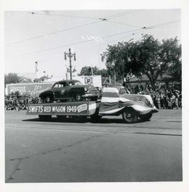
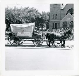
Winnipeg's 75th Anniversary parade - Swift's Red Wagon 1949 float
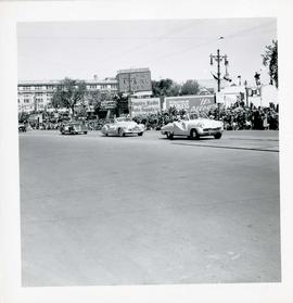
Winnipeg's 75th Anniversary parade - line of cars
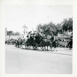
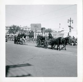
Winnipeg's 75th Anniversary parade – Cowboys on stagecoach
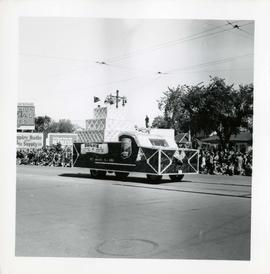
Winnipeg's 75th Anniversary parade - Ogilvie float


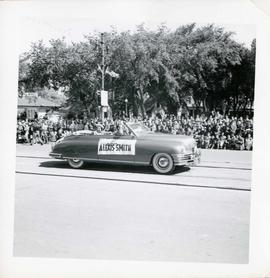
Winnipeg's 75th Anniversary parade - Hollywood star Alexis Smith
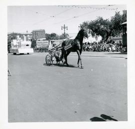
Winnipeg's 75th Anniversary parade - "Princess Patch" cart

Waghorn's Guide map and street index
Part of City Clerk's Library collection
Waghorn's Guide - a small promotional pamphlet published by J.R. Waghorn in 1895. The pamphlet contains a street map of Winnipeg, a street index, and advertisements for various Winnipeg businesses including the Clarendon Hotel, the Redwood Brewery, and the Massey-Harris Company. The map shows the old City of Winnipeg from the Red River on the east to Waverly, Aubrey, and McPhillips Streets on the west, and from Athole Avenue (now Luxton Avenue) in the north to Parker Avenue in the south. Southern Elmwood, Old St. Boniface, and Norwood are also shown on the east side of the river. Railway lines are in black and electric street railway lines are in red.
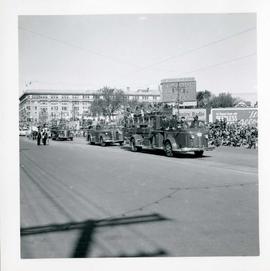
Winnipeg's 75th Anniversary parade - fire trucks
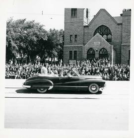
Winnipeg's 75th Anniversary parade - car carrying women


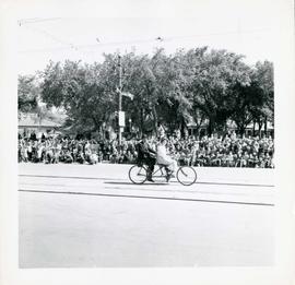
Winnipeg's 75th Anniversary parade - two person bicycle
Winnipeg's 75th Anniversary parade - The Outlet Store float
Winnipeg's 75th Anniversary parade - horse drawn fire engines

Polo Park Shopping Centre panorama
View of Polo Park Shopping Centre, 1485 Portage Avenue, 41 acres. West side of shopping centre, north side of Portage Avenue between Empress Street and St. James Street. Left to Right: Winnipeg Stadium, Winnipeg Arena, Loblaws, Simpson Sears Marina, Simpson Sears Garden Shop, Simpson Sears Department Store, Simpson Sears Service Station. Consists of 4 separate photographs pasted together on cardboard to create a panorama. The cardboard is a scrap made from an old sign of the Metropolitan Corporation of Greater Winnipeg (visible on the reverse). The cardboard is numbered “11”, presumably as part of a compilation with other shopping centre panoramas.
Metropolitan Corporation of Greater Winnipeg (Man.). Planning Division