
- i02942
- Pièce
- 1905
Fait partie de Parks and Recreation Photograph collection
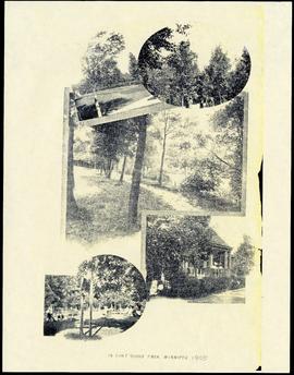
Item features reproductions of five photographs showing Fort Rouge Park in 1905. Caption reads, "In Fort Rouge Park, Winnipeg."
2569 résultats avec objets numériques Afficher les résultats avec des objets numériques
Fait partie de Parks and Recreation Photograph collection
Item features reproductions of five photographs showing Fort Rouge Park in 1905. Caption reads, "In Fort Rouge Park, Winnipeg."

Crane and David (Western Cake and Pie Co) storefront
Fait partie de Morris Block collection
Group photograph mounted on cardboard of the staff of Crane and David, Bakers and Confectioners (also knows as the Western Cake and Pie Company) in front of their store at 765 Dufferin Avenue.
Sans titre
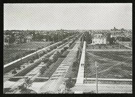
Broadway looking west from Fort Garry Court
Fait partie de Morris Block collection
Photograph taken from Fort Garry Court, located at Broadway and Main Street, looking west down Broadway. St. Mary’s Academy, the Parliament Building (Legislature), and Law Courts are labeled off in the distance.
Sans titre
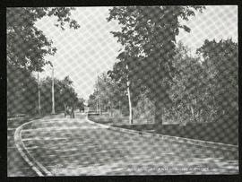
Assiniboine Avenue at Armstrong’s Point
Fait partie de Morris Block collection
Photograph of a horse-drawn cart on Assiniboine Avenue near Armstrong Point, possibly what is now the Cornish Path.
Sans titre
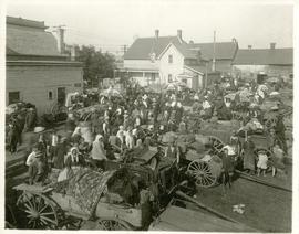
The North End market behind Dufferin Avenue and Derby Street
Fait partie de City of Winnipeg Archives Photograph collection
Carts of goods and shoppers in a bustling market around Dufferin Avenue and Derby Street in the North End.
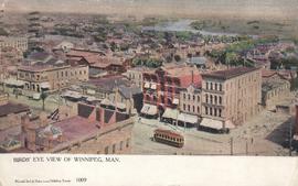
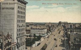
Birds' Eye view of Winnipeg, Man.
Fait partie de City of Winnipeg Archives Photograph collection

G. Champion, Superintendent of Public Parks Board
Fait partie de Parks and Recreation Photograph collection
Photograph shows G. Champion, Superintendent for the Public Parks Board from 1907 to 1935.
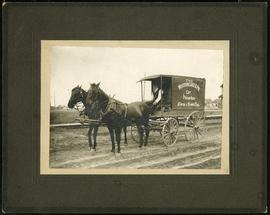
Western Cake and Pie Co carriage
Fait partie de Morris Block collection
Photograph mounted on cardboard of the horse-drawn delivery wagon of the Western Cake and Pie Comapany, owned by Crane and David, who owned a bakery at 765 Dufferin Avenue.
Sans titre

Fait partie de Morris Block collection
Photograph of the Land Titles Building on Broadway and Memorial Boulevard.
Sans titre
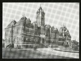
Fait partie de Morris Block collection
Photograph of the old Winnipeg Law Courts Building.
Sans titre
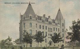
Wesley College, 515 Portage Avenue, northwest corner of Portage Avenue and Balmoral Street
Fait partie de City of Winnipeg Archives Photograph collection
Date of postcard is approximate, ca. 1905.
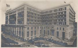
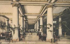
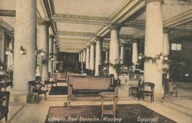
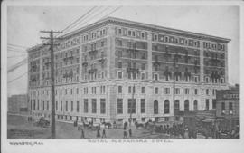
"The Royal Alexandra," Canadian Pacific Railway's Hotel, Winnipeg, Manitoba
Fait partie de City of Winnipeg Archives Photograph collection
Item consists of postcard in printed format that shows the Royal Alexandra, the Canadian Pacific Railway's Hotel. Now demolished, the Hotel once stood at the northeast corner of Higgins Avenue and Main Street. - Published by Valentine Edy Company, Limited, Winnipeg, Manitoba. Printed in Great Britain. Date of postcard is unknown.

Plan of University section of Tuxedo Park
Fait partie de Parks and Recreation Photograph collection
A map of the proposed Tuxedo Park residential suburb, specifically the area surrounding the old University of Manitoba campus and Olmsted and Assiniboine Parks. The map shows streets and lots as well as details of the university campus. The map was created by Charles Clifton Chataway (1869-1920) and Bulman Brothers Ltd.
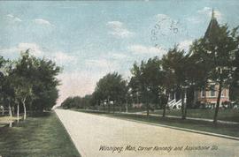
Winnipeg, Man., Corner Kennedy and Assiniboine Sts.
Fait partie de City of Winnipeg Archives Photograph collection
Postcard shows view of Kennedy Street, looking North from Assiniboine Avenue. Nicholas Bawlf residence, 11 Kennedy Street, shown at right foreground. Published by W. J. & Co. Ltd., Toronto, made in Germany. Date of postcard is approximate, ca. 1906.
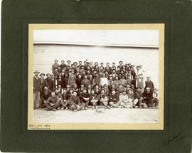
Group photo of workers at Stony Mountain Quarry
Fait partie de City of Winnipeg Archives Photograph collection
A group photograph of Stony Mountain Quarry workers posing for the camera.
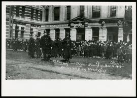
Police during 1906 Winnipeg Street Railway Strike
Fait partie de City of Winnipeg Archives Photograph collection
A photograph of the street Railway strike in Winnipeg, taken March 30th,1906.
Fait partie de City of Winnipeg Archives Photograph collection