
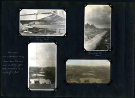
William Smaill Photo Album – Page 65
- p00183
- Part
- [1914 or 1915]
Part of William Smaill fonds
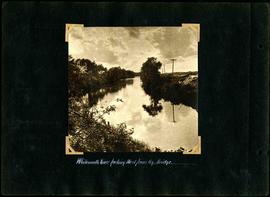
Captions read: Whitemouth River looking west from railway bridge..
Smaill, William
191 results with digital objects Show results with digital objects
William Smaill Photo Album – Page 65
Part of William Smaill fonds
Captions read: Whitemouth River looking west from railway bridge..
Smaill, William
William Smaill Photo Album – Page 69
Part of William Smaill fonds
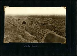
Captions read: Traveller, camp 2.
Smaill, William
William Smaill Photo Album – Page 72
Part of William Smaill fonds
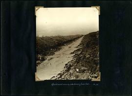
Captions read: Quicksand running into trench from sides, Mile 72.
Smaill, William
William Smaill Photo Album – Page 76
Part of William Smaill fonds
Smaill, William
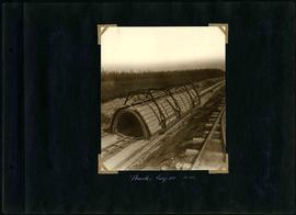
William Smaill Photo Album – Page 78
Part of William Smaill fonds
Captions read: Traveller, camp 3, Mile 65.
Smaill, William
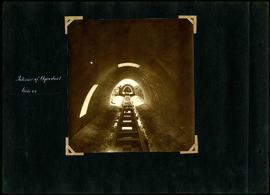
William Smaill Photo Album – Page 79
Part of William Smaill fonds
Captions read: Interior of aqueduct, mile 64.
Smaill, William
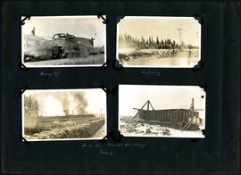
William Smaill Photo Album – Page 85
Part of William Smaill fonds
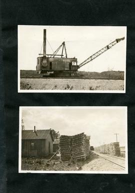
Captions read: Plouging off - Surfacing - Bush fires Patriotic Wood Camp, mile 57.
Smaill, William
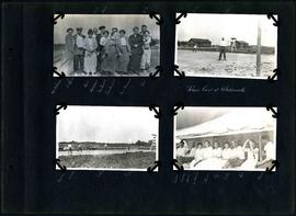
William Smaill Photo Album – Page 88
Part of William Smaill fonds
Captions read: Mrs Williams, McLerie, Josh, Kathleen, Mrs. Stewart, Mrs. Smaill, Mrs Pariseau, Pat, Taylor, Baldy, Scotty - Tennis court at Whitemouth, McLearrie, Crawley - Barber, Crawly, McLerie, Taylor - Taylor, Crawly, Janie, Mrs. Williams, Grace, Peg
Smaill, William
William Smaill Photo Album – Page 91
Part of William Smaill fonds
Captions read: Shows settlement of class 19[?] in muskeg, mile 86 - Foundation Fill, camp 6 - Pilot ditch dug with class in drag, shows how muskeg rises in ditch after being excavated to a depth of 8 feet.
Smaill, William

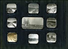
William Smaill Photo Album – Page 95
Part of William Smaill fonds
Captions read: Whitemouth River.
Smaill, William
William Smaill Photo Album – Page 97
Part of William Smaill fonds
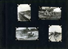
Captions read: Views at Camp 2, Mile 51 - Packed backfill, gravel - Inverst after Rainstorm - Boulders from trench - Mixer, concrete cars, and gas dinkey - Pads protected from frost with moss - Manhole and blowoff - Mixer.
Smaill, William
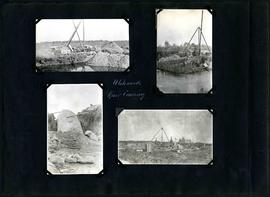
William Smaill Photo Album – Page 99
Part of William Smaill fonds
Captions read: Whitemouth River crossing.
Smaill, William
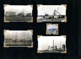
William Smaill Photo Album – Page 107
Part of William Smaill fonds
Smaill, William
William Smaill Photo Album – Page 108
Part of William Smaill fonds
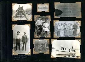
Captions read: My car at mile 38 - Indian Bay - First crew to operate class 7 drag, C. Walgren, operator, [W.H.?] Smaill, fireman - Lassie, Hamish - Fisherman's Tug, Shoal Lake. Also contains a photo showing Kekekoziibii Shoal Lake 40 First Nation in the distance.
Smaill, William
William Smaill Photo Album – Page 109
Part of William Smaill fonds
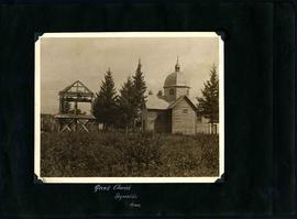
Captions read: Greek church, Reynolds, Manitoba.
Smaill, William
William Smaill Photo Album – Page 110
Part of William Smaill fonds
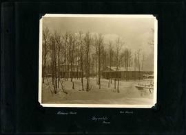
Captions read: Richan's house, our house, Reynolds, Manitoba.
Smaill, William

William Smaill Photo Album – Page 113
Part of William Smaill fonds
Blank page.
Smaill, William

William Smaill Photo Album – Page 116
Part of William Smaill fonds
Blank page.
Smaill, William
William Smaill Photo Album – loose page
Part of William Smaill fonds
Captions read: Contains no captions.
Smaill, William
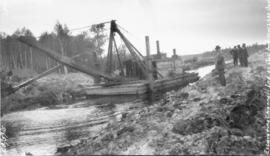
Excavating Falcon River Diversion Canal at Shoal Lake
Photograph of a dredge excavating the Falcon River Diversion Canal between Indian Bay and Snowshoe Bay, with consulting Engineer James H. Fuertes standing to the right. Photograph is looking northwest and the photographer is unknown.
Greater Winnipeg Water District