
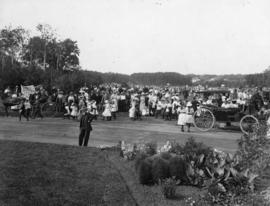
Playground Sports Day at Assiniboine Park
- i03099
- Pièce
- 1910
Fait partie de Parks and Recreation Photograph collection
Photograph shows playground sports day at Assiniboine Park.
103 résultats avec objets numériques Afficher les résultats avec des objets numériques
Playground Sports Day at Assiniboine Park
Fait partie de Parks and Recreation Photograph collection
Photograph shows playground sports day at Assiniboine Park.
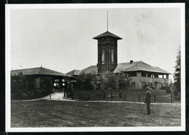
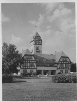
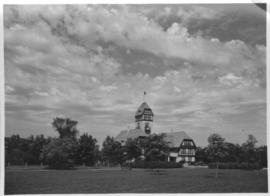
Assiniboine Park Pavilion and Annex
Fait partie de Parks and Recreation Photograph collection
A man standing in front of the Pavilion and Annex at Assiniboine Park.
Fait partie de Parks and Recreation Photograph collection
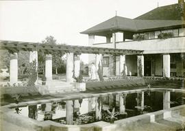
A page from a photograph album. Photograph shows people viewing the pergola behind the former Assiniboine Park Pavilion. Date of photograph is approximate, [ca. 1920].
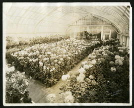
Interior of the Assiniboine Park conservatory
Fait partie de Public Works Photograph collection
A photo of flowers growing in the interior of the original Assiniboine Park conservatory.
Sans titre
Fait partie de Public Works Photograph collection
From a collection of records about the history of parks and recreational activities in Winnipeg with photos of the Assiniboine Park Zoo Bear Enclosure
Sans titre
Fait partie de Parks and Recreation Photograph collection
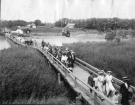
Photograph shows people walking across the foot bridge to Assiniboine Park. Date of photograph is uncertain, [ca. 1920].
Fait partie de Parks and Recreation Photograph collection
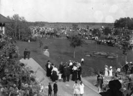
Photograph shows a view of Assiniboine Park from the front of the Pavilion. Date of photograph is uncertain, [ca. 1920].
Fait partie de City of Winnipeg Archives Photograph collection
Fait partie de City of Winnipeg Archives Photograph collection

Women at Assiniboine Park lily pond
Fait partie de Parks and Recreation Photograph collection
Two young women sitting near the lily pond and the Pergola at Assiniboine Park.

Plan of University section of Tuxedo Park
Fait partie de Parks and Recreation Photograph collection
A map of the proposed Tuxedo Park residential suburb, specifically the area surrounding the old University of Manitoba campus and Olmsted and Assiniboine Parks. The map shows streets and lots as well as details of the university campus. The map was created by Charles Clifton Chataway (1869-1920) and Bulman Brothers Ltd.