
- i03953
- Pièce
- [ca. 1920]
Fait partie de Parks and Recreation Photograph collection
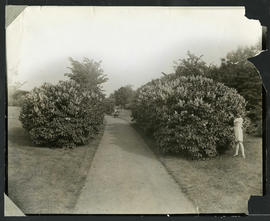
Photograph of a child picking lilacs from a hedge in Elmwood Park. Photograph by Cyril Jessop, 502 Sherburne Street.
146 résultats avec objets numériques Afficher les résultats avec des objets numériques
Fait partie de Parks and Recreation Photograph collection
Photograph of a child picking lilacs from a hedge in Elmwood Park. Photograph by Cyril Jessop, 502 Sherburne Street.
Fait partie de Parks and Recreation Photograph collection
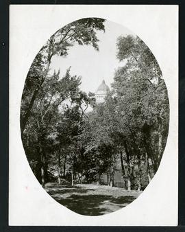
A photograph showing Fort Rouge Park with Legislature in the background. Date of photograph is approximate, [ca. 1930].
Fait partie de Parks and Recreation Photograph collection
Record consists of one album page with two mounted photographs of Fort Rouge Park. Includes image of Fort Rouge Park with the Manitoba Legislature in the background (left) and an image of an unknown green space (right). On the reverse, there is an image of a group of girls performing on an outdoor stage.
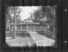
Kildonan Park – Pavilion back entrance
Fait partie de Parks and Recreation Photograph collection
Photograph shows a view of the back entrance to the former pavilion at Kildonan Park. Photograph was likely taken by Cyril Jessop. Date of photograph is approximate, [ca. 1930].
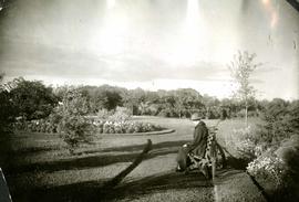
Woman sitting on bench in Kildonan Park
Fait partie de Parks and Recreation Photograph collection
Photograph shows a view of Kildonan Park with a woman sitting on a bench. Her bicycle is leaning against the bench. Date of photograph is approximate, [ca. 1930].
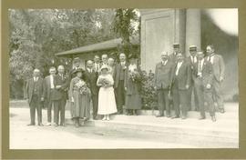
Wedding party at Kildonan Park
Fait partie de Parks and Recreation Photograph collection
Photograph shows a wedding party posing near the front entrance to the former Pavilion in Kildonan Park. Guests include, from right to left, Aldermen D. McLean, H. Jones [?], Thomas Boyd [?], W.B. Simpson, J.A. McKerchar, A.H. Pulford, F.O. Fowler[?], and, on the far left, Thomas Flye.
Fait partie de Parks and Recreation Photograph collection
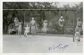
Photograph shows children playing on swing set in St. John's Park. Date of photograph is approximate, [ca. 1930].
Fait partie de Parks and Recreation Photograph collection
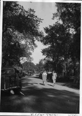
Photograph shows women walking in St. Vital Park.
Fait partie de Parks and Recreation Photograph collection
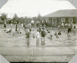
Photograph shows children playing at a wading pool in Weston Park. Date of photograph is approximate, [ca. 1930].
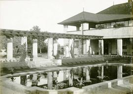
Assiniboine Park Pergola and Pavilion
Fait partie de Parks and Recreation Photograph collection
A photograph album page with a photograph of storm clouds near the Assiniboine Park Pavilion on the first side and a photograph of the Pergola behind the Pavilion at Assinboine Park on the second side.

Plan of University section of Tuxedo Park
Fait partie de Parks and Recreation Photograph collection
A map of the proposed Tuxedo Park residential suburb, specifically the area surrounding the old University of Manitoba campus and Olmsted and Assiniboine Parks. The map shows streets and lots as well as details of the university campus. The map was created by Charles Clifton Chataway (1869-1920) and Bulman Brothers Ltd.
Fait partie de Parks and Recreation Photograph collection
Fait partie de Parks and Recreation Photograph collection
A page from a photograph album. Photograph shows people viewing the pergola behind the former Assiniboine Park Pavilion. Date of photograph is approximate, [ca. 1920].
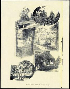
Fait partie de Parks and Recreation Photograph collection
Item features reproductions of five photographs showing Fort Rouge Park in 1905. Caption reads, "In Fort Rouge Park, Winnipeg."
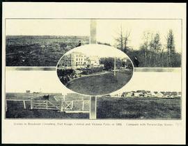
Scenes in Brookside Cemetery, Fort Rouge, Central and Victoria Parks in 1898
Fait partie de Parks and Recreation Photograph collection
A printed page consisting of a 5 photograph collage of scenes from Fort Rouge Park, Central Park, Victoria Park, and Brookside Cemetery. The photographs date from 1898, but the page itself is likely from 1913.

Fait partie de Parks and Recreation Photograph collection
Photograph shows a playground opening ceremony. From left to right: Frank White, Samuel Cartwright, Mayor Garnett Coulter, ?, Charlie Barbour.
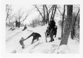
Omand's Creek Park and Linear Playground
Fait partie de Parks and Recreation Photograph collection
Photograph shows children and adults on a hill tobogganing. Date of photograph is unknown.
Fait partie de Parks and Recreation Photograph collection
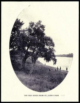
The Red River from St. John's Park.
Fait partie de Parks and Recreation Photograph collection
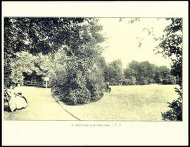
A quiet corner in St. John's Park.
Fait partie de Parks and Recreation Photograph collection
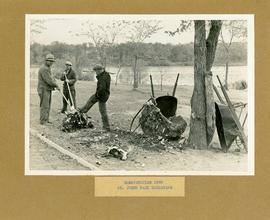
Description (on recto): Construction 1938 St. Johns Park extension.