
Winnipeg City Hall with sign over entrance "V FOR VICTORY"
- i01438
- Item
- 1941
Photograph shows Winnipeg's second City Hall (1886-1962). Date of photograph is approximate, ca. 1941.
Winnipeg City Hall with sign over entrance "V FOR VICTORY"
Photograph shows Winnipeg's second City Hall (1886-1962). Date of photograph is approximate, ca. 1941.
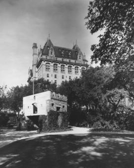
Fort Garry Gate and Fort Garry Hotel
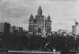
Ceremonies at Unveiling Volunteer Monument, Winnipeg, Sept. 28th, 1886
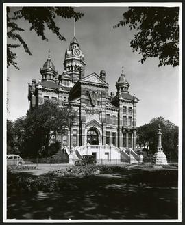
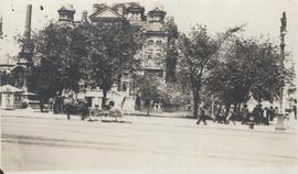
Photograph shows Winnipeg's second City Hall (1886-1962) and Volunteer Monument (or Soldiers Monument).
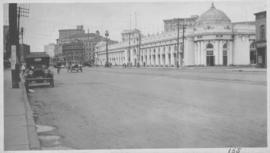
Industrial Bureau Exposition Building
Photograph shows the Industrial Bureau Exposition Building, also called the Board of Trade Building, at Main Street and Water Avenue (now William Stephenson Way). Date of photograph is approximate, ca. 1915.
Winnipeg City Hall looking south west across Main Street at William Avenue
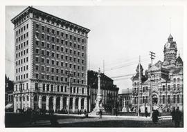
Photograph shows Winnipeg's second City Hall (1886-1962), Union Bank Building and Soldiers Monument (or Volunteer Monument). Date of photograph is uncertain, [before 1949].
Winnipeg City Hall, Clock Tower
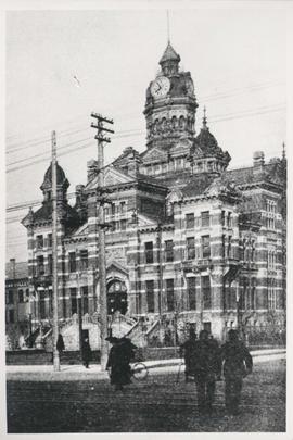
Photograph shows Winnipeg's second City Hall (1886-1962) with good view of clock tower. Date of photograph is uncertain, [before 1949].

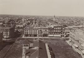
Central Business District: Aerial view - Central Winnipeg
Date of photograph is approximate, ca. 1947.
Winnipeg City Hall, Recruiting Stand
Photograph shows Winnipeg's second City Hall (1886-1962) with recruiting stand at lower left: 'Sign Up for Overseas. Volunteer Today, Tomorrow May be too Late.' - Likely taken shortly after the start of World War 1.
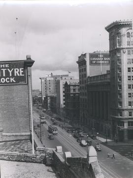
View of Main Street looking north from the Western Canada Loan Building
Photograph shows view of Main Street looking north from the roof of the Western Canada Loan Building, 392 Main Street at Portage Avenue. Date of photograph is approximate, ca. 1935.
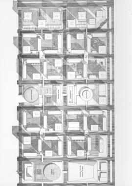
Downtown Winnipeg - Plan of St. Mary-Broadway Sector
Item shows drawing in printed format that records plans for downtown area.
Metropolitan Corporation of Greater Winnipeg (Man.). Planning Division

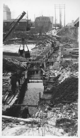
Main interceptor looking toward curve, Broadway and Main St.
Photograph shows construction of sewer. Date of photograph is uncertain, [before 1949].
Assiniboine River crossing at Main Street, laying pipe
Photograph shows construction of sewer.

Downtown Winnipeg - Isometric of St. Mary-Broadway Sector
Item shows drawing in printed format that records plans for downtown Winnipeg.
Metropolitan Corporation of Greater Winnipeg (Man.). Planning Division
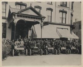
Cars and drivers, Clarendon Hotel
Photograph shows cars and drivers at Clarendon Hotel, northwest corner of Donald Street and Portage Avenue. - Inscription (on verso): 1st car, R. M. McLeod and R. Newman 2nd car, W. C. Power at wheel. 3rd car, Kelly Bros. 4th car, Douglas M. McLaughlin and Bert Wells (standing between cars is Ace Emmett). 5th car, Jack McCullock and Jimmy Boswell. - Date of photograph is approximate, ca. 1904.

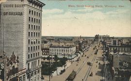
Main Street Winnipeg looking south from City Hall
Winnipeg looking west from the tower of City Hall
Winnipeg looking west from the tower of City Hall, September 5, 1900. Present site of Red River College's Princess Street campus. Campus design included stabilization of five historic building facades along Princess Street: right to left from the corner of Elgin Avenue and Princess Street, the Utility Building (Winnipeg's first Grain Exchange) at 164 Princess; the Exchange Building II at 160 Princess; the Harris Building (Hochman's) at 154 Princess; the Bawlf Block at 150 Princess; and the Drake Hotel (Benson Block) at 146 Princess.
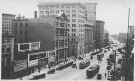
Photograph shows Main Street, west side from Bannatyne Avenue looking south. Part of City of Winnipeg Historical Photographs. Date of postcard is unknown, [before 1949].
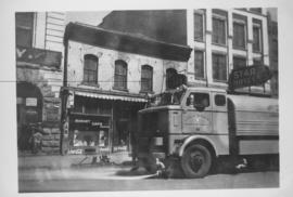
Sicard Flusher, Market Street - May 1948
Star Hotel, Market Café, Dirkfield's Novelty Mfg. shown in background of photograph.

Southeast corner of back lane, north side of Market Avenue and Main Street, circa 1941
Photograph shows present site of the Centennial Concert Hall. Cristall's Mens Outfitters and Klasser's Mail Order House visible in photograph.