
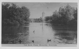
The Duck Pond, Winnipeg, Manitoba
- i01759
- Pièce
- 1940
Fait partie de City of Winnipeg Archives Photograph collection
Photograph shows duck pond in Assiniboine Park. Date of photograph is approximate, ca. 1940.
46 résultats avec objets numériques Afficher les résultats avec des objets numériques
The Duck Pond, Winnipeg, Manitoba
Fait partie de City of Winnipeg Archives Photograph collection
Photograph shows duck pond in Assiniboine Park. Date of photograph is approximate, ca. 1940.
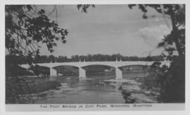
The Foot Bridge in City Park, Winnipeg, Manitoba
Fait partie de City of Winnipeg Archives Photograph collection
Photograph shows the foot bridge across the Assiniboine River in City Park. Date of photograph is approximate, ca. 1940.
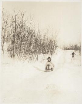
Woman going down slide on toboggan
Fait partie de City of Winnipeg Archives Photograph collection
Photograph shows unidentified woman going down slide on toboggan, one of three photos mounted on page with caption "Slide on Seine River." Date of photograph is probable, [1923?].
![Assiniboine skating rink, ft. [?] of Kennedy Street - 1918](/uploads/r/city-of-winnipeg-archives-amp-records-control-branch/5/c/4/5c459682c313c672f73aaa83adbcc27373ee5977fea1a1ef42f5e5d1f62c9fc3/C0013_0000_0000_P0022_0095_068_142.jpg)
Assiniboine skating rink, ft. [?] of Kennedy Street - 1918
Fait partie de City of Winnipeg Archives Photograph collection
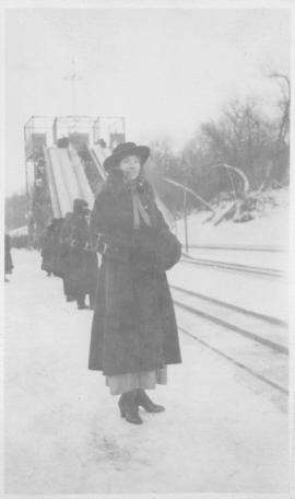
Maude on Assiniboine Rink - 1918
Fait partie de City of Winnipeg Archives Photograph collection
Shows Assiniboine River frozen over with woman (Maude) posing for photograph, toboggan slide in background. Taken in winter 1918.

Arthur and Fred Landen photograph album – page 28
Fait partie de City of Winnipeg Archives Photograph collection
Page 28 of a photograph album created by brothers Arthur and Fred Landen of Hull, England. Page consists of 6 photographs taken by Fred Landen depicting, clockwise from top-left: bricklayers in front of houses; women on a horse-drawn sleigh (captioned “Cutter”); police in raccoon-skin uniforms; a streetcar crossing the Osborne Bridge; a Ox-drawn sleigh in front of the Royal Oak Hotel in Market Square (Market Avenue and King Street); and a woman pushing a baby in a sleigh in at the northwest corner of Broadway and Kennedy Street.
Sans titre

Aerial of 1974 Flood – Red River between North and West Kildonan
Fait partie de City of Winnipeg Archives Photograph collection
Aerial photograph of the Red River during the 1974 Flood. The photograph faces west from North Kildonan, where the Chief Peguis Trail now stands, across the river towards Kildonan Park and West Kildonan on the left, the North End Water Treatment Plant in the middle, and Old Kildonan on the right. The photographs were taken by the Department of Environmental Planning.
Sans titre