

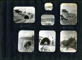
William Smaill Photo Album – Page 34
- p00152
- Part
- [1914 or 1915]
Fait partie de William Smaill fonds
Sans titre
93 résultats avec objets numériques Afficher les résultats avec des objets numériques
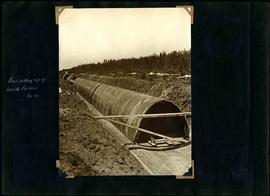
William Smaill Photo Album – Page 34
Fait partie de William Smaill fonds
Sans titre
William Smaill Photo Album – Page 39
Fait partie de William Smaill fonds
Captions read: First setting up of inside forms, mile 51.
Sans titre
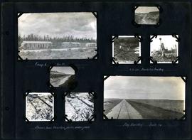
William Smaill Photo Album – Page 60
Fait partie de William Smaill fonds
Captions read: Camp 5, mile 77.
Sans titre
William Smaill Photo Album – Page 64
Fait partie de William Smaill fonds
Captions read: Camp 1, mile 51 1/2.
Sans titre
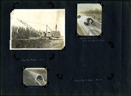
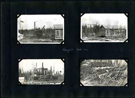
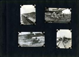
William Smaill Photo Album – Page 83
Fait partie de William Smaill fonds
1 photograph appears to be missing. Captions read: Bay City dredge, mile 91 - Cracked arch, mile 85, broke with traveler sacks - Mile 58 - Bay City dredge, Mile 91.
Sans titre
William Smaill Photo Album – Page 96
Fait partie de William Smaill fonds
Captions read: Arch, mile 65 - Harold, Monty - Invert, mile 65.
Sans titre

William Smaill Photo Album – loose page
Fait partie de William Smaill fonds
Captions read: Water tank, Indian Bay, Greater Winnipeg Water District.
Sans titre
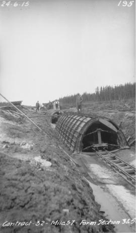
Winnipeg Aqueduct arch forms near Spruce Siding
Fait partie de Greater Winnipeg Water District fonds
Photograph of forms for arch sections three and five of the Winnipeg Aqueduct near Spruce Siding, Manitoba. Photograph taken by William G. Chace, Chief Engineer of the Winnipeg Aqueduct.
Sans titre

Waghorn's Guide map and street index
Fait partie de City Clerk's Library collection
Waghorn's Guide - a small promotional pamphlet published by J.R. Waghorn in 1895. The pamphlet contains a street map of Winnipeg, a street index, and advertisements for various Winnipeg businesses including the Clarendon Hotel, the Redwood Brewery, and the Massey-Harris Company. The map shows the old City of Winnipeg from the Red River on the east to Waverly, Aubrey, and McPhillips Streets on the west, and from Athole Avenue (now Luxton Avenue) in the north to Parker Avenue in the south. Southern Elmwood, Old St. Boniface, and Norwood are also shown on the east side of the river. Railway lines are in black and electric street railway lines are in red.

Canadian National Railways and Icelandic pioneers floats
Fait partie de City of Winnipeg (1874-1971)
Sans titre

William Smaill Photo Album – Page 17
Fait partie de William Smaill fonds
Captions read: First bucket on aqueduct - Erection number 3 class 7 at mile 64.
Sans titre

William Smaill Photo Album – Page 18
Fait partie de William Smaill fonds
Captions read: Class 9 at Oguaka, Iowa - Monighan machine.
Sans titre

William Smaill Photo Album – Page 19
Fait partie de William Smaill fonds
Captions read: Tomlison and Pleming's camp - Ballast trains - Birch River - Clearing land, Whtiemouth - Class 14 pads - Lidgerwood - Unloading boom - Camp 5, April 14 - Work train - McLerie's - Deacon - Hand cars - Culverts, mile 57 - Hunter and Jack Cumm
Sans titre

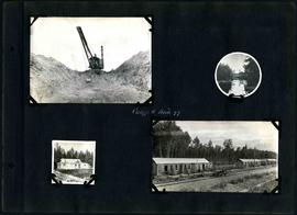
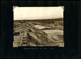
William Smaill Photo Album – Page 33
Fait partie de William Smaill fonds
Sans titre
William Smaill Photo Album – Page 47
Fait partie de William Smaill fonds
Captions read: Protection of inverts from sun and rain, mile 51.
Sans titre
William Smaill Photo Album – Page 58
Fait partie de William Smaill fonds
Captions read: Camp 6, mile 85 - 2 cubic yard bucket in muskeg - Shows how muskeg packs under pads - Big muskeg, mile 90.
Sans titre
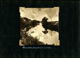
William Smaill Photo Album – Page 65
Fait partie de William Smaill fonds
Captions read: Whitemouth River looking west from railway bridge..
Sans titre
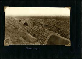
William Smaill Photo Album – Page 69
Fait partie de William Smaill fonds
Captions read: Traveller, camp 2.
Sans titre
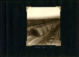
William Smaill Photo Album – Page 76
Fait partie de William Smaill fonds
Sans titre
William Smaill Photo Album – Page 78
Fait partie de William Smaill fonds
Captions read: Traveller, camp 3, Mile 65.
Sans titre