
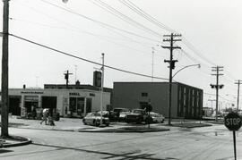
Shell station on Rothesay Street near Kingsford
- i04664
- Item
- [197-?]
Shell Service Station at the corner of Rothesay Street and Kingsford Avenue.
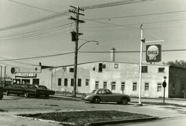
Shell station on Rothesay Street near Kingsford
Shell Service Station at the corner of Rothesay Street and Kingsford Avenue.
7-eleven and Shell station on Rothesay between Edison and Kingsford
7-Eleven store and sign of Shell Service Station on Rothesay Street between Edison and Kingsford Avenues.
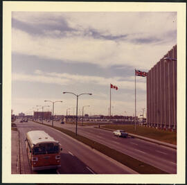
Portage Avenue looking west from Empress Street
Portage Avenue in front of Manitoba Telephone Systems building on Empress Street, looking west.
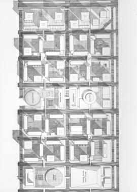
Downtown Winnipeg - Plan of St. Mary-Broadway Sector
Item shows drawing in printed format that records plans for downtown area.
Metropolitan Corporation of Greater Winnipeg (Man.). Planning Division

Downtown Winnipeg - Model photo of Downtown Plan (side view)
Item appears to show photographic reproduction of model (side view) in printed format that records plans for downtown area.
Metropolitan Corporation of Greater Winnipeg (Man.). Planning Division

Downtown Winnipeg - Section and Interior View of Winter Garden
Items shows drawing in printed format that record plans for downtown area.
Metropolitan Corporation of Greater Winnipeg (Man.). Planning Division
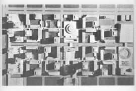
Downtown Winnipeg - Model Photo of Downtown Plan (aerial view)
Item appears to show photographic reproduction of model (aerial view) in printed format that records plans for downtown area.
Metropolitan Corporation of Greater Winnipeg (Man.). Planning Division

Item consists of a report cover for Downtown Winnipeg, created by the Metropolitan Corporation of Greater Winnipeg - Planning Division, April 1, 1969.
Metropolitan Corporation of Greater Winnipeg (Man.). Planning Division

Downtown Winnipeg - Isometric of St. Mary-Broadway Sector
Item shows drawing in printed format that records plans for downtown Winnipeg.
Metropolitan Corporation of Greater Winnipeg (Man.). Planning Division
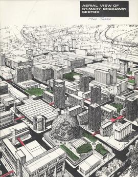
Downtown Winnipeg - Aerial view of St. Mary-Broadway Sector (Map Three)
Items shows drawing in printed format that record plans for downtown area.
Metropolitan Corporation of Greater Winnipeg (Man.). Planning Division
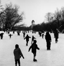
Skating Rink at the Assiniboine Park Duck Pond
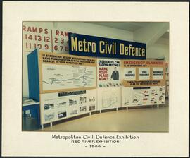
Metro Civil Defence Exhibition
Panels showing off the Metropolitan Corporation of Greater Winnipeg’s Civil Defence plans at the Red River Exhibition.
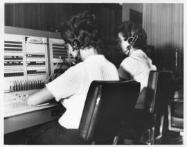
Photograph of the 999 Call Centre when it was located in the Public Safety Building. Mayor's Office stamp on verso. Date of photograph is approximate, ca. 1965.

City Hall (exterior), No. C-508
Photograph of Civic Complex, showing Council Building and Administration Building, taken from corner of Main Street and William Avenue. Description (on verso): Third City Hall - Officially Opened October 5th, 1964. Photograph taken by Henry Kalen.
Kalen, Henry
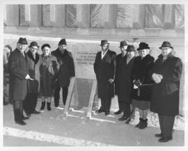
Laying of the cornerstone for Public Safety Building, November 30, 1965
Photograph taken at the laying of the cornerstone for the Public Safety Building, showing Mayor Juba, City Councillors, and other officials. Date of photograph is November 30, 1965.
Allan, Hugh
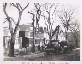
City crews trimming tree branches
Photograph shows city crews trimming tree branches.
Official Opening of the new City Hall, October 5, 1964.
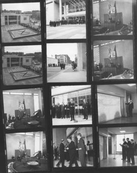
Winnipeg City Hall, (1964-) Contact sheet showing 12 different views, interior and exterior views
Allan, Hugh

Official Opening of the new City Hall, October 5, 1964
Contact sheet showing interior and exterior views of the official opening of the new City Hall, October 5, 1964.
Allan, Hugh
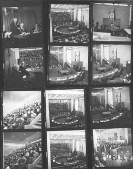
Official Opening of the new City Hall, October 5, 1964
Contact sheet showing interior views of the Council Chamber at the official opening of the new City Hall, October 5, 1964.
Allan, Hugh
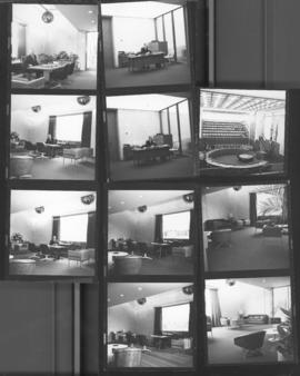
Official Opening of the new City Hall, October 5, 1964
Contact sheet showing interior views of the Council Building and Mayor's Office at the official opening of the new City Hall, October 5, 1964.
Allan, Hugh