![Sargent Park [Aerial View]](/uploads/r/city-of-winnipeg-archives-amp-records-control-branch/e/5/1/e51b6ff83bb626c524f2415a4d84c08187de0f175c746cbde40dcf11e700b8eb/C0013_0000_0000_P0018_0039_001_142.jpg)
Sargent Park [Aerial View]
![Vicinity of Elmwood Park [Aerial view]](/uploads/r/city-of-winnipeg-archives-amp-records-control-branch/5/b/9/5b929d618c2f619e557788462eee14587693511e7959bc6ca77ae96654d1bc98/C0013_0000_0000_P0018_0041_001_142.jpg)
Vicinity of Elmwood Park [Aerial view]
![Vicinity of Elmwood Park [Aerial view]](/uploads/r/city-of-winnipeg-archives-amp-records-control-branch/c/6/d/c6dc0bd0b8c2199f232fe8c7f5245d25e681a6a759be00e013a35a7a1ecada23/C0013_0000_0000_P0018_0042_001_142.jpg)
Vicinity of Elmwood Park [Aerial view]
![Assiniboine to Airport, St. James [Aerial view]](/uploads/r/city-of-winnipeg-archives-amp-records-control-branch/c/9/8/c986dd715644d9b7d48854b59c8285d029a7db80cb4798af462d336b696964c9/C0013_0000_0000_P0018_0043_001_142.jpg)
Assiniboine to Airport, St. James [Aerial view]
![CNR Yards [Aerial view]](/uploads/r/city-of-winnipeg-archives-amp-records-control-branch/3/a/c/3acce1afab65125da800d4ce81f386345349a1e9b9021d949ebfd6c8147f2db0/C0013_0000_0000_P0018_0044_001_142.jpg)
CNR Yards [Aerial view]
![CNR Yards [Aerial view]](/uploads/r/city-of-winnipeg-archives-amp-records-control-branch/e/1/8/e184dce7e98d8a8fabf3b8481cfbdc63ba39898edb5f89746bd2e0a6795f8148/C0013_0000_0000_P0018_0045_001_142.jpg)
CNR Yards [Aerial view]
![Legislative Building and Central Winnipeg [Aerial view]](/uploads/r/city-of-winnipeg-archives-amp-records-control-branch/5/1/1/511af88a9e92fe7d7d3edda2bdaee6fc5652013532efb88411d3403dfcf85917/C0013_0000_0000_P0018_0046_001_142.jpg)
Legislative Building and Central Winnipeg [Aerial view]
![No. 3 W.S. and Assiniboine Park [Aerial view]](/uploads/r/city-of-winnipeg-archives-amp-records-control-branch/0/2/f/02fa7ece5584f4fa43e0835434562e4c2231167b495e3777cf859d3e7d3500f4/C0013_0000_0000_P0018_0047_001_142.jpg)
No. 3 W.S. and Assiniboine Park [Aerial view]
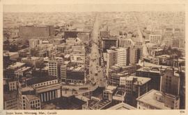
Street Scene, Winnipeg, Man., Canada

Aerial photograph Red River north from southern boundaries of North Kildonan and West St. Paul, north of Winnipeg, 1943

Aerial photograph south of Winnipeg, east of Red River, 1943

Aerial photograph south side of Assiniboine River, west from Assiniboine Park, 1943

Aerial photograph area west of Red River, south of Winnipeg City Limits, 1943

Aerial view of Point Douglas, St. Boniface, and Elmwood areas

Aerial view of Riverview, St. Vital, and Wildwood

Aerial of 1974 Flood – Red River between East and West Kildonan

Aerial of 1974 Flood – Red River between North and West Kildonan

Aerial of 1974 Flood – Bergen Cutoff Bridge

Aerial of 1974 Flood – Pritchard Avenue Boat Dock and Redwood Bridge

Aerial of 1974 Flood – Fraser’s Grove Park
