
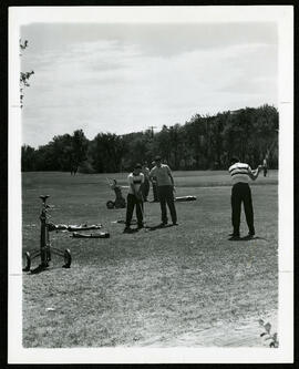
Junior golfers on the green at Kildonan Park Golf Course
- i04979
- Item
- [ca. 1953]
A photo of junior golfers on the practice green on the Kildonan Park Golf Course.
Winnipeg (Man.). Board of Parks and Recreation
47 results with digital objects Show results with digital objects
Junior golfers on the green at Kildonan Park Golf Course
A photo of junior golfers on the practice green on the Kildonan Park Golf Course.
Winnipeg (Man.). Board of Parks and Recreation
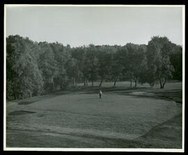
A man standing alone on the green of the Kildonan Park Golf Course
A photo of a man standing alone on the green in the Kildonan Park Golf Course.
Winnipeg (Man.). Board of Parks and Recreation
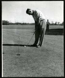
A man putting a golf ball on the Kildonan Park Golf Course
A photo of a man putting a golf ball at the fifth tee, another man watches in the distance at Kildonan Golf Course.
Winnipeg (Man.). Board of Parks and Recreation

A man putting a golf ball on the Kildonan Park Golf Course
A photo of a man putting a golf ball at the Kildonan Park Golf Course.
Winnipeg (Man.). Board of Parks and Recreation
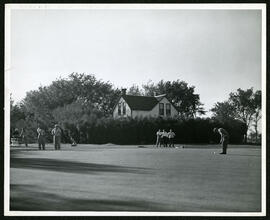
Golfers on the Kildonan Park Golf Course Green
A photo of golfers on the green on the Kildonan Park Golf Course. In the background is a house surrounded by trees.
Winnipeg (Man.). Board of Parks and Recreation
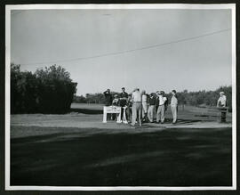
A photo of a man golfing with a group of onlookers in Kildonan Golf Course.
Winnipeg (Man.). Board of Parks and Recreation
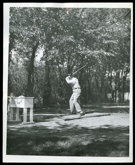
A man driving a golf ball on the Kildonan Park Golf Course
A photo of a man driving a golf ball at the 15th tee on the Kildonan Golf Course.
Winnipeg (Man.). Board of Parks and Recreation
Scrapbook [1950 flood photographs]
Part of City of Winnipeg (1874-1971)
Subseries consists of a scrapbook assembled by the City Engineering Department to serve as photographic evidence of the 1950 flood. It contains black and white photographs that mostly document flooding in residential areas near the Red River (Fort Rouge, Riverview, North End, Point Douglas, Crescentwood, Armstrong's Point and others). Scrapbook appears to be organized geographically by area and street. In addition to documenting flooding, the photographs provide a detailed record of residential neighbourhoods, houses, streets, and businesses like corner grocery stores and laundries. All photographs were taken by Harold K. White Studio.
Winnipeg (Man.). City Engineer
![Kildonan Park [Aerial view]](/uploads/r/city-of-winnipeg-archives-amp-records-control-branch/f/1/2/f128f88f8d2c2c0c11c754244bf269182c057eec594b0ca1962384f7a8471152/C0013_0000_0000_P0018_0036_001_142.jpg)
Inscription (on recto): WG M35: 2-16, 5 Mar '45, Kildonan Park Wpg [Winnipeg], appox scale 1/12000.
![Kildonan Park [Aerial view]](/uploads/r/city-of-winnipeg-archives-amp-records-control-branch/f/5/8/f589f26a584950aadbe5b101158e69cde3cad16f0f0cf05dcbb2a97e34661f16/C0013_0000_0000_P0018_0037_001_142.jpg)
Inscription (on recto): WG M35: 2-18, 5 Mar. '45, Kildonan Park, Wpg [Winnipeg], appr. scale 1/12000.
![Vicinity of Elmwood Park [Aerial view]](/uploads/r/city-of-winnipeg-archives-amp-records-control-branch/c/6/d/c6dc0bd0b8c2199f232fe8c7f5245d25e681a6a759be00e013a35a7a1ecada23/C0013_0000_0000_P0018_0042_001_142.jpg)
Vicinity of Elmwood Park [Aerial view]
Inscription (on recto): WG M35: 3-16, 5 Mar '45, vicinity Elmwood Park Wpg, appr scale 1/12000.
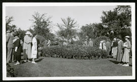
A gathering in the gardens in Kildonan Park
A photo of a group in formal dress standing amongst the gardens in Kildonan Park.
Winnipeg (Man.). Board of Parks and Recreation
From a collection of records about the history of parks and recreational activities in Winnipeg with photos of Kildonan Park.
Winnipeg (Man.). Board of Parks and Recreation
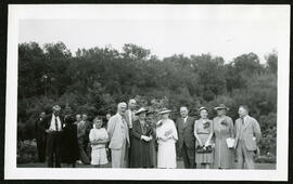
A group photo in the gardens in Kildonan Park
A group photo of people in formal dress in the gardens at Kildonan Park.
Winnipeg (Man.). Board of Parks and Recreation
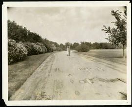
Lilac trees in bloom at Kildonan Park
A photo of a man, woman, and child standing in front of lilac trees in bloom in Kildonan Park.
Winnipeg (Man.). Board of Parks and Recreation
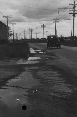
Main Street, corner Seven Oaks, Rainfall, June 29, 1932
Photograph is dated July 1, 1932.
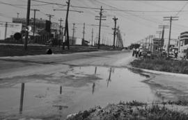
Main Street - Perth to Hartford, Rainfall, June 29, 1932
Photograph is dated July 1, 1932.
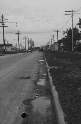
Main Street - Perth to Hartford, Rainfall, June 29, 1932
Photograph is dated July 1, 1932.
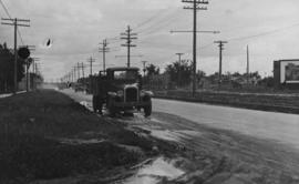
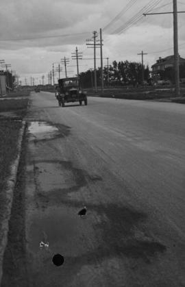
Main Street - Hartford to Belmont, 48 hours after rain
Date of photograph is July 1, 1932.