
- i03459
- Item
- [ca. 1935]
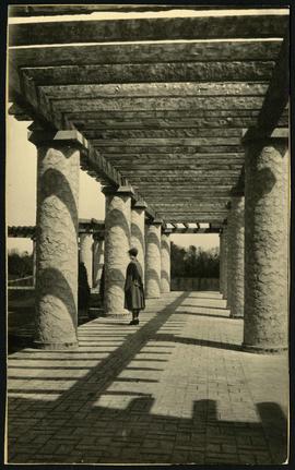
A view of the Pergola behind the Assiniboine Park Pavilion(current).
2569 results with digital objects Show results with digital objects
A view of the Pergola behind the Assiniboine Park Pavilion(current).
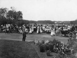
Playground Sports Day at Assiniboine Park
Photograph shows playground sports day at Assiniboine Park.

Plan of University section of Tuxedo Park
A map of the proposed Tuxedo Park residential suburb, specifically the area surrounding the old University of Manitoba campus and Olmsted and Assiniboine Parks. The map shows streets and lots as well as details of the university campus. The map was created by Charles Clifton Chataway (1869-1920) and Bulman Brothers Ltd.

Art installation at Assiniboine Park
Art installation at Assiniboine Park.
Winnipeg (Man.). Parks and Recreation Department

Women at Assiniboine Park lily pond
Two young women sitting near the lily pond and the Pergola at Assiniboine Park.
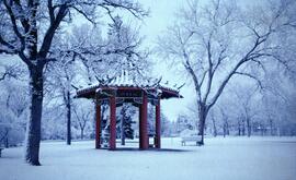
Pagoda formerly located in Assiniboine Park. Now located in King's Park.
Winnipeg (Man.). Parks and Recreation Department
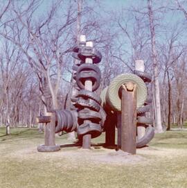
Art installation at Assiniboine Park
Art installation at Assiniboine Park.
Winnipeg (Man.). Parks and Recreation Department
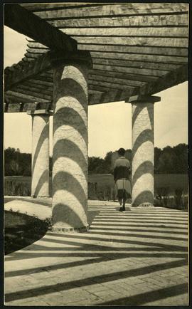
A view of the Pergola behind the Assiniboine Park Pavilion(current).
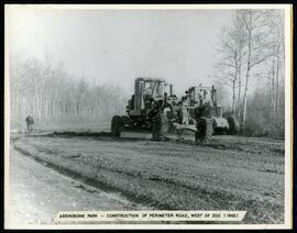
Perimeter road construction at Assiniboine Park Zoo
Construction of perimeter road west of the Assiniboine Park Zoo.
Winnipeg (Man.). Parks and Recreation Department
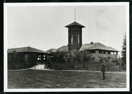
Assiniboine Park Pavilion and Annex
A man standing in front of the Pavilion and Annex at Assiniboine Park.
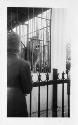
Photograph shows a lion at the Assiniboine Park Zoo. Stamp (on verso): Processed Feb 18 1947.
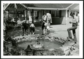
Aunt Sally's Farm at the Assiniboine Park Zoo
Photograph of visitors enjoying a fountain at Aunt Sally's Farm, in the Assiniboine Park Zoo. Photograph was taken by Gunter A. Schoch, Landscape Architect with the Metropolitan Corporation of Greater Winnipeg's Parks and Protection Division.
Metropolitan Corporation of Greater Winnipeg (Man.). Parks and Protection Division
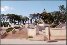
Louis Riel statue along the River Walk
Statue of Louis Riel and Legislature, looking north from the River Walk.
Winnipeg (Man.). Parks and Recreation Department
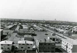
Aerial view of strip mall at Rothesay and Kingsford
Aerial view of Springfield Heights strip mall at Rothesay Street and Kingsford Avenue, facing south. Businesses include Easton’s and a Husky Service Centre.

Apartment block at 415 Edison Avenue
Apartment block at 415 Edison Avenue, near Rothesay Street.
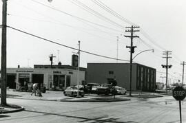
Strip mall on Rothesay at Kingsford
Springfield Heights Value Centre strip mall on Rothesay Street near Kingsford Avenue. Businesses include a barber shop, a pharmacy, Kwik Shop, and Penner’s Food.
7-Eleven at the corner of Rothesay and Kingsford
Photograph of a 7-Eleven store at the corner of Rothesay Street and Kingsford Avenue.
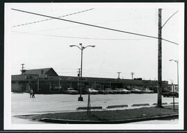
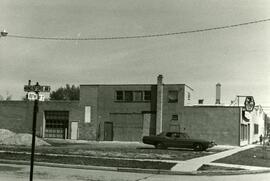
Shell station on Rothesay Street near Kingsford
Shell Service Station at the corner of Rothesay Street and Kingsford Avenue.
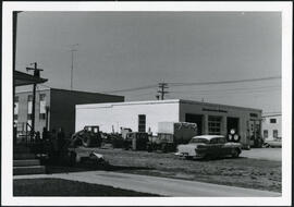
Shell station on Rothesay Street near Kingsford
Shell Service Station at the corner of Rothesay Street and Kingsford Avenue.
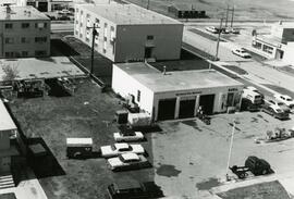
Shell station on Rothesay Street near Kingsford
Shell Service Station at the corner of Rothesay Street and Kingsford Avenue.