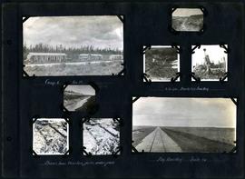
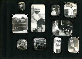
William Smaill Photo Album – Page 19
Add to clipboard
Captions read: Tomlison and Pleming's camp - Ballast trains - Birch River - Clearing land, Whtiemouth - Class 14 pads - Lidgerwood - Unloading boom - Camp 5, April 14 - Work train - McLerie's - Deacon - Hand cars - Culverts, mile 57 - Hunter and Jack Cumm
Smaill, William
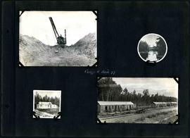
William Smaill Photo Album – Page 58
Add to clipboard
Captions read: Camp 6, mile 85 - 2 cubic yard bucket in muskeg - Shows how muskeg packs under pads - Big muskeg, mile 90.
Smaill, William
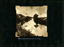
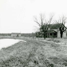
Area of John Blumberg Golf Course prior to construction.
Add to clipboard
Photograph of abandoned buildings on a rural stretch of land in the area of what is now John Blumberg Golf Course. A description of the photo used for publication is recorded on a separate piece of paper. Photo's reverse is stamped by the Parks and Protection Division of the Metro Government.
Metropolitan Corporation of Greater Winnipeg (Man.). Information Officer
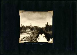
William Smaill Photo Album – Page 9
Add to clipboard
Captions read: Station men's shack - Boggy number 1 - Hadashville - Settlers' house - Whitemouth - camp 3 - Indian Bay, April 1914.
Smaill, William
Supervised skating rink
Add to clipboard
The second side of an album page with a photograph of a Parks Board supervised skating rink outside the Norhtland Knitting Company Building at 618 Arlington Street affixed.
Winnipeg (Man.). Parks and Recreation Department
Gladstone Street from Sutherland Avenue
Add to clipboard
A photograph of flooding on Gladstone Street during the 1950 flood in Winnipeg. The photograph was taken from Sutherland Avenue.
Harold K. White Studio
Euclid and Barber
Add to clipboard
A photograph of flooding in a residential area of Winnipeg during the 1950 flood. The photograph was taken at the intersection of Disraeli and Euclid.
Harold K. White Studio
Disraeli
Add to clipboard
A photograph of flooding on Disraeli St during the 1950 flood. The photograph shows a child standing on a pile of lumber beside the flooded street.
Harold K. White Studio
Causeway to Rover Street Station
Add to clipboard
A photograph of high water surrounding a causeway that ran to the Rover Street hydro station during the 1950 flood.
Harold K. White Studio