
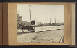
Greater Winnipeg Water District float
- p00398
- Part
- [after 18 Jun. 1924]
Part of City of Winnipeg (1874-1971)
Winnipeg (Man.). Special Jubilee Committee
130 results with digital objects Show results with digital objects
Greater Winnipeg Water District float
Part of City of Winnipeg (1874-1971)
Winnipeg (Man.). Special Jubilee Committee
Greater Winnipeg Water District float
Part of City of Winnipeg (1874-1971)
Winnipeg (Man.). Special Jubilee Committee
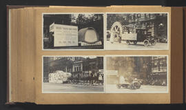
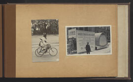
Greater Winnipeg Water District, Winnipeg Rotary Club, and other floats
Part of City of Winnipeg (1874-1971)
Winnipeg (Man.). Special Jubilee Committee

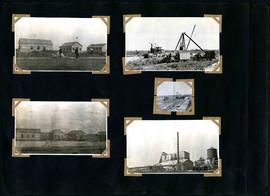
William Smaill Photo Album – loose page
Part of William Smaill fonds
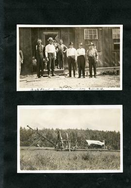
Captions read: Bunk houses, rock plant, Greater Winnipeg Water District - Rock crushing plant, Greater Winnipeg Water District.
Smaill, William
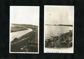
William Smaill Photo Album – loose page
Part of William Smaill fonds
Captions read: Completed aqueduct tube, Greater Winnipeg Water District - View of Shoal Lake, Greater Winnipeg Water District.
Smaill, William
William Smaill Photo Album – loose page
Part of William Smaill fonds
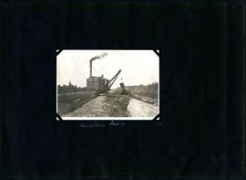
Captions read: Rock plant camp, on a Sunday, Greater Winnipeg Water District.
Smaill, William
William Smaill Photo Album – loose page
Part of William Smaill fonds
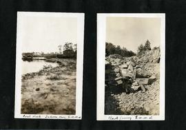
Captions read: Coal [dock?], Indian Bay, Greater Winnipeg Water District - Rock quarry, Greater Winnipeg Water District.
Smaill, William
William Smaill Photo Album – loose page
Part of William Smaill fonds
Captions read: Tube partly covered, Greater Winnipeg Water District.
Smaill, William
William Smaill Photo Album – loose page
Part of William Smaill fonds
Captions read: Contains no captions.
Smaill, William

William Smaill Photo Album – loose page
Part of William Smaill fonds
Captions read: Water tank, Indian Bay, Greater Winnipeg Water District.
Smaill, William
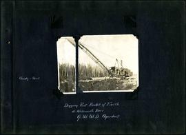
William Smaill Photo Album – Page 1
Part of William Smaill fonds
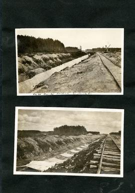
Captions read: Cloudy and sleet - Digging first bucket of earth at Whitemouth River, Greater Winnipeg Water District aqueduct.
Smaill, William

William Smaill Photo Album – Page 10
Part of William Smaill fonds
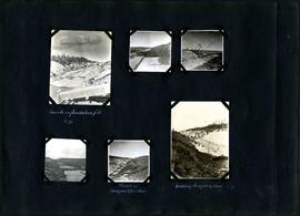
Captions read: Views at Greater Winnipeg Water District gravel pit.
Smaill, William
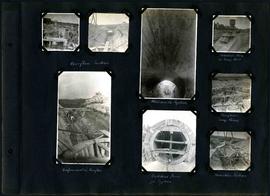
William Smaill Photo Album – Page 100
Part of William Smaill fonds
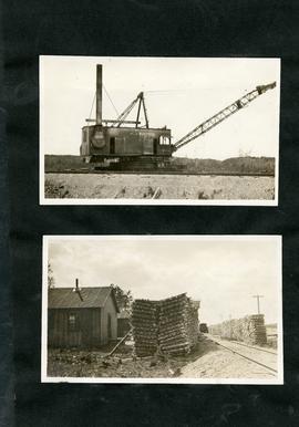
Captions read: Overflow section - Whitemouth syphon - Manhole form at sump well -Reinforcement in overflow - Bulkhead form for syphon - Overflow sump forms - Transition section.
Smaill, William
William Smaill Photo Album – Page 101
Part of William Smaill fonds
Captions read: Boat house, west bank - excavation for overflow and sump.
Smaill, William
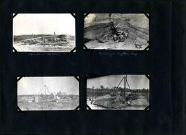
William Smaill Photo Album – Page 102
Part of William Smaill fonds
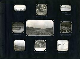
Captions read: Camp 2, mile 57 - Culvert - Camp 2- Mile 58.
Smaill, William
William Smaill Photo Album – Page 103
Part of William Smaill fonds
Captions read: Inverts on foundation fill, mile 71 - Trench in hardpan after rain - excavating hardpan by hand, mile 71.
Smaill, William
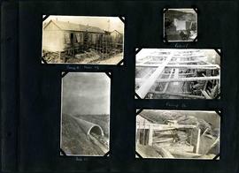
William Smaill Photo Album – Page 104
Part of William Smaill fonds
Captions read: Moving outside forms - Rails to hold sheeting - hand excavation in hardpan -Backfilling - 1st foundation fill - Rock Cut - Hardpan sloughed into trench after rain - Camp 4, mile 71 - Traveller.
Smaill, William
William Smaill Photo Album – Page 105
Part of William Smaill fonds
Captions read: Backfilling, mile 65.
Smaill, William
William Smaill Photo Album – Page 106
Part of William Smaill fonds
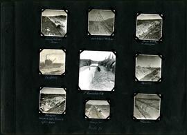
Captions read: Dyke - Blanchard's, Indian Bay - Indian Camp, Shoal Lake [Kekekoziibii Shoal Lake 40 First Nation] - Removing arch - Camp 5, mile 77 - Remains after oil House fire, camp 5, mile 77 - Excursion train, camp 6 -Tennis court, Indian Bay - Young wild ducks.
Smaill, William
William Smaill Photo Album – Page 107
Part of William Smaill fonds
Smaill, William