
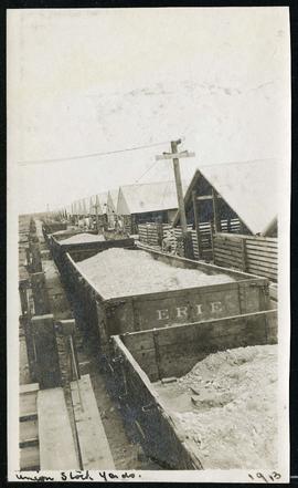
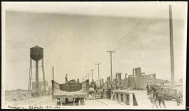
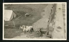
Cars hauling gravel material at Union Stock Yards
- i04362
- Item
- 1913
Part of Morris Block collection
Block, Morris
93 results with digital objects Show results with digital objects
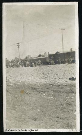
Cars hauling gravel material at Union Stock Yards
Part of Morris Block collection
Block, Morris


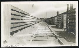
Cars hauling gravel material at Union Stock Yards
Part of Morris Block collection
Block, Morris
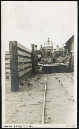
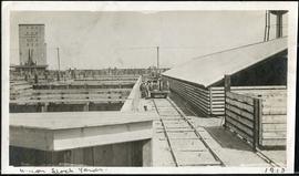
Work being done near water tower at Union Stock Yards
Part of Morris Block collection
Block, Morris
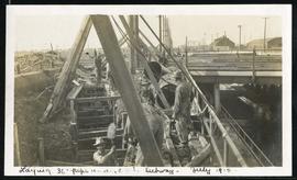
Laying 36” pipe under CPR subway
Part of Morris Block collection
Block, Morris
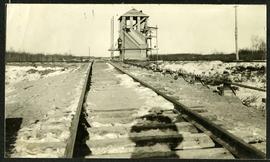
Interlocking tower over CNR track
Part of Morris Block collection
The reverse reads “Inter-locking tower, Diamond over CNR”, followed by unreadable text.
Block, Morris
Part of Morris Block collection
Block, Morris
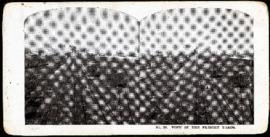
Eaton's promotional stereogram no. 29 - view of the freight yards
Part of Morris Block collection
Block, Morris

Part of Morris Block collection
Photograph of a family standing on a platform or rail cart on rail tracks.
Block, Morris

For Your Guidance While in Winnipeg promotional map
Part of Morris Block collection
A promotional map created by the Publicity Bureau of Winnipeg and Manitoba titled "For Your Guidance While in Winnipeg". Map was originally folded as a pamphlet, the front page of which features a graphic of two people driving down Highway 14 (now Highway 75) to Winnipeg. The map is not scale and features cartoon depictions of tourist destinations and landmarks around Winnipeg and St. Boniface. The maps shows major streets, railroads, and street railway lines. The map side was originally framed and cut to fit. At a result a small part of the front page is cut off, including a stamp reading "St. Raphael's Ukrainian Immigrants' Welfare Association of Can[ada]".
Block, Morris

Waghorn's Guide map and street index
Part of City Clerk's Library collection
Waghorn's Guide - a small promotional pamphlet published by J.R. Waghorn in 1895. The pamphlet contains a street map of Winnipeg, a street index, and advertisements for various Winnipeg businesses including the Clarendon Hotel, the Redwood Brewery, and the Massey-Harris Company. The map shows the old City of Winnipeg from the Red River on the east to Waverly, Aubrey, and McPhillips Streets on the west, and from Athole Avenue (now Luxton Avenue) in the north to Parker Avenue in the south. Southern Elmwood, Old St. Boniface, and Norwood are also shown on the east side of the river. Railway lines are in black and electric street railway lines are in red.
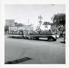
Winnipeg's 75th Anniversary parade - float with picture frames and model train

Scrapbook of Corporal Wallace – page 2
Page 2 of a photograph scrapbook made by Corporal John Wallace in April 1940. Photos consist of Portage Avenue looking west from around Vaughn Street, a rail line at Portage Avenue and St. James Street, troops in formation, and Mrs. and Shirley Gardiner. See general notes section for more details.
Wallace, John
Part of City of Winnipeg (1874-1971)
Consists of correspondence, invitations, and souvenir programmes related to the 1926 meeting of the Brotherhood of Locomotive Engineers.
Winnipeg (Man.). Committee on Legislation and Reception
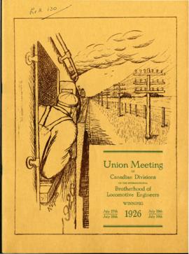
Souvenir Programme of Brotherhood of Locomotive Engineers meeting
Part of City of Winnipeg (1874-1971)
A promotional souvenir programme of the 1926 union meeting of the Canadian Divisions of the International Brotherhood of Locomotive Engineers, held in Winnipeg on July 27-30, 1926. Booklet contains promotional information about and histories of the union, photographs of and statements made by union members and local politicians, and advertisements.
Winnipeg (Man.). Committee on Legislation and Reception

Pumping water on Robert Street
Part of City of Winnipeg (1874-1971)
A photograph of a pipe pouring water onto tracks on Robert Street (Galt Avenue) during the 1950 flood. A pile of wood is along one side of the street. The Ogilvie Flour Mill can be seen in the background.
Harold K. White Studio