
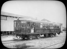
Passengers aboard GWWD Railway Service car at St. Boniface Station
- i02913
- Item
- 24 Jul. 1922
Passengers aboard GWWD Railway Service car at St. Boniface Station. Image derived from glass lantern slide.
Greater Winnipeg Water District
70 results with digital objects Show results with digital objects
Passengers aboard GWWD Railway Service car at St. Boniface Station
Passengers aboard GWWD Railway Service car at St. Boniface Station. Image derived from glass lantern slide.
Greater Winnipeg Water District
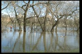
1997 flood - The Forks - view of St. Boniface across river
Part of Winnipeg Flood Record and Archives Committee collection
A photograph of St. Boniface Cathedral, taken from across the flooded Red River during the 1997 flood.
Winnipeg (Man.). Community Services Department

1932 Relief Works and Committee Winnipeg
Photograph collage of the 1932 Winnipeg Relief Works and Committee. Portraits of committee members are surrounding photographs of projects the committee had worked on. The committee members are, clockwise from top left: Alderman John Blumberg, Alderman H. Andrews, City Clerk Magnus Peterson, Alderman J.A. Barry, Alderman A.A. Ryley, Alderman W.B. Simpson, City Engineer W.P. Brereton, G.W. Northwood, Alderman E.D. Honeyman, Mayor Ralph Webb, Alderman J.A. McKerschar, A. MacNamara, Resident Engineer A.J. Taunton, Alderman L.F. Borrowman, and Alderman C.E. Simonite. The works projects showcased in the center are, clockwise from top left: the Main Street Bridge, the Norwood Bridge, the Assiniboine Park Bridge, the Winnipeg Auditorium, the Sargent Park Swimming Pool, and the Salter Street Bridge. Created by Robson Photo.

Aerial view of Point Douglas, St. Boniface, and Elmwood areas
Aerial photograph of Point Douglas, St. Boniface, and west Elmwood.

Southdale Shopping Centre panorama
View of Southdale Shopping Centre, 35 Lakewood Boulevard, 12.8 acres. From left to right: Dominion Store, Canadian Imperial Bank of Commerce, Mall Entrance, Quintons, Ebbeling Pharmacy, Kmart Department Store. Consists of 3 separate photographs pasted together on cardboard to create a panorama. The cardboard is a scrap made from an old sign of the Metropolitan Corporation of Greater Winnipeg (visible on the reverse). The cardboard is numbered “5”, presumably as part of a compilation with other shopping centre panoramas.
Metropolitan Corporation of Greater Winnipeg (Man.). Planning Division

Waghorn's Guide map and street index
Part of City Clerk's Library collection
Waghorn's Guide - a small promotional pamphlet published by J.R. Waghorn in 1895. The pamphlet contains a street map of Winnipeg, a street index, and advertisements for various Winnipeg businesses including the Clarendon Hotel, the Redwood Brewery, and the Massey-Harris Company. The map shows the old City of Winnipeg from the Red River on the east to Waverly, Aubrey, and McPhillips Streets on the west, and from Athole Avenue (now Luxton Avenue) in the north to Parker Avenue in the south. Southern Elmwood, Old St. Boniface, and Norwood are also shown on the east side of the river. Railway lines are in black and electric street railway lines are in red.
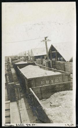
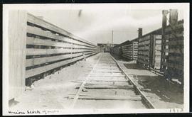
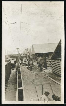
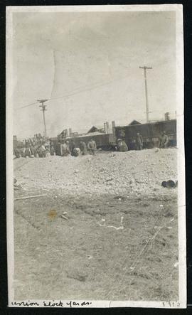
Cars hauling gravel material at Union Stock Yards
Part of Morris Block collection
Block, Morris


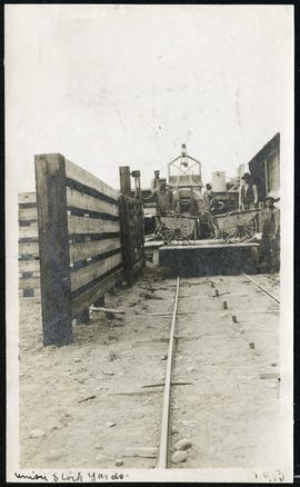
Cars hauling gravel material at Union Stock Yards
Part of Morris Block collection
Block, Morris

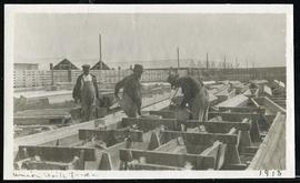
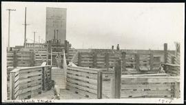

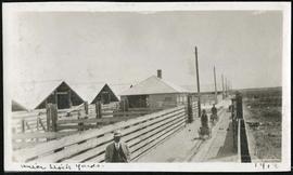
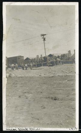
Walls and buildings at Union Stock Yards
Part of Morris Block collection
Block, Morris