
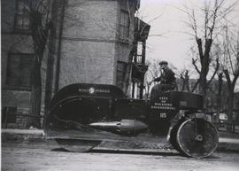
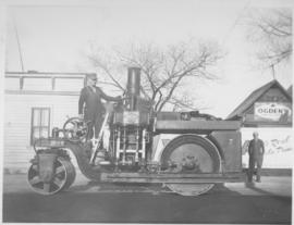
115, Buffalo Springfield Roller, St. Mary and Carlton
- i01616
- Item
- 1948
140 results with digital objects Show results with digital objects
115, Buffalo Springfield Roller, St. Mary and Carlton
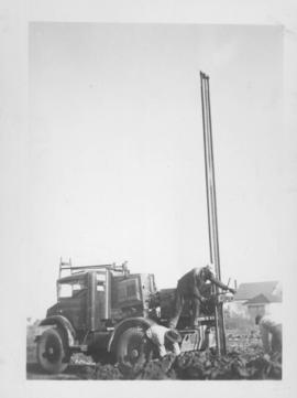
#2, P.R.M., Westminster and Canora - 1947
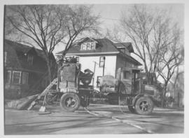
#7 - Roller, rolling hot asphalt, Dufferin, east of Arlington - 1947
Ogden's shown in background of photograph.

A military funeral, Broadway and Spence Streets, Winnipeg - 1914
Photograph taken at time of World War 1.

Aerial view of intersection at Portage Avenue and Main Street
Photograph shows aerial view of intersection at Portage Avenue and Main Street (after barriers closing intersection to pedestrian concourse). Also shows Bank of Nova Scotia (Trizec Building) under construction. Photograph likely taken from the top of the Richardson Building.
Allan, Hugh
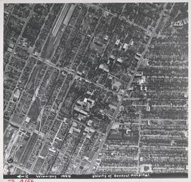
Aerial view of Vicinity of General Hospital, 1944
Description (on recto): WG A156, vicinity of General Hospital, Winnipeg, 1944. - Area around William Avenue and Sherbrook Street shown in photograph. - Photo credit: Royal Canadian Air Force Photograph.
Date of postcard is approximate, ca. 1909.
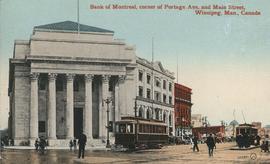
Bank of Montreal, corner of Portage Avenue and Main Street
Date of postcard is approximate, ca. 1912.
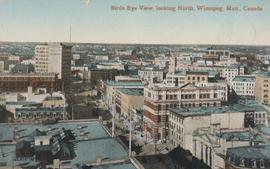
Bird's Eye View, looking North
Postcard shows view looking north, down Main Street from Lombard Avenue. Probably taken from roof of McArthur Building (Childs Building). Date of postcard is approximate, ca. 1910.
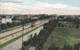
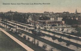
Broadway Avenue from Manitoba Club, Winnipeg
A photograph of streetcar on Broadway, looking west from Main Street. The Manitoba Club building can be seen on the left. Photographed by Steele and Company.
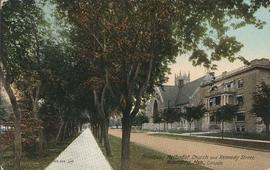
Broadway Methodist Church and Kennedy Street, Winnipeg
Date of postcard is uncertain, [before 1949].
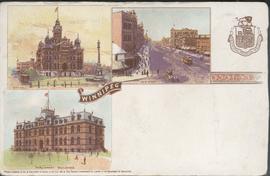
Canadian Postal Card showing Winnipeg City Hall, Main Street and Parliament Buildings
Postcard shows Winnipeg's second city hall (1886-1962), Main Street and Parliament buildings.

Causeway to Rover Street Station
Part of City of Winnipeg (1874-1971)
A photograph of high water surrounding a causeway that ran to the Rover Street hydro station during the 1950 flood.
Harold K. White Studio
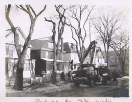
City crews trimming tree branches
Photograph shows city crews trimming tree branches.
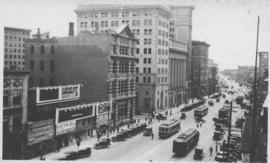
Photograph shows Main Street, west side from Bannatyne Avenue looking south. Part of City of Winnipeg Historical Photographs. Date of postcard is unknown, [before 1949].

Colony Street and Whitehall Avenue
Photograph is one of five photos mounted on page with caption "Assiniboine River flooded, Spring 1916."

Corner Portage Avenue and Main Street, Winnipeg, Manitoba
Print is a photographic image of the intersection of Portage Avenue and Main Street. Date of print is uncertain, [193-].