

Aerial photograph area west of Red River, south of Winnipeg City Limits, 1943
- i02333
- Item
- 1943
Photograph shows an aerial view of the area west of Red River, south of Winnipeg City Limits. Photograph is dated December 2, 1943.
31 results with digital objects Show results with digital objects
Aerial photograph area west of Red River, south of Winnipeg City Limits, 1943
Photograph shows an aerial view of the area west of Red River, south of Winnipeg City Limits. Photograph is dated December 2, 1943.

Photograph shows an aerial view of the Red River north from the southern boundaries of North Kildonan and West St. Paul, north of Winnipeg. Photograph is dated December 2, 1943.

Aerial photograph south of Winnipeg, east of Red River, 1943
Photograph shows an aerial view of south of Winnipeg, east of Red River. Photograph dated December 2, 1943.

Aerial photograph south side of Assiniboine River, west from Assiniboine Park, 1943
Photograph shows an aerial view of the south side of the Assiniboine River, west from Assiniboine Park. Photograph is dated December 2, 1943.

Photograph is one of five photos mounted on page with caption "Assiniboine River flooded, Spring 1916."
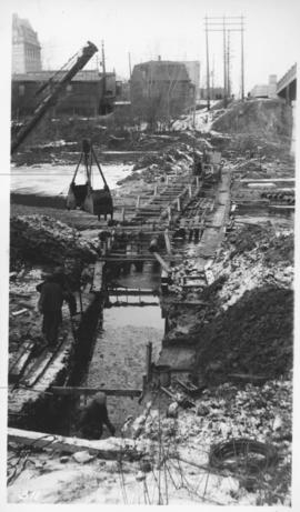
Assiniboine River crossing at Main Street, laying pipe
Photograph shows construction of sewer.
![Assiniboine skating rink, ft. [?] of Kennedy Street - 1918](/uploads/r/city-of-winnipeg-archives-amp-records-control-branch/5/c/4/5c459682c313c672f73aaa83adbcc27373ee5977fea1a1ef42f5e5d1f62c9fc3/C0013_0000_0000_P0022_0095_068_142.jpg)
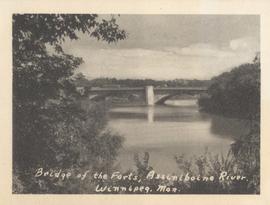
Bridge of the Forts, Assiniboine River, Winnipeg, Man.
Date of photograph is approximate, ca. 1940.
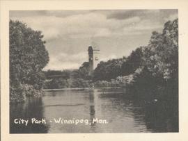
Photograph shows Assiniboine Park with pavilion and river in view. Date of photograph is approximate, ca. 1940.
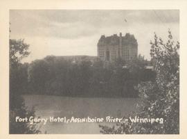
Fort Garry Hotel, Assiniboine River - Winnipeg
Photograph shows Fort Garry Hotel with view looking northwest over Assiniboine River. Date of photograph is approximate, ca. 1940.
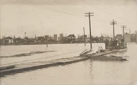
Group of people on barge with flood waters all around, 1916 Flood, Norwood
Postcard is a photographic print showing scene from the 1916 flooding of the Assiniboine River in Norwood, flood waters with group of people on barge in view. Noko mark appears in stamp box.
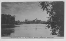
Junction of Red and Assiniboine Rivers, Winnipeg, Manitoba
Date of photograph is approximate, ca. 1940.
Junction of Red River and Assiniboine River
Photograph shows Fort Garry Hotel in background. Date of photograph is approximate, ca. 1940.
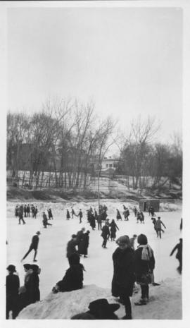
Kennedy Street skating rink, Winnipeg - 1918
![Kildonan Park [Aerial view]](/uploads/r/city-of-winnipeg-archives-amp-records-control-branch/f/1/2/f128f88f8d2c2c0c11c754244bf269182c057eec594b0ca1962384f7a8471152/C0013_0000_0000_P0018_0036_001_142.jpg)
Inscription (on recto): WG M35: 2-16, 5 Mar '45, Kildonan Park Wpg [Winnipeg], appox scale 1/12000.
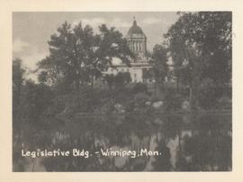
Legislative Bldg., Winnipeg, Man.
Photograph shows Legislative building and view looking north over Assiniboine River. Date of photograph is approximate, ca. 1940.
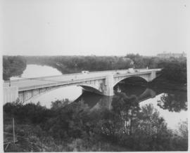
Photograph shows Maryland Street Bridge looking southeast into Crescentwood. Date of photograph is approximate, ca. 1925.
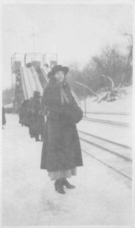
Maude on Assiniboine Rink - 1918
Shows Assiniboine River frozen over with woman (Maude) posing for photograph, toboggan slide in background. Taken in winter 1918.
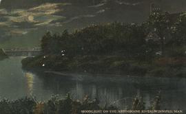
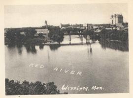
Moonlight on the Assiniboine River, Winnipeg, Man.
Date of postcard is uncertain, [before 1949].
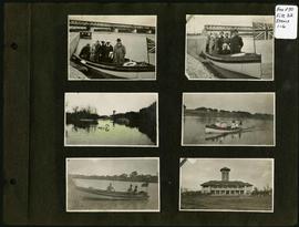
Photograph album of Winnipeg during WW1: Page 1
Item consists of a scrapbook page showing group of unidentified people in boat on river, possibly at Lockpart (Items 1 and 2), duck pond and pavilion at Assiniboine Park (Item 3), unidentified people in boat on river (Items 4 and 5), and pavilion at Assiniboine Park (Item 6). Dates of photographs are approximate, [ca. 1913].