

Winnipeg, Main Street looking south, Spring of 1874
- i00036
- Item
- 1874
Part of City of Winnipeg (1874-1971)
Photograph taken from top of Courthouse.
351 results with digital objects Show results with digital objects
Winnipeg, Main Street looking south, Spring of 1874
Part of City of Winnipeg (1874-1971)
Photograph taken from top of Courthouse.

Part of East Ward, St. Boniface in the distance
Part of City of Winnipeg (1874-1971)
Photograph taken from top of Courthouse.

Part of City of Winnipeg (1874-1971)
A photograph of flooding in a residential area of Winnipeg during the 1950 flood. The photograph was taken at the intersection of Disraeli and Euclid.
Harold K. White Studio

Foot of Robert Street (Galt Ave)
Part of City of Winnipeg (1874-1971)
A photograph of the Eaton's printing plant and warehouse on Robert Street (Galt Avenue) during the 1950 flood. The building is surrounded by a sandbag dike and water.
Harold K. White Studio

William Smaill Photo Album – Page 7
Part of William Smaill fonds
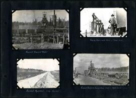
Captions read: Mayor T.R. Deacon driving last spike, Chief Commissioner S.H. Reynolds, Ex. Mayor Thomas Sharpe.
Smaill, William
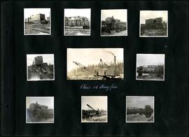
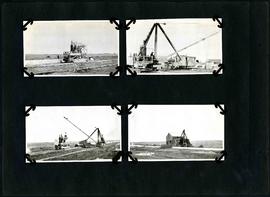
William Smaill Photo Album – Page 14
Part of William Smaill fonds
Captions read: Class 14 drag line.
Smaill, William
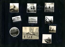
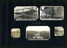
William Smaill Photo Album – Page 20
Part of William Smaill fonds
Captions read: Mile 85 - Old Fort Garry and hotel - Fort Garry apartments - Hudson's Bay stores, Winnipeg - Bay City dredge - Whitemouth, April 1914 - W.G. Chas, J.H. Fuertes [?], A. C.H. Blanchard [?] - Mile 57.
Smaill, William
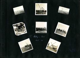
William Smaill Photo Album – Page 22
Part of William Smaill fonds
Captions read: T. Kelley and Sons, cont. [contract?] 31.
Smaill, William
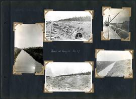
William Smaill Photo Album – Page 38
Part of William Smaill fonds
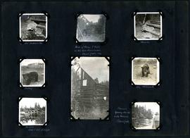
Captions read: Views at camp 2, mile 57.
Smaill, William
William Smaill Photo Album – Page 44
Part of William Smaill fonds
Captions read: Concrete train at mixer - Towing mixer with train, first move, mile 64 - Finished aqueduct, mile 64, first mile - Gravel platform, cement shed, mixer, and water tank, mile 64.
Smaill, William
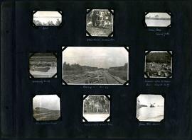
William Smaill Photo Album – Page 49
Part of William Smaill fonds
Captions read: Jumbo[?], Indian Bay - Ruins of camp 1 built on Ontario gold concessions, Shoal Lake, 1896 - Jumbo - Teddy - Teddy, Whitemouth - Birch River railroad bridge - Chasing young ducks with launch, Shoal Lake.
Smaill, William
William Smaill Photo Album – Page 50
Part of William Smaill fonds
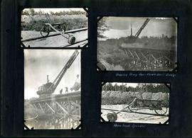
Captions read: Moving drag over Birch River bridge - Home made speeder.
Smaill, William
William Smaill Photo Album – Page 51
Part of William Smaill fonds
Captions read: Contains no captions.
Smaill, William
William Smaill Photo Album – Page 54
Part of William Smaill fonds
Captions read: Class 14 in muskeg, mile 86.
Smaill, William
William Smaill Photo Album – Page 75
Part of William Smaill fonds
Smaill, William
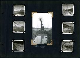
William Smaill Photo Album – Page 86
Part of William Smaill fonds
Captions read: Bay City dredge, Brokenhead River, March15 - Site for camp 8, December 15 - Camp 8, December 15.
Smaill, William
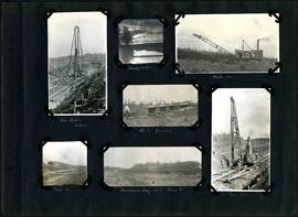
William Smaill Photo Album – Page 92
Part of William Smaill fonds
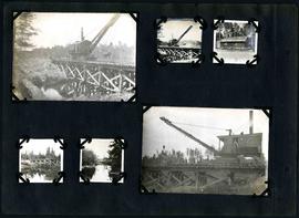
Captions read: Pile driver, mile 85 plus - Headquarter - Mile 86 - 4.5% grade - Mile 85 - Dominion Day, 1915, camp 6 - Mile 85 plus.
Smaill, William
William Smaill Photo Album – Page 106
Part of William Smaill fonds
Captions read: Dyke - Blanchard's, Indian Bay - Indian Camp, Shoal Lake [Kekekoziibii Shoal Lake 40 First Nation] - Removing arch - Camp 5, mile 77 - Remains after oil House fire, camp 5, mile 77 - Excursion train, camp 6 -Tennis court, Indian Bay - Young wild ducks.
Smaill, William

William Smaill Photo Album – loose page
Part of William Smaill fonds
Captions read: Bunk houses, rock plant, Greater Winnipeg Water District - Rock crushing plant, Greater Winnipeg Water District.
Smaill, William
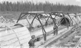
Device for moving aqueduct arch forms near Spruce Siding
Photograph of workers using a contractor's device for moving outside arch forms of the Winnipeg Aqueduct near Spruce Siding, Manitoba. Photographer is unknown.
Greater Winnipeg Water District