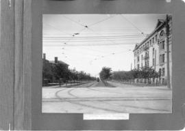
Crescentwood Park and Broadway
- i02934
- Item
- [ca. 1920]
A photo album page with a view of Crescentwood Park on the first side and a view of Broadway from Main Street on the second side.
140 results with digital objects Show results with digital objects
Crescentwood Park and Broadway
A photo album page with a view of Crescentwood Park on the first side and a view of Broadway from Main Street on the second side.

Causeway to Rover Street Station
Part of City of Winnipeg (1874-1971)
A photograph of high water surrounding a causeway that ran to the Rover Street hydro station during the 1950 flood.
Harold K. White Studio

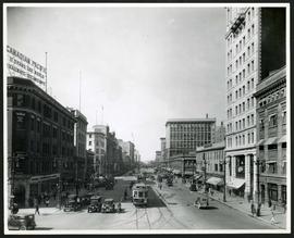
Main Street looking north from Portage Avenue
Part of City of Winnipeg (1874-1971)
Bentley Building, Courthouse and Artesian well shown in photograph.
A photograph of streetcar on Broadway, looking west from Main Street. The Manitoba Club building can be seen on the left. Photographed by Steele and Company.

A photograph of the Portage Avenue underpass, which crosses Century Street on the north side of the St. James Bridge. The photographer is unknown.
Metropolitan Corporation of Greater Winnipeg (Man.). Information Officer

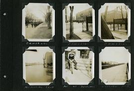
Scrapbook of Corporal Wallace – page 2
Page 2 of a photograph scrapbook made by Corporal John Wallace in April 1940. Photos consist of Portage Avenue looking west from around Vaughn Street, a rail line at Portage Avenue and St. James Street, troops in formation, and Mrs. and Shirley Gardiner. See general notes section for more details.
Wallace, John
Scrapbook of Corporal Wallace – page 8
Page 8 of a photograph scrapbook made by Corporal John Wallace in April 1940. Photographs depict the Queen’s Own Cameron Highlanders of Canada near the Raleigh Apartments at Vaughan Street and Ellice Avenue, Memorial Boulevard (likely at Broadway, facing west with the Mall Hotel in the distance), a road outside Fort Osborne Barracks, and Corporal Wallace at the home of “The Dowlings” (likely on Beaverbrook Street).
Wallace, John
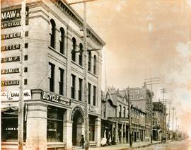
South West Corner of King and William
Item is a photographic reproduction, date unknown (original created ca. 1900). Shows the south west corner of King Street and William Avenue.

Portage Avenue looking west from Colony Street
A view of Portage Avenue looking west from Colony Street. The Hudson's Bay Company Building is featured prominantly and the Power Building is visible farther west. Playing "Young Mr. Lincoln", the Gaiety Theatre can be seen across the street with two poli
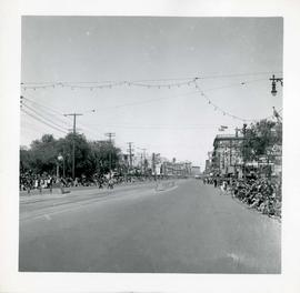
Winnipeg's 75th Anniversary parade - view of parade route
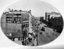
Main Street, looking north from Portage Avenue
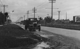
Main Street - Perth to Hartford, Rainfall, June 29, 1932
Photograph is dated July 1, 1932.
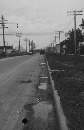
Main Street - Perth to Hartford, Rainfall, June 29, 1932
Photograph is dated July 1, 1932.
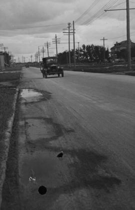
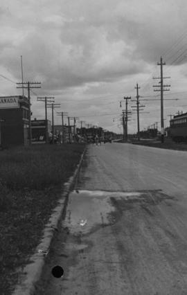
Main Street - Hartford to Belmont, 48 hours after rain
Date of photograph is July 1, 1932.
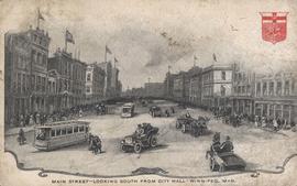
Main Street - Looking South from City Hall - Winnipeg, Man.
Postcard shows black and white drawing of Main Street with bustling activity.
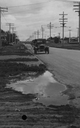
Main Street - Kilbridge to Burrin, Rainfall, June 29, 1932
Date of photograph is July 1, 1932.
Portage Avenue looking west from Main Street
Date of photograph is approximate, ca. 1927.

View of Main Street south from Higgins showing Alberta Hotel and Nugget Hotel
Date of photograph is uncertain, [before 1949].