
- i01432
- Item
- 1925
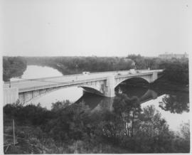
Photograph shows Maryland Street Bridge looking southeast into Crescentwood. Date of photograph is approximate, ca. 1925.
957 results with digital objects Show results with digital objects
Photograph shows Maryland Street Bridge looking southeast into Crescentwood. Date of photograph is approximate, ca. 1925.
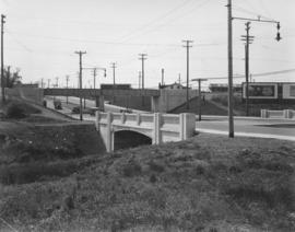
Bridge over Omands Creek on Portage Avenue, looking west to Polo Park

Canadian Pacific Railway depot (or station) shown in postcard. Published by Valentine & Sons' Publishing Co., Ltd., Montreal and Toronto, printed in Great Britain. Date of postcard is uncertain, [before 1949].
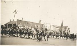
Photograph shows Lord Strathcona Horse, just before departure overseas during World War 1, at Selkirk and Main, looking at the east side of Main Street..

View of Main Street south from Higgins showing Alberta Hotel
Date of photograph is uncertain, [before 1949].

Floods - St. Boniface and Norwood - April 1916
Postcard is a photographic print showing water flooding homes. Photograph taken by Advance Photo Company, Winnipeg. Azo mark appears in stamp box, made in Canada.

Rue Langevin, Floods, St. Boniface - April 1916
Postcard is a photographic print showing flood water and debris around buildings. Photograph taken by Advance Photo Company, Winnipeg. Azo mark appears in stamp box, made in Canada.

Winnipeg Boat Club under water, Norwood, April 1916
Postcard is a photographic print. Photograph taken by Advance Photo Company, Winnipeg. Azo mark appears in stamp box, made in Canada.

Photograph shows old St. James Bridge approach, looking north up Madison Street (now Century Street/Route 90). Present Viscount Gort site in center. Date of photograph is uncertain, [after 1932].

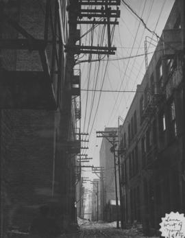
Overhanging Signs: North side of Portage Avenue looking West from Young Street
Photograph shows signs for multiple businesses, including Club Morocco, Riviera Restaurant, Princeton Café Fish and Chips, Portage Credit Jewellers. Date of photograph is uncertain, [196-?].
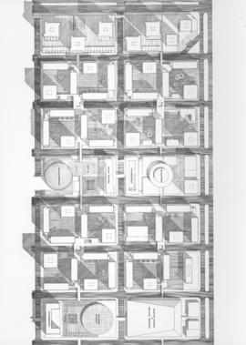
Downtown Winnipeg - Plan of St. Mary-Broadway Sector
Item shows drawing in printed format that records plans for downtown area.
Metropolitan Corporation of Greater Winnipeg (Man.). Planning Division

Downtown Winnipeg - Model photo of Downtown Plan (side view)
Item appears to show photographic reproduction of model (side view) in printed format that records plans for downtown area.
Metropolitan Corporation of Greater Winnipeg (Man.). Planning Division
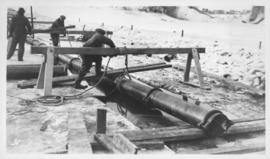
Montcalm Street, river crossing
Photograph shows construction of sewer. Date of photograph is uncertain, [before 1949].

Item is a photographic reproduction of map showing various sewer system details. Stamp (on verso): City of Winnipeg - Engineering Dept., Water Works Division, Ross and Tecumseh.
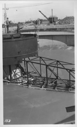
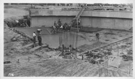
East Clarifier, placing mortar finish
Photograph shows construction of sewer. Date of photograph is uncertain, [before 1949].
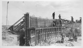
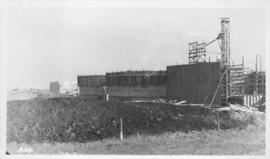
West Clarifier, 1st section wall
Photograph shows construction of sewer. Date of photograph is uncertain, [before 1949].
Photograph shows construction of sewer. Date of photograph is uncertain, [before 1949].

Photograph shows construction of sewer. Date of photograph is uncertain, [before 1949].
Photograph shows construction of sewer. Date of photograph is uncertain, [before 1949].