- i01462
- Item
- [194-?]
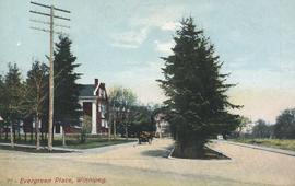
Postcard includes message from Tab to Beat? on verso. Published by C. S. Co. Ltd., Winnipeg, printed in Saxony.
Postcard includes message from Tab to Beat? on verso. Published by C. S. Co. Ltd., Winnipeg, printed in Saxony.
View of Notre Dame Avenue looking east from Kate Street
Photograph shows Notre Dame Avenue looking east from Kate Street toward Lindsay Building at 228 Notre Dame Avenue. Businesses appearing in photograph include Green Orchard Lunch, 551 Notre Dame Avenue, and B - A Service Station. Date of photograph is approximate, ca. 1939.
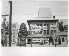
Existing Conditions, Corner of Graham and Donald looking East
A photograph of the southeast corner of Donald Street and Graham Avenue featuring a Moore's Taxi U Drive station in the foreground. Behind it in the background can be seen The Columbus Hall / Aragon Building with advertisements for Pepsi Cola and the Rainbow Dance Gardens, and the Tribune Building can be seen at the left. This is the present site of the Millennium Library. The back of the photo is marked: "Photograph 5. Existing Conditions, corner of Graham and Donald Looking East. Urban Renewal and Rehabilitation Board City of Winnipeg".
Winnipeg (Man.). Urban Renewal and Rehabilitation Board
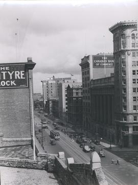
View of Main Street looking north from the Western Canada Loan Building
Photograph shows view of Main Street looking north from the roof of the Western Canada Loan Building, 392 Main Street at Portage Avenue. Date of photograph is approximate, ca. 1935.

Photograph shows old St. James Bridge approach, looking North up present Kintrye Street. Viscount Gort site centre right/Hydro sub-station - St. James Street and Portage Avenue far left. Date of photograph is uncertain [after 1932].

Overhanging Signs: North side of Portage Avenue looking East from Langside Street
Photograph shows signs for multiple businesses, including Club Morocco and Aqua-Terre Pet & Sporting Goods. Date of photograph is uncertain, [196-?].

Overhanging Signs: North side of Portage Avenue
Photograph shows sign for Club Morocco. Date of photograph is uncertain, [196-?].

Item consists of a report cover for Downtown Winnipeg, created by the Metropolitan Corporation of Greater Winnipeg - Planning Division, April 1, 1969.
Metropolitan Corporation of Greater Winnipeg (Man.). Planning Division

Downtown Winnipeg - Isometric of St. Mary-Broadway Sector
Item shows drawing in printed format that records plans for downtown Winnipeg.
Metropolitan Corporation of Greater Winnipeg (Man.). Planning Division
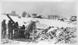
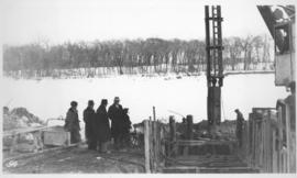
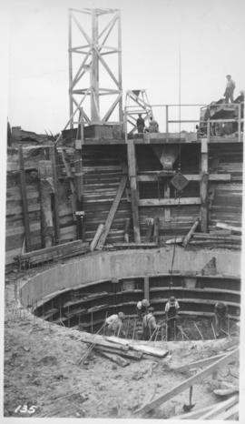
Montcalm Street, river crossing
Photograph shows construction of sewer. Date of photograph is uncertain, [before 1949].

Main Street Winnipeg looking south from City Hall
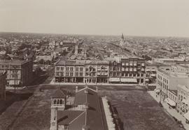
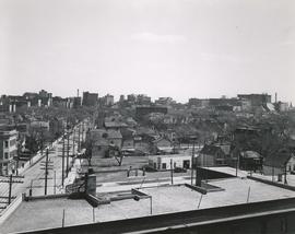
Winnipeg looking west from the tower of City Hall
Winnipeg looking west from the tower of City Hall, September 5, 1900. Present site of Red River College's Princess Street campus. Campus design included stabilization of five historic building facades along Princess Street: right to left from the corner of Elgin Avenue and Princess Street, the Utility Building (Winnipeg's first Grain Exchange) at 164 Princess; the Exchange Building II at 160 Princess; the Harris Building (Hochman's) at 154 Princess; the Bawlf Block at 150 Princess; and the Drake Hotel (Benson Block) at 146 Princess.

1950 Flood - Flood Evacuees at the St. Boniface train station
A Short, Pictorial Documentary on the Winnipeg Flood of 1950
Portigal & Wardle
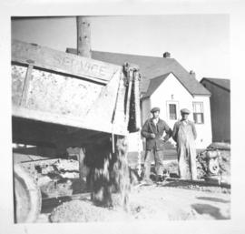
Photograph shows construction of sewer. Date of photograph is probable, [1936?].
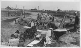
Outfall sewer, reinforcing diffuser, 1936
Photograph shows construction of sewer. Date of photograph is March 26, 1936.
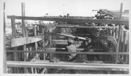
Photograph shows construction of sewer. Date of photograph is uncertain, [before 1949].
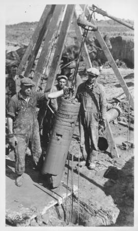
West Clarifier, pile foundation - clay core
Photograph shows construction of sewer. Date of photograph is unknown.
Photograph shows construction of sewer. Date of photograph is uncertain, [before 1949].