
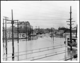
Main Street looking south from Main Street Bridge
- i00142
- Item
- 1950
Part of City of Winnipeg (1874-1971)
A photograph of flooded Main Street, looking south from the Main Street Bridge, during the 1950 flood in Winnipeg.
Harold K. White Studio
47 results with digital objects Show results with digital objects
Main Street looking south from Main Street Bridge
Part of City of Winnipeg (1874-1971)
A photograph of flooded Main Street, looking south from the Main Street Bridge, during the 1950 flood in Winnipeg.
Harold K. White Studio

Part of City of Winnipeg (1874-1971)
A photograph of floodwater and sandbag dikes outside 368 and 372 Main Street during the 1950 flood in Winnipeg.
Harold K. White Studio

Winnipeg, Main Street looking south, Spring of 1874
Part of City of Winnipeg (1874-1971)
Photograph taken from top of Courthouse.

Part of City of Winnipeg (1874-1971)

Part of East Ward, St. Boniface in the distance
Part of City of Winnipeg (1874-1971)
Photograph taken from top of Courthouse.

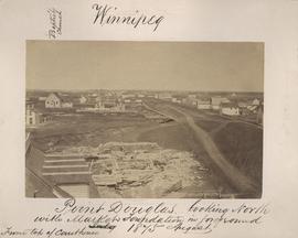
Point Douglas from Courthouse, 1874
Part of City of Winnipeg (1874-1971)

Winnipeg, Main Street looking south, Summer 1875
Part of City of Winnipeg (1874-1971)
Photograph taken from top of Courthouse.

Part of City of Winnipeg (1874-1971)
Photograph shows the North End Farmer's Market (west side Main Street, north of Stella Avenue, looking west to King Street). Included in photograph: front entrance to market, automobiles parked on street, and North End Horse Exchange (523 King Street). Photograph likely taken from 919-921 Main Street by city employee.

Part of City of Winnipeg (1874-1971)
Photograph shows the North End Farmer's Market, looking east across Main Street (northwest Main Street and Stella Avenue). Included in photograph: stalls filled with vegetables and people walking through the market, Aime Bicycle Shop, 909 Main Street, two-storey brick building (899-905 Main Street), and Norquay School.
Part of City of Winnipeg (1874-1971)
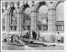
A photograph of floodwater and a pump outside the Royal Bank on Main Street during the 1950 flood in Winnipeg.
Harold K. White Studio

Main Street looking north from Portage Avenue
Part of City of Winnipeg (1874-1971)
Bentley Building, Courthouse and Artesian well shown in photograph.

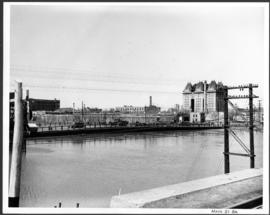
Pontoon Bridge, Fort Garry and Warehouse from south side Assiniboine River
Part of City of Winnipeg (1874-1971)
Part of City of Winnipeg (1874-1971)
A photograph of the Main Street Bridge during the 1950 flood in Winnipeg. The Hotel Fort Garry can be seen in the background.
Harold K. White Studio
Point Douglas looking north with City Hall foundation in foreground, August 1875
Part of City of Winnipeg (1874-1971)
Photograph taken from top of Courthouse.
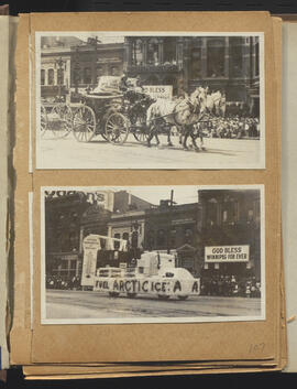
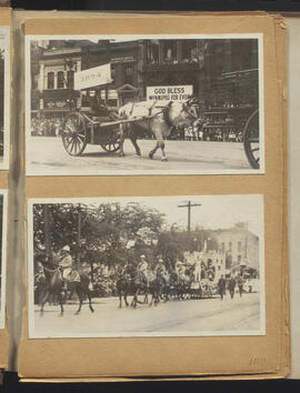
Fire engine and Arctic Ice floats
Part of City of Winnipeg (1874-1971)
Winnipeg (Man.). Special Jubilee Committee
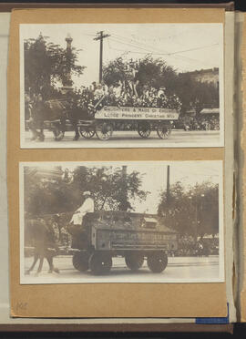
Daughters and Maids of England and Ye Olde Pest House floats
Part of City of Winnipeg (1874-1971)
Winnipeg (Man.). Special Jubilee Committee
Part of City of Winnipeg (1874-1971)
Winnipeg (Man.). Special Jubilee Committee

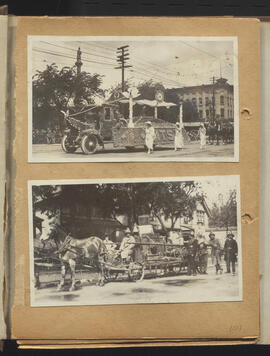
Greater Winnipeg Board of Trade and United Commercial Travellers floats
Part of City of Winnipeg (1874-1971)
Winnipeg (Man.). Special Jubilee Committee
Red River cart and Fort Garry floats
Part of City of Winnipeg (1874-1971)
Winnipeg (Man.). Special Jubilee Committee
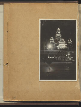
City Hall lit up for Winnipeg’s 50th anniversary celebration
Part of City of Winnipeg (1874-1971)
Winnipeg (Man.). Special Jubilee Committee