
- i03459
- Item
- [ca. 1935]
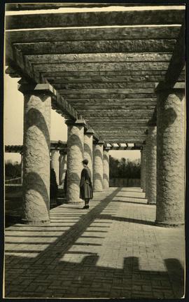
A view of the Pergola behind the Assiniboine Park Pavilion(current).
103 results with digital objects Show results with digital objects
A view of the Pergola behind the Assiniboine Park Pavilion(current).
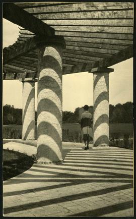
A view of the Pergola behind the Assiniboine Park Pavilion(current).

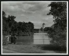
Women at Assiniboine Park lily pond
Two young women sitting near the lily pond and the Pergola at Assiniboine Park.

New Conservatory in Assiniboine Park
Photograph of the new conservatory in Assiniboine Park, built in June 1970. The photo's reverse is marked with Metro's Parks and Protection Division stamp and G. A. Schoch (Landscape Architect) written. The photographer is likely G. A. Schoch.
Metropolitan Corporation of Greater Winnipeg (Man.). Information Officer
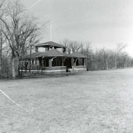
Old Cricket Pavilion in Assiniboine Park
Photograph of the old Cricket Pavilion in Assiniboine Park, originally constructed in 1911 and demolished in 1966. Photo's reverse is stamped by the Parks and Protection Division of the Metro Government.
Metropolitan Corporation of Greater Winnipeg (Man.). Information Officer
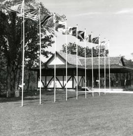
New Cricket Pavilion in Assiniboine Park
Photograph of the new Cricket Pavilion in Assiniboine Park, which replaced the original pavilion in 1966. Photo's reverse is stamped by the Parks and Protection Division of the Metro Government.
Metropolitan Corporation of Greater Winnipeg (Man.). Information Officer
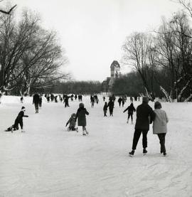
Skating on the Assiniboine Duck Pond
Photograph of park goers skating on the Assiniboine Duck Pond in winter, with the pavilion off in the distance. A description of the photo used for publication is recorded on a separate piece of paper. Photo's reverse is stamped by the Parks and Protection Division of the Metro Government.
Metropolitan Corporation of Greater Winnipeg (Man.). Information Officer

1932 Relief Works and Committee Winnipeg
Photograph collage of the 1932 Winnipeg Relief Works and Committee. Portraits of committee members are surrounding photographs of projects the committee had worked on. The committee members are, clockwise from top left: Alderman John Blumberg, Alderman H. Andrews, City Clerk Magnus Peterson, Alderman J.A. Barry, Alderman A.A. Ryley, Alderman W.B. Simpson, City Engineer W.P. Brereton, G.W. Northwood, Alderman E.D. Honeyman, Mayor Ralph Webb, Alderman J.A. McKerschar, A. MacNamara, Resident Engineer A.J. Taunton, Alderman L.F. Borrowman, and Alderman C.E. Simonite. The works projects showcased in the center are, clockwise from top left: the Main Street Bridge, the Norwood Bridge, the Assiniboine Park Bridge, the Winnipeg Auditorium, the Sargent Park Swimming Pool, and the Salter Street Bridge. Created by Robson Photo.
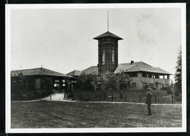
Assiniboine Park Pavilion and Annex
A man standing in front of the Pavilion and Annex at Assiniboine Park.

Plan of University section of Tuxedo Park
A map of the proposed Tuxedo Park residential suburb, specifically the area surrounding the old University of Manitoba campus and Olmsted and Assiniboine Parks. The map shows streets and lots as well as details of the university campus. The map was created by Charles Clifton Chataway (1869-1920) and Bulman Brothers Ltd.
Duck pond and pavilion at Assiniboine Park
A family enjoying the duck pond and the view of the pavilion at Assiniboine Park.
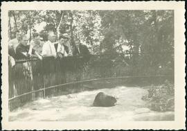
Original beaver enclosure at Assiniboine Park
Audience admiring a beaver in Assiniboine Park’s first beaver enclosure.
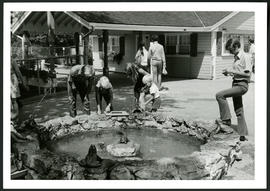
Aunt Sally's Farm at the Assiniboine Park Zoo
Photograph of visitors enjoying a fountain at Aunt Sally's Farm, in the Assiniboine Park Zoo. Photograph was taken by Gunter A. Schoch, Landscape Architect with the Metropolitan Corporation of Greater Winnipeg's Parks and Protection Division.
Metropolitan Corporation of Greater Winnipeg (Man.). Parks and Protection Division
Part of Morris Block collection
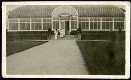
Photograph of a man and woman standing outside the Assiniboine Park conservatory.
Block, Morris
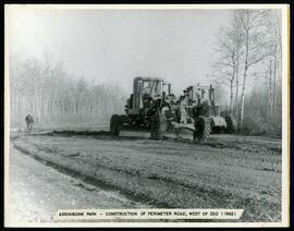
Perimeter road construction at Assiniboine Park Zoo
Construction of perimeter road west of the Assiniboine Park Zoo.
Winnipeg (Man.). Parks and Recreation Department
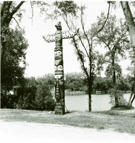
Ceremony to recognize erection of totem pole made by James F. Sutherland.
Winnipeg (Man.). Parks and Recreation Department
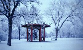
Pagoda formerly located in Assiniboine Park. Now located in King's Park.
Winnipeg (Man.). Parks and Recreation Department
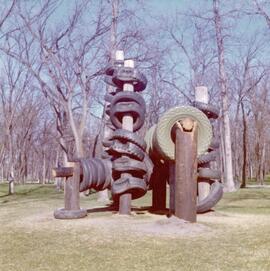
Art installation at Assiniboine Park
Art installation at Assiniboine Park.
Winnipeg (Man.). Parks and Recreation Department

Art installation at Assiniboine Park
Art installation at Assiniboine Park.
Winnipeg (Man.). Parks and Recreation Department
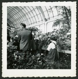
Father and daughter walking through Assiniboien Park Conservatory.