
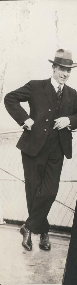
- i02060
- Item
- 1923
Date of photograph is approximate, ca. 1923.
123 results with digital objects Show results with digital objects
Date of photograph is approximate, ca. 1923.
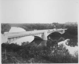
Photograph shows Maryland Street Bridge looking southeast into Crescentwood. Date of photograph is approximate, ca. 1925.
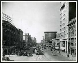
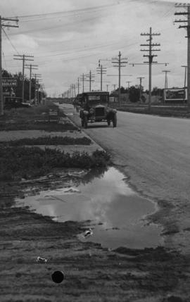
Portage Avenue looking west from Main Street
Date of photograph is approximate, ca. 1927.
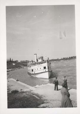
People waiting for S.S. Keenora to dock
Date of photograph is uncertain, [192-?].
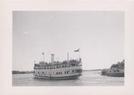
S.S. Keenora with crowds of people on deck
Stamp (on verso): Taylor Made Service Process, July 11 ????. Date of photograph is uncertain, [192-?].

1932 Relief Works and Committee Winnipeg
Photograph collage of the 1932 Winnipeg Relief Works and Committee. Portraits of committee members are surrounding photographs of projects the committee had worked on. The committee members are, clockwise from top left: Alderman John Blumberg, Alderman H. Andrews, City Clerk Magnus Peterson, Alderman J.A. Barry, Alderman A.A. Ryley, Alderman W.B. Simpson, City Engineer W.P. Brereton, G.W. Northwood, Alderman E.D. Honeyman, Mayor Ralph Webb, Alderman J.A. McKerschar, A. MacNamara, Resident Engineer A.J. Taunton, Alderman L.F. Borrowman, and Alderman C.E. Simonite. The works projects showcased in the center are, clockwise from top left: the Main Street Bridge, the Norwood Bridge, the Assiniboine Park Bridge, the Winnipeg Auditorium, the Sargent Park Swimming Pool, and the Salter Street Bridge. Created by Robson Photo.
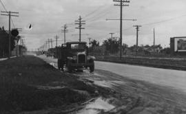
Main Street, corner Seven Oaks, Rainfall, June 29, 1932
Photograph is dated July 1, 1932.
Main Street - Perth to Hartford, Rainfall, June 29, 1932
Photograph is dated July 1, 1932.
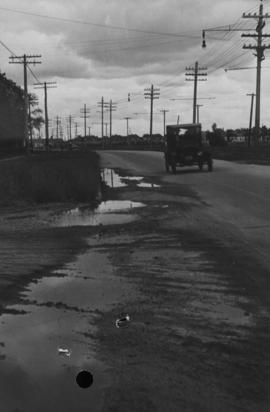
Main Street - Hartford to Belmont, 48 hours after rain
Date of photograph is July 1, 1932.

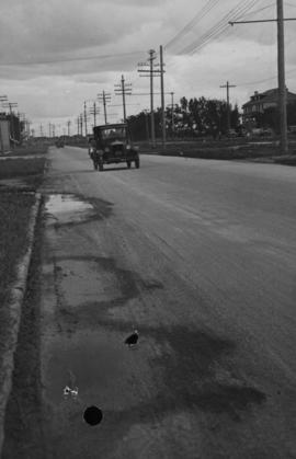
Main Street, south of Seven Oaks, 48 hours after rain
Date of photograph is July 8, 1932.

Winnipeg’s Best Tourist Cabin Camp on Pembina Highway
Postcard featuring “Winnipeg’s Best Tourist Cabin Camp”, located on Pembina Highway (then Highway Number 14) around Chevrier Boulevard.

Winnipeg Tourist Cabins and Camp Park on Pembina Highway
Postcard featuring “Winnipeg Tourist Cabins and Camp Park”, located on Pembina Highway (then Highway Number 14) around Chevrier Boulevard.
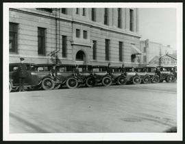
Police cars outside Rupert Avenue Police Station
A photograph of the Police Station and police car fleet on Rupert Avenue, taken ca. 1930.
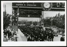
Police on Osborne Street Bridge during 1935 parade
A photograph of a parade on Osborne Street Bridge, taken 1935.
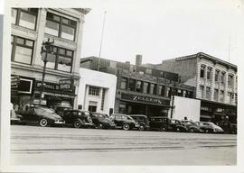
Storefronts on Portage Avenue between Carlton and Hargrave Streets
Cars and shoppers in front of stores on the north side of Portage Avenue, between Carlton and Hargrave Streets. Featured are The Berryhill Shoe Store in the Enderton / Mitchell-Copp Building, the Bank of Montreal, Zeller's (Zellers), and Rannards Shoes in

Portage Avenue looking west from Colony Street
A view of Portage Avenue looking west from Colony Street. The Hudson's Bay Company Building is featured prominantly and the Power Building and the Boyd Building are visible farther west.
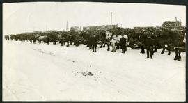
Unloading of relief wood at Greater Winnipeg Water District Station
Men at the Greater Winnipeg Water District station in St. Boniface standing in front of horses hauling wood piles for relief work. Photograph taken by Robinson Studio.

Storefronts on Portage Avenue between Carlton and Hargrave Streets
Cars and shoppers in front of stores on the north side of Portage Avenue, between Carlton and Hargrave Streets. Featured are The Berryhill Shoe Store in the Enderton / Mitchell-Copp Building, the Bank of Montreal, and Zeller's (Zellers).

Portage Avenue looking west from Colony Street
A view of Portage Avenue looking west from Colony Street. The Hudson's Bay Company Building is featured prominantly and the Power Building is visible farther west. Playing "Young Mr. Lincoln", the Gaiety Theatre can be seen across the street with two poli