
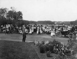
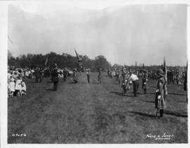
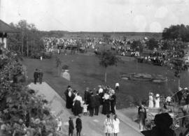
Playground Sports Day at Assiniboine Park
- i03099
- Item
- 1910
Photograph shows playground sports day at Assiniboine Park.
98 results with digital objects Show results with digital objects
Playground Sports Day at Assiniboine Park
Photograph shows playground sports day at Assiniboine Park.

Plan of University section of Tuxedo Park
A map of the proposed Tuxedo Park residential suburb, specifically the area surrounding the old University of Manitoba campus and Olmsted and Assiniboine Parks. The map shows streets and lots as well as details of the university campus. The map was created by Charles Clifton Chataway (1869-1920) and Bulman Brothers Ltd.

Footbridge over Assiniboine River to City Park, Sunday afternoon
Date of photograph is approximate, ca. 1914.
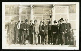
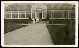
A group photo taken in front of the original Assiniboine Park Conservatory
A group photo taken in front of the original Assiniboine Park conservatory.
Winnipeg (Man.). Board of Parks and Recreation
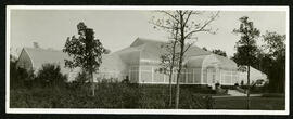
Exterior of the Assiniboine Park conservatory
A photo of the exterior of the Assiniboine park conservatory.
Winnipeg (Man.). Board of Parks and Recreation
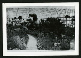
Interior of the Assiniboine Park conservatory palm house
A photo of the interior of the original Assiniboine park conservatory palm house.
Winnipeg (Man.). Board of Parks and Recreation
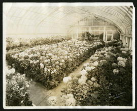
Interior of the Assiniboine Park conservatory
A photo of flowers growing in the interior of the original Assiniboine Park conservatory.
Winnipeg (Man.). Board of Parks and Recreation
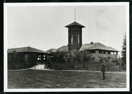
Assiniboine Park Pavilion and Annex
A man standing in front of the Pavilion and Annex at Assiniboine Park.
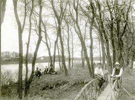
A page from a photograph album. Photograph shows small groups of people gathered near the river and a small bridge at Assiniboine Park (City Park). Date of photograph is approximate, [ca. 1920].
Photograph shows a Girl Guide rally at Assiniboine Park. Date of photograph is August 28, 1928.
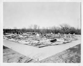
Photograph shows the burnt remains of the Assiniboine Park Pavilion constructed in 1908. Date of photograph is May 27, 1929.

Women at Assiniboine Park lily pond
Two young women sitting near the lily pond and the Pergola at Assiniboine Park.

Date of photograph is approximate, ca. 1929.
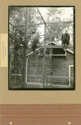
Photograph shows three Eagles in their pen at the Assiniboine Park Zoo. On the reverse side of the photograph, there is an image of the ribbon cutting ceremony for Assiniboine Drive. Date of photograph is approximate, [ca. 1929].
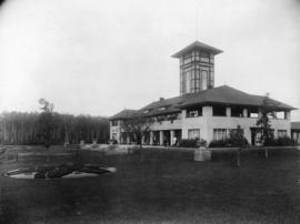
Photograph shows a view of the Assiniboine Park Pavilion (former). Date of photograph is uncertain, [ca. 1920].
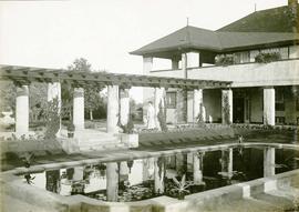
A page from a photograph album. Photograph shows people viewing the pergola behind the former Assiniboine Park Pavilion. Date of photograph is approximate, [ca. 1920].
Part of Morris Block collection
Photograph of a man and woman standing outside the Assiniboine Park conservatory.
Block, Morris
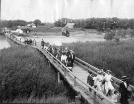
Photograph shows people walking across the foot bridge to Assiniboine Park. Date of photograph is uncertain, [ca. 1920].
Photograph shows a view of Assiniboine Park from the front of the Pavilion. Date of photograph is uncertain, [ca. 1920].

1932 Relief Works and Committee Winnipeg
Photograph collage of the 1932 Winnipeg Relief Works and Committee. Portraits of committee members are surrounding photographs of projects the committee had worked on. The committee members are, clockwise from top left: Alderman John Blumberg, Alderman H. Andrews, City Clerk Magnus Peterson, Alderman J.A. Barry, Alderman A.A. Ryley, Alderman W.B. Simpson, City Engineer W.P. Brereton, G.W. Northwood, Alderman E.D. Honeyman, Mayor Ralph Webb, Alderman J.A. McKerschar, A. MacNamara, Resident Engineer A.J. Taunton, Alderman L.F. Borrowman, and Alderman C.E. Simonite. The works projects showcased in the center are, clockwise from top left: the Main Street Bridge, the Norwood Bridge, the Assiniboine Park Bridge, the Winnipeg Auditorium, the Sargent Park Swimming Pool, and the Salter Street Bridge. Created by Robson Photo.