
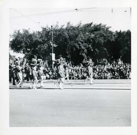
Winnipeg's 75th Anniversary parade - Belgian Club Band
- i04191
- Item
- 6 Jun. 1949
195 results with digital objects Show results with digital objects
Winnipeg's 75th Anniversary parade - Belgian Club Band
Winnipeg's 75th Anniversary parade - baton twirlers
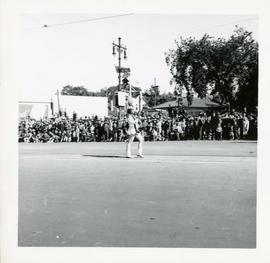
Winnipeg's 75th Anniversary parade - baton twirler
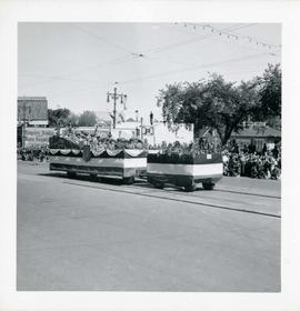
Winnipeg's 75th Anniversary parade - Automatic Stacker Company float

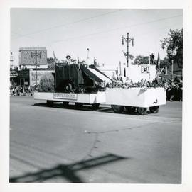
Winnipeg's 75th Anniversary parade - Ashdown's Hardware float
Winnipeg's 75th Anniversary parade - Army, Navy, Airforce Veterans Units float
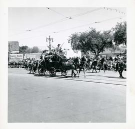
Winnipeg's 75th Anniversary parade - armed men on stagecoach
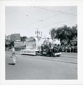
Winnipeg's 75th Anniversary parade - Anti-Tuberculosis Drive float
Float is supported by CJOB radio station, and Associated Canadian Travellers.
Winnipeg's 75th Anniversary parade
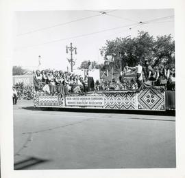
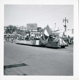
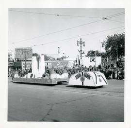
Photographs of a parade celebrating Winnipeg's 75th anniversary. The photos are taken on Portage Avenue between Colony/Memorial and Balmoral Streets. The parade features marching bands, baton twirlers, clowns, celebrities, floats of various businesses, organizations, and ethnic communities, as well as members of the Blackfoot Nation. There is no apparent order to the photos, as photos of the same float can be found several photos away from each other.

Winnipeg General Hospital and Alexandra Park
Postcard shows Winnipeg General Hospital in background, Bannatyne Avenue looking South across Alexandra Park. In foreground, Alexandra Park appears. Shows 1884 and 1897 buildings. Date of postcard is approximate, ca. 1897.

Thoroughfares: Academy Road at Wellington Crescent
View of cars and cyclists heading down Academy Road towards Wellington Crescent and the Maryland Bridge. The cupola of Misericordia Hospital can be seen across the bridge.

Thoroughfares: Academy Road at Wellington Crescent
View of cars and cyclists heading down Academy Road towards Wellington Crescent and the Maryland Bridge. A small portion of Misericordia Hospital can be seen across the bridge.
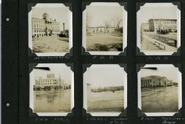
Scrapbook of Corporal Wallace – page 7
Page 7 of a photograph scrapbook made by Corporal John Wallace in April 1940. Photographs depict Fort Osborne Barracks and its Parade Square, soldiers marching, the Civic Auditorium, and the Mall Hotel on Portage Avenue between Colony and Balmoral Streets.
Wallace, John
![Sargent Park vicinity [Aerial view]](/uploads/r/city-of-winnipeg-archives-amp-records-control-branch/6/d/b/6dbefceeef372f0514de159e1569f5aba581dc63a4d454200688557662b9ce22/C0013_0000_0000_P0018_0038_001_142.jpg)
Sargent Park vicinity [Aerial view]
Inscription (on recto): WG M35: 5-9, 5 Mar. '45, Sgt Park Vicinity, appr. scale 1/12000.
![Sargent Park [Aerial View]](/uploads/r/city-of-winnipeg-archives-amp-records-control-branch/e/5/1/e51b6ff83bb626c524f2415a4d84c08187de0f175c746cbde40dcf11e700b8eb/C0013_0000_0000_P0018_0039_001_142.jpg)
Inscription (on recto): WG. M35: 5-10, 5 Mar' 45, Sgt Park Vicinity, appr. scale 1/12000.

Polo Park Shopping Centre panorama
View of Polo Park Shopping Centre, 1485 Portage Avenue, 41 acres. West side of shopping centre, north side of Portage Avenue between Empress Street and St. James Street. Left to Right: Winnipeg Stadium, Winnipeg Arena, Loblaws, Simpson Sears Marina, Simpson Sears Garden Shop, Simpson Sears Department Store, Simpson Sears Service Station. Consists of 4 separate photographs pasted together on cardboard to create a panorama. The cardboard is a scrap made from an old sign of the Metropolitan Corporation of Greater Winnipeg (visible on the reverse). The cardboard is numbered “11”, presumably as part of a compilation with other shopping centre panoramas.
Metropolitan Corporation of Greater Winnipeg (Man.). Planning Division

Polo Park Shopping Centre panorama
View of Polo Park Shopping Centre, 1485 Portage Avenue, 41 acres. East side of shopping centre. From left to right: the Pancake House, Simpsons-Sears, Perth's Dry Cleaners, Genser's Furniture, Daytons, Jack and Jill, Reward, Gordi's Restaurant, Ricki’s, addition to shopping centre under construction, Dominion Store, CJAY-TV Station (CKY-TV), Winnipeg Arena. Consists of 4 separate photographs pasted together on cardboard to create a panorama. The cardboard is a scrap made from an old sign of the Metropolitan Corporation of Greater Winnipeg (visible on the reverse). The cardboard is numbered “12”, presumably as part of a compilation with other shopping centre panoramas.
Metropolitan Corporation of Greater Winnipeg (Man.). Planning Division

Polo Park Shopping Centre panorama
View of Polo Park Shopping Centre, 1485 Portage Avenue, 41 acres. South side of shopping centre. Left to right: Winnipeg Motor Products, Motor Club, Simpson Sears Service Station, Simpson Sears Department Store. Consists of 3 separate photographs pasted together on cardboard to create a panorama. The cardboard is a scrap made from an old sign of the Metropolitan Corporation of Greater Winnipeg (visible on the reverse). The cardboard is numbered “13”, presumably as part of a compilation with other shopping centre panoramas.
Metropolitan Corporation of Greater Winnipeg (Man.). Planning Division