

- i01471
- Item
- [after 1932]
Photograph shows old St. James Bridge approach, looking north up Madison Street (now Century Street/Route 90). Present Viscount Gort site in center. Date of photograph is uncertain, [after 1932].
768 results with digital objects Show results with digital objects
Photograph shows old St. James Bridge approach, looking north up Madison Street (now Century Street/Route 90). Present Viscount Gort site in center. Date of photograph is uncertain, [after 1932].
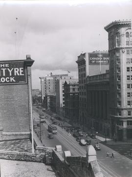
View of Main Street looking north from the Western Canada Loan Building
Photograph shows view of Main Street looking north from the roof of the Western Canada Loan Building, 392 Main Street at Portage Avenue. Date of photograph is approximate, ca. 1935.

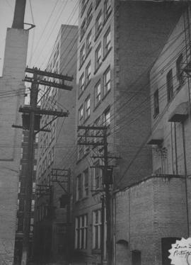
Photograph shows old St. James Bridge approach, looking North up present Kintrye Street. Viscount Gort site centre right/Hydro sub-station - St. James Street and Portage Avenue far left. Date of photograph is uncertain [after 1932].
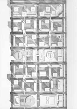
Downtown Winnipeg - Plan of St. Mary-Broadway Sector
Item shows drawing in printed format that records plans for downtown area.
Metropolitan Corporation of Greater Winnipeg (Man.). Planning Division

Downtown Winnipeg - Section and Interior View of Winter Garden
Items shows drawing in printed format that record plans for downtown area.
Metropolitan Corporation of Greater Winnipeg (Man.). Planning Division

Item consists of a report cover for Downtown Winnipeg, created by the Metropolitan Corporation of Greater Winnipeg - Planning Division, April 1, 1969.
Metropolitan Corporation of Greater Winnipeg (Man.). Planning Division

Downtown Winnipeg - Model photo of Downtown Plan (side view)
Item appears to show photographic reproduction of model (side view) in printed format that records plans for downtown area.
Metropolitan Corporation of Greater Winnipeg (Man.). Planning Division
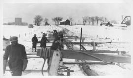
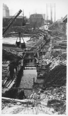
Montcalm Street, river crossing
Photograph shows construction of sewer. Date of photograph is uncertain, [before 1949].
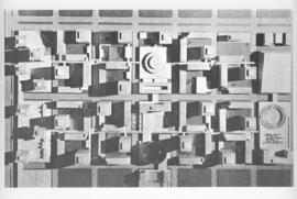
Downtown Winnipeg - Model Photo of Downtown Plan (aerial view)
Item appears to show photographic reproduction of model (aerial view) in printed format that records plans for downtown area.
Metropolitan Corporation of Greater Winnipeg (Man.). Planning Division
Montcalm Street, river crossing
Photograph shows construction of sewer. Date of photograph is uncertain, [before 1949].
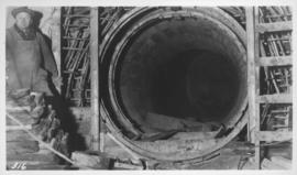
Junction, main interceptor and surge tank
Photograph shows construction of sewer. Date of photograph is uncertain, [before 1949].

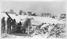
Main interceptor looking toward curve, Broadway and Main St.
Photograph shows construction of sewer. Date of photograph is uncertain, [before 1949].
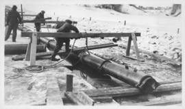
Assiniboine River crossing at Main Street, laying pipe
Photograph shows construction of sewer.

Downtown Winnipeg - Isometric of St. Mary-Broadway Sector
Item shows drawing in printed format that records plans for downtown Winnipeg.
Metropolitan Corporation of Greater Winnipeg (Man.). Planning Division
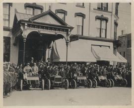
Cars and drivers, Clarendon Hotel
Photograph shows cars and drivers at Clarendon Hotel, northwest corner of Donald Street and Portage Avenue. - Inscription (on verso): 1st car, R. M. McLeod and R. Newman 2nd car, W. C. Power at wheel. 3rd car, Kelly Bros. 4th car, Douglas M. McLaughlin and Bert Wells (standing between cars is Ace Emmett). 5th car, Jack McCullock and Jimmy Boswell. - Date of photograph is approximate, ca. 1904.
Montcalm Street, river crossing
Photograph shows construction of sewer. Date of photograph is uncertain, [before 1949].

Main Street Winnipeg looking south from City Hall