

- i02112
- Pièce
- 1916
Fait partie de City of Winnipeg Archives Photograph collection
Photograph is one of five photos mounted on page with caption "Assiniboine River flooded, Spring 1916."
140 résultats avec objets numériques Afficher les résultats avec des objets numériques
Fait partie de City of Winnipeg Archives Photograph collection
Photograph is one of five photos mounted on page with caption "Assiniboine River flooded, Spring 1916."

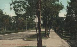
New boulevards on street north from Palmerston Avenue.
Fait partie de Parks and Recreation Photograph collection
View of new boulevards on an unidentified street in the Wolseley area, facing north from Palmerston Avenue.
Fait partie de Parks and Recreation Photograph collection
Photographs of boulevards around Winnipeg, some new, others damaged.
Industrial Bureau Exposition Building
Fait partie de City of Winnipeg Archives Photograph collection
Photograph shows the Industrial Bureau Exposition Building, also called the Board of Trade Building, at Main Street and Water Avenue (now William Stephenson Way). Date of photograph is approximate, ca. 1915.

A military funeral, Broadway and Spence Streets, Winnipeg - 1914
Fait partie de City of Winnipeg Archives Photograph collection
Photograph taken at time of World War 1.
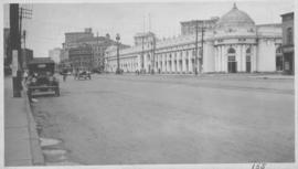
Fait partie de City of Winnipeg Archives Photograph collection
Photograph taken from McLaren Hotel at Rupert and Main Street, looking northeast, probably during World War 1. Date of photograph is uncertain, [between 1912 and 1925].
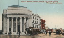
Bank of Montreal, corner of Portage Avenue and Main Street
Fait partie de City of Winnipeg Archives Photograph collection
Date of postcard is approximate, ca. 1912.
Fait partie de City of Winnipeg Archives Photograph collection
Postcard shows streetcar, horse buggies and Union Bank building.
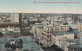
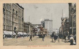
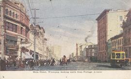
Bird's Eye View, looking North
Fait partie de City of Winnipeg Archives Photograph collection
Postcard shows view looking north, down Main Street from Lombard Avenue. Probably taken from roof of McArthur Building (Childs Building). Date of postcard is approximate, ca. 1910.
Crescentwood Park and Broadway
Fait partie de Parks and Recreation Photograph collection
A photo album page with a view of Crescentwood Park on the first side and a view of Broadway from Main Street on the second side.
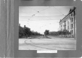
Fait partie de Parks and Recreation Photograph collection
A photograph of streetcar on Broadway, looking west from Main Street. The Manitoba Club building can be seen on the left. Photographed by Steele and Company.

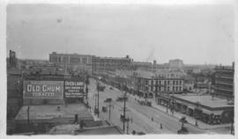
North side of Lombard, Rorie to Main Street
Fait partie de City of Winnipeg (1874-1971)
A photograph of storefronts and advertisements on the north side of Lombard Avenue, between Rorie Street and Main Street. The photograph is part of small album containing photographs of maps tracking the outbreak of typhoid from 1905 to 1909 and other scenes. Item is loose and at back of album.
Fait partie de City of Winnipeg Archives Photograph collection
Date of postcard is approximate, ca. 1909.
Fait partie de City of Winnipeg Archives Photograph collection

Main Street North from Merchants' Bank Building, Winnipeg
Fait partie de City of Winnipeg Archives Photograph collection
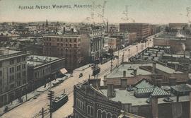
Main Street, looking south from corner Portage Ave., Winnipeg
Fait partie de City of Winnipeg Archives Photograph collection
Fait partie de City of Winnipeg Archives Photograph collection
Main Street, Winnipeg, looking north from Portage Avenue
Fait partie de City of Winnipeg Archives Photograph collection
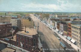
Fait partie de City of Winnipeg Archives Photograph collection
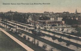
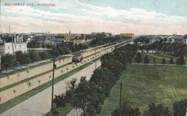
Broadway Avenue from Manitoba Club, Winnipeg
Fait partie de City of Winnipeg Archives Photograph collection