

- p00289
- Part
- [after 1929]
Fait partie de Parks and Recreation Photograph collection
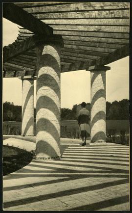
An album page with a photo of the Pergola behind the Pavilion at Assiniboine Park affixed to it.
Fait partie de Parks and Recreation Photograph collection
An album page with a photo of the Pergola behind the Pavilion at Assiniboine Park affixed to it.
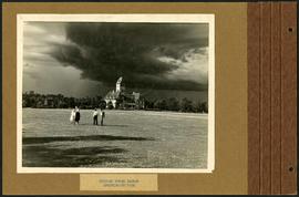
Storm clouds over Assiniboine Park
Fait partie de Parks and Recreation Photograph collection
An album page with a photo of storm clouds near the Assiniboine Park Pavilion affixed to it.
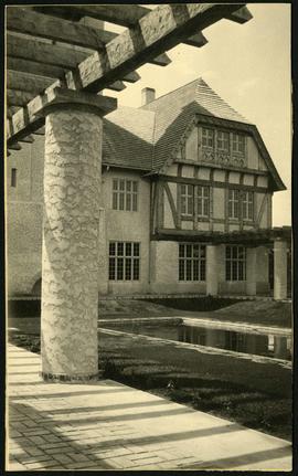
Back view of Assiniboine Park Pavilion
Fait partie de Parks and Recreation Photograph collection
A view of the back of the Assiniboine Park Pavilion (current) and the Pergola.
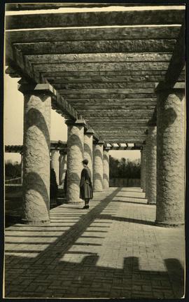
Fait partie de Parks and Recreation Photograph collection
A view of the Pergola behind the Assiniboine Park Pavilion(current).
Fait partie de Parks and Recreation Photograph collection
A view of the Pergola behind the Assiniboine Park Pavilion(current).

Women at Assiniboine Park lily pond
Fait partie de Parks and Recreation Photograph collection
Two young women sitting near the lily pond and the Pergola at Assiniboine Park.
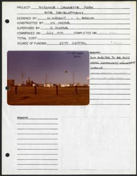
Suzanne - Jeannette Park – project development components
Fait partie de Parks and Recreation Photograph collection
Project development components form for Suzanne – Jeanette Park with a colour photograph affixed.
Sans titre
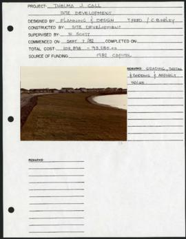
Thelma J. Call Park – project development components
Fait partie de Parks and Recreation Photograph collection
Project development components form for Thelma J. Crull Park with a colour photograph affixed.
Sans titre
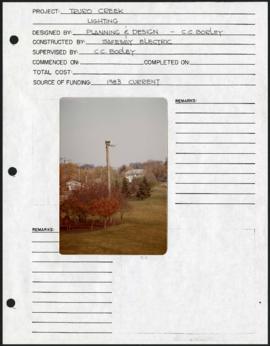
Truro Creek Parkway – project development components
Fait partie de Parks and Recreation Photograph collection
Project development components form for Truro Creek Parkway with a colour photograph affixed.
Sans titre
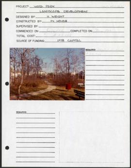
Vista Park – project development components
Fait partie de Parks and Recreation Photograph collection
Project development components form for Vista Park with a colour photograph affixed.
Sans titre

Westboine Park – project development components
Fait partie de Parks and Recreation Photograph collection
Project development components form for Westboine Park with 2 colour photographs affixed.
Sans titre
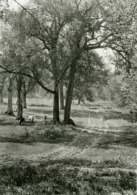
Fait partie de Parks and Recreation Photograph collection
A photograph of cows grazing in Fraser’s Grove Park in East Kildonan.

Plan of University section of Tuxedo Park
Fait partie de Parks and Recreation Photograph collection
A map of the proposed Tuxedo Park residential suburb, specifically the area surrounding the old University of Manitoba campus and Olmsted and Assiniboine Parks. The map shows streets and lots as well as details of the university campus. The map was created by Charles Clifton Chataway (1869-1920) and Bulman Brothers Ltd.
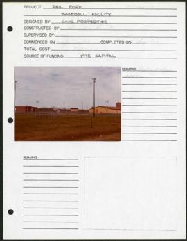
Riel Park – project development components
Fait partie de Parks and Recreation Photograph collection
Project development components form for Riel Park with a colour photograph affixed.
Sans titre
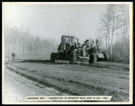
Perimeter road construction at Assiniboine Park Zoo
Fait partie de Parks and Recreation Photograph collection
Construction of perimeter road west of the Assiniboine Park Zoo.
Sans titre
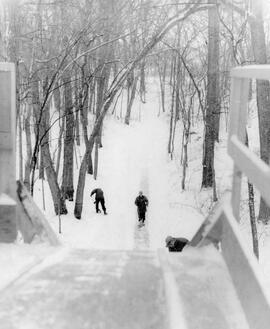
Cleaning toboggan slide in Kildonan Park
Fait partie de Parks and Recreation Photograph collection
Park workers cleaning off the toboggan slide in Kildonan Park.
Sans titre
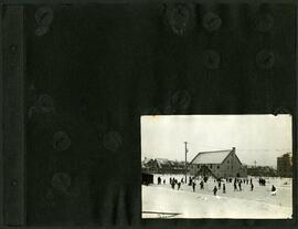
Children playing hockey outside Isaac Brock School
Fait partie de Parks and Recreation Photograph collection
A photograph album page with children playing hockey on outside of Isaac Brock School and Chalmers United Church at Spruce Street and Barratt Avenue.
Sans titre

Fait partie de Parks and Recreation Photograph collection
2 photographs affixed to an album page: top depicts a person standing under a tree, bottom is a view of a park and neighborhood in the background.
Sans titre
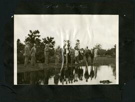
Fait partie de Parks and Recreation Photograph collection
A photograph album page with a group of people inspecting a park [King Edward Park?].
Sans titre

Playing hockey in outdoor rinks
Fait partie de Parks and Recreation Photograph collection
A photograph album page with 2 photographs of children playing hockey in a residential area.
Sans titre