A page from a photograph album. Photographs show boys dancing on an outdoor dance floor (top), children posing at a playground (bottom left), and children playing volleyball at a school playground on the first side (bottom right). Date of photographs is approximate, [ca. 1920].
A map of the proposed Tuxedo Park residential suburb, specifically the area surrounding the old University of Manitoba campus and Olmsted and Assiniboine Parks. The map shows streets and lots as well as details of the university campus. The map was created by Charles Clifton Chataway (1869-1920) and Bulman Brothers Ltd.
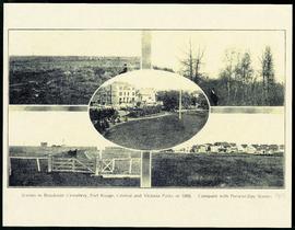
A printed page consisting of a 5 photograph collage of scenes from Fort Rouge Park, Central Park, Victoria Park, and Brookside Cemetery. The photographs date from 1898, but the page itself is likely from 1913.
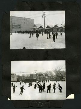
Two photographs of children playing hockey on outdoor skating rinks. Photo at top was taken outside the Northland Knitting Company building at 618 Arlington Street. Photo at bottom was taken on Scotia Street, near Luxton Avenue. The photographs are affixed to one side of a piece of construction paper that has two other photos on its reverse.
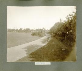
One of two photographs affixed to page. This photograph shows Selkirk Park, and the one on the other side shows Dufferin Park. Inscription (on recto): "a-859- Selkirk Park." Date of photograph is approximate, [ca. 1910].

![Parks and Playgrounds - General [Greenway School No.1]](/uploads/r/city-of-winnipeg-archives-amp-records-control-branch/b/3/4/b34046418918de050940ae205eb78e0897287dd3dda334c96f28092c41f83ba3/C0008_0001_0000_A0056_0044_002_142.jpg)