
- i02919
- Item
- 1920
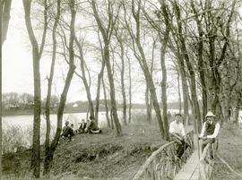
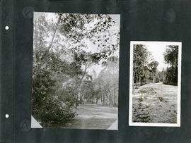
A page from a photograph album. Photograph shows small groups of people gathered near the river and a small bridge at Assiniboine Park (City Park). Date of photograph is approximate, [ca. 1920].
A page from a photograph album. Photograph shows small groups of people gathered near the river and a small bridge at Assiniboine Park (City Park). Date of photograph is approximate, [ca. 1920].

Children's wading pool and park benches along a stone path in the Park.
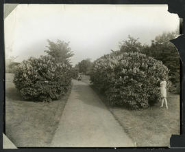
Photograph shows the lilac hedge at Elmwood Park. Photographer's stamp on verso. Date of photograph is approximate, [ca. 1920].
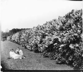
Photograph of a child picking lilacs from a hedge in Elmwood Park. Photograph by Cyril Jessop, 502 Sherburne Street.
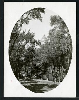
A photograph showing Fort Rouge Park with Legislature in the background. Date of photograph is approximate, [ca. 1930].
One side of an album page with two mounted photographs of Fort Rouge Park. Includes image of Fort Rouge Park with the Manitoba Legislature in the background (left) and an image of an unknown green space (right).
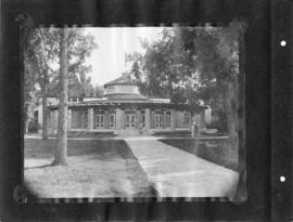
Kildonan Park – Pavilion back entrance
Photograph shows a view of the back entrance to the former pavilion at Kildonan Park. Photograph was likely taken by Cyril Jessop. Date of photograph is approximate, [ca. 1930].
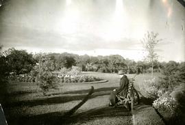
Woman sitting on bench in Kildonan Park
Photograph shows a view of Kildonan Park with a woman sitting on a bench. Her bicycle is leaning against the bench. Date of photograph is approximate, [ca. 1930].
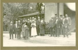
Wedding party at Kildonan Park
Photograph shows a wedding party posing near the front entrance to the former Pavilion in Kildonan Park. Guests include, from right to left, Aldermen D. McLean, H. Jones [?], Thomas Boyd [?], W.B. Simpson, J.A. McKerchar, A.H. Pulford, F.O. Fowler[?], and, on the far left, Thomas Flye.

Chief Peguis Memorial in Kildonan Park.
Winnipeg (Man.). Parks and Recreation Department
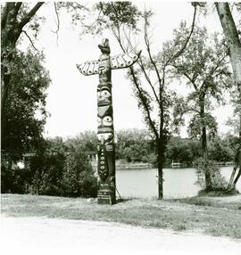
Ceremony to recognize erection of totem pole made by James F. Sutherland.
Winnipeg (Man.). Parks and Recreation Department
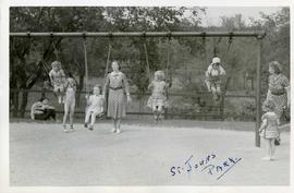
Photograph shows children playing on swing set in St. John's Park. Date of photograph is approximate, [ca. 1930].
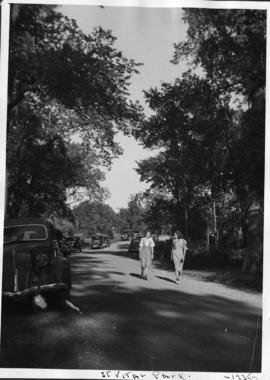
Photograph shows women walking in St. Vital Park.
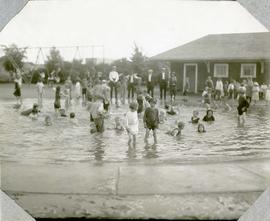
Photograph shows children playing at a wading pool in Weston Park. Date of photograph is approximate, [ca. 1930].
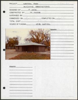
Weston Park – project development components
Project development components form for Weston Park with a colour photograph affixed.
Winnipeg (Man.). Parks and Recreation Department
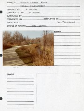
Bunn’s Creek Park – project development components
Project development components form for Bunn’s Creek Park with a photograph affixed.
Winnipeg (Man.). Parks and Recreation Department
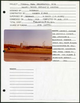
Tyndall Park Recreation Site – project development components
Project development components form for Tyndall Park Recreation Site with a colour photograph affixed.
Winnipeg (Man.). Parks and Recreation Department
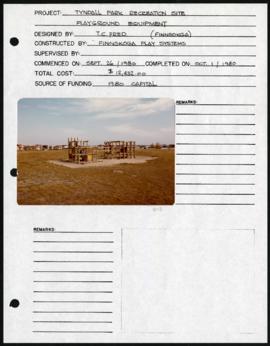
Tyndall Park Recreation Site – project development components
Project development components form for Tyndall Park Recreation Site with a colour photograph affixed.
Winnipeg (Man.). Parks and Recreation Department
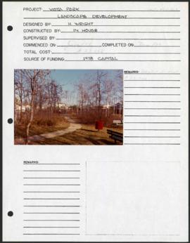
Vista Park – project development components
Project development components form for Vista Park with a colour photograph affixed.
Winnipeg (Man.). Parks and Recreation Department

Plan of University section of Tuxedo Park
A map of the proposed Tuxedo Park residential suburb, specifically the area surrounding the old University of Manitoba campus and Olmsted and Assiniboine Parks. The map shows streets and lots as well as details of the university campus. The map was created by Charles Clifton Chataway (1869-1920) and Bulman Brothers Ltd.