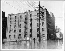
A photograph of the Winnipeg Electric Company building surrounded by water during the 1950 flood. Two men are in a boat in the floodwater outside the building.
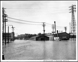
A photograph of flooded Water Street, taken from the Provencher Bridge, during the 1950 flood in Winnipeg. This photograph was taken before the causeway down Water Street was built.
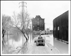
A photograph of a causeway near an underpass on Anabella Street during the 1950 flood in Winnipeg. A city employee is driving some equipment down the causeway.
A photograph of the intersection of Broadway and Osborne Street during the 1950 flood in Winnipeg. The photo is taken from Osborne Street, looking north; the stone cross of All Saints' Church can be seen near the left side of the image.
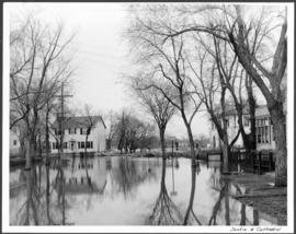
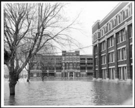
Subseries consists of a scrapbook assembled by the City Engineering Department to serve as photographic evidence of the 1950 flood. It contains black and white photographs that mostly document flooding in residential areas near the Red River (Fort Rouge, Riverview, North End, Point Douglas, Crescentwood, Armstrong's Point and others). Scrapbook appears to be organized geographically by area and street. In addition to documenting flooding, the photographs provide a detailed record of residential neighbourhoods, houses, streets, and businesses like corner grocery stores and laundries. All photographs were taken by Harold K. White Studio.
A photograph taken during the 1950 flood, showing the southwest corner of Arnold Avenue and Mabel Avenue and possibly 62 Arnold Avenue. Item is 8 of 8 photographs on page 1 of scrapbook.
A photograph taken during the 1950 flood, showing 144 Arnold Avenue and 146 Arnold Avenue 148 Arnold Avenue. Item is 5 of 8 photographs on page 3 of scrapbook.