
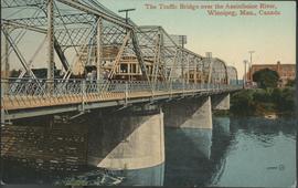
The Traffic Bridge over the Assiniboine River, Winnipeg
- i01723
- Item
- [194-?]
Date of postcard is uncertain, [before 1949].
123 results with digital objects Show results with digital objects
The Traffic Bridge over the Assiniboine River, Winnipeg
Date of postcard is uncertain, [before 1949].

Thoroughfares: Academy Road at Wellington Crescent
View of cars and cyclists heading down Academy Road towards Wellington Crescent and the Maryland Bridge. The cupola of Misericordia Hospital can be seen across the bridge.

Thoroughfares: Academy Road at Wellington Crescent
View of cars and cyclists heading down Academy Road towards Wellington Crescent and the Maryland Bridge. A small portion of Misericordia Hospital can be seen across the bridge.
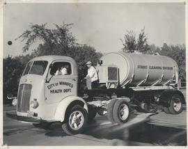
Photograph shows a street cleaning truck from the City of Winnipeg Health Department's Street Cleaining Division. Two City workers can be seen in the photograph. Date of photograph is uncertain.
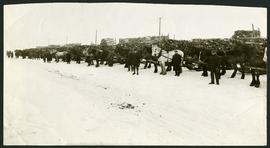
Unloading of relief wood at Greater Winnipeg Water District Station
Men at the Greater Winnipeg Water District station in St. Boniface standing in front of horses hauling wood piles for relief work. Photograph taken by Robinson Studio.
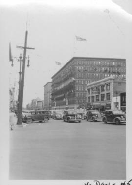
VE Day in Winnipeg showing Portage Avenue and Eaton's building in background
Photograph shows Victory in Europe Day (VE Day) celebrations marking the end of World War 2 in Europe.

Visit of Duke and Duchess of Cornwall & York (George V and Queen Mary)
Photograph showing an arch built near the C.P.R. Station in honour of a visit by the Duke and Duchess of Cornwall & York, George V and Queen Mary.

Westwood Shopping Centre panorama
View of Westwood Shopping Centre, 3276-3332 Portage Avenue, 10.2 acres. From left to right: various shops, motel, various shops and Assiniboia Public Library, Safeway Store, Marshall Wells, Perths, Westwood Pharmacy, various Shops, Zeller's County Fair, Auto Centre. Consists of 3 separate photographs pasted together on cardboard to create a panorama. The cardboard is a scrap made from an old sign of the Metropolitan Corporation of Greater Winnipeg (visible on the reverse). The cardboard is numbered “10”, presumably as part of a compilation with other shopping centre panoramas.
Metropolitan Corporation of Greater Winnipeg (Man.). Planning Division

Winnipeg Electric Co. trolley bus
Photograph shows people waiting to board electric trolley bus (Winnipeg Electric Company), southbound Garry Street at Portage Avenue. Destination sign reads, No. 73 Sargent, Valour Road. Lindsay Building in background.
Date of photograph is uncertain, [before 1949].

Winnipeg Street Railway on Portage Avenue in front of Merchants Hotel

Winnipeg Tourist Cabins and Camp Park on Pembina Highway
Postcard featuring “Winnipeg Tourist Cabins and Camp Park”, located on Pembina Highway (then Highway Number 14) around Chevrier Boulevard.

Winnipeg’s Best Tourist Cabin Camp on Pembina Highway
Postcard featuring “Winnipeg’s Best Tourist Cabin Camp”, located on Pembina Highway (then Highway Number 14) around Chevrier Boulevard.
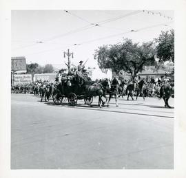
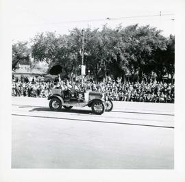
Winnipeg's 75th Anniversary parade - armed men on stagecoach
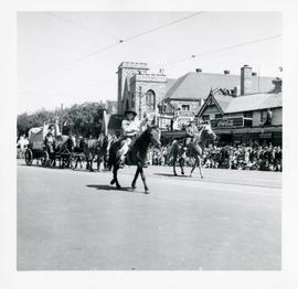
Winnipeg's 75th Anniversary parade - boy on horseback waving
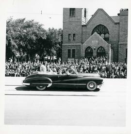
Winnipeg's 75th Anniversary parade - car carrying women

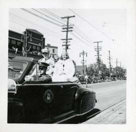
Winnipeg's 75th Anniversary parade - crowned woman in car